Near Grand Meadow in Mower County, Minnesota — The American Midwest (Upper Plains)
The Quarry Story/Maḳa Ook'e Wóyakapi Kiŋ Dée
Photographed by McGhiever, October 5, 2025
1. The Quarry Story/Maḳa Ook'e Wóyakapi Kiŋ Dée Marker

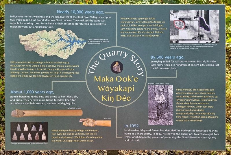
Nearly 10,000 years ago,
Indigenous hunters walking along the headwaters of the Root River Valley came upon two creek beds full of Grand Meadow Chert nodules. They realized the stone was suitable for making tools. For millennia, their descendants returned periodically to replenish worn out and broken tools.
Grand Meadow Chert Quarry at the headwaters of the Root River Watershed.
people began using the bow and arrow to hunt deer, elk, and bison. They needed more Grand Meadow Chert for arrowheads and hide scrapers, and started digging pits.
Hafted hide scraper
Side view
Triangular arrowheads made of Grand Meadow Chert.
this page online
Hékta waniyetu opawiŋġe ṡakpe wahehaŋyaŋ, ok'e yuṡtaŋpi tḳa tóḳeca uŋ ṭaŋiŋ ṡni. Hékta waniyetu ake ṡahdoġaŋ sam wikcemna ṡakpe héehaŋ wóżu wic̣aṡta kiŋ hena maḳa ok'e kiŋ ożuyapi. Dehaŋn maḳa ok'e wikcemna ṡahdoġaŋ yuḳe.
By 600 years ago,
quarrying ended for reasons unknown. Starting in 1860, local farmers filled in hundreds of ancient pits, leaving just the 88 preserved here.
Maynard Green in the Quarry.
Photographed by McGhiever, October 5, 2025
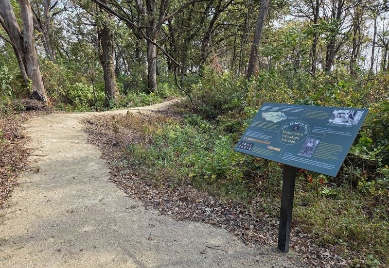
2. The Quarry Story/Maḳa Ook'e Wóyakapi Kiŋ Dée Marker at the Grand Meadow Chert Quarry
local resident Maynard Green first identified the oddly pitted landscape near his home as a chert quarry. In 1980, he showed the quarry pits to archaeologist Tom Trow, which began the process of preserving the Grand Meadow Chert Quarry and this trail.
Topics. This historical marker is listed in these topic lists: Anthropology & Archaeology • Indigenous Peoples and Communities.
Location. 43° 43.65′ N, 92° 35.323′ W. Marker is near Grand Meadow, Minnesota, in Mower County. It can be reached from 730th Avenue, on the right when traveling north. The marker is on the self-guided interpretive trail at the Grand Meadow Chert Quarry. Touch for map. Marker is at or near this postal address: 25578 730th Avenue, Grand Meadow MN 55936, United States of America. Touch for directions.

Regionally, this marker is in Southeast Minnesota. It is also in the American Midwest and in the Corn Belt. Globally, it is in North America, the Western Hemisphere, the Western World, and the Anglosphere. Historically, it finds itself in what was once Rupert’s Land, the territory of the Mississippian Culture, and the Louisiana Purchase.
Other nearby markers. At least 8 other markers are within walking distance of this marker: Everything is Related/Mitakuye Owas'iŋ (a few steps from this marker); Rock Stars/Waŋhi Icaptuġe (within shouting distance of this marker); The Perfect Spot (within shouting distance of this marker); A Truly Grand Rock (within shouting distance of this marker); Grand Meadow Chert Quarry/Wanhi Yukan (within shouting distance of this marker); Not Just a Quarry/De Maḳa Ok'e Ecéedaŋ Héc̣a Ṡni (within shouting distance of this marker); Those Who Came Here/Ehaŋnah Tuweweka Ded Hípi? (within shouting distance of this marker); Making These Pits/Maḳa Ok'e Kaġapi (within shouting distance of this marker). Touch for a list and map of all markers in Grand Meadow.
Credits. This page was last revised on November 29, 2025. It was originally submitted on November 29, 2025, by McGhiever of Minneapolis, Minnesota. This page has been viewed 53 times since then and 28 times this year. Photos: 1, 2. submitted on November 29, 2025, by McGhiever of Minneapolis, Minnesota.
