Near Greycliff in Sweet Grass County, Montana — The American West (Mountains)
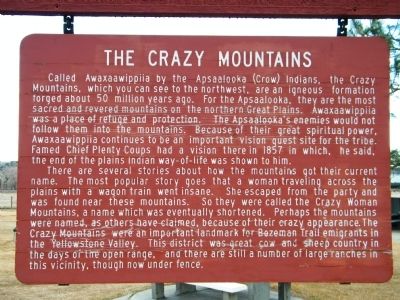
The Crazy Mountains
Photographed by Rich Pfingsten, March 22, 2009
1. The Crazy Mountains Marker
There are several stories about how the mountains got their current name. The most popular story goes that a woman traveling across the plains with a wagon train went insane. She escaped from the party and was found near these mountains. So they were called the Crazy Woman Mountains, a name which was eventually shortened. Perhaps the mountains were named, as others have claimed, because of their crazy appearance. The Crazy Mountains were an important landmark for Bozeman Trail emigrants in the Yellowstone
this page online
Topics. This historical marker is listed in these topic lists: Indigenous Peoples and Communities • Landmarks • Natural Features • Notable Places. A significant historical year for this entry is 1857.
Location. 45° 44.16′ N, 109° 45.417′ W. Marker is near Greycliff, Montana, in Sweet Grass County. It is on Interstate 90 at milepost 381, 4 miles west of Bridger Creek Road and I-90 Interchange (Exit 384), on the right when traveling west. Located at the I-90 Westbound Rest Area near mile marker 381, next to the Captain Wm. Clark marker. Touch for map. Marker is in this post office area: Greycliff MT 59033, United States of America. Touch for directions.

Regionally, this marker is in Yellowstone Country. It is also in the American Mountain West and in the Lewis & Clark Corridor. Globally, it is in North America, the Rocky Mountains, the Western Hemisphere, the Western World, and the Anglosphere. Historically, it finds itself in what was once
Photographed by Rich Pfingsten, March 22, 2009
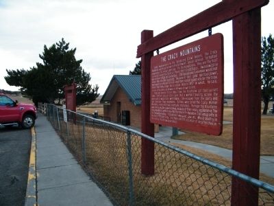
2. The Crazy Mountains Marker
Other nearby markers. At least 8 other markers are within 2 miles of this marker, measured as the crow flies: The Crazy Mountains (original title obscured) (a few steps from this marker); Captain Wm. Clark (a few steps from this marker); The Cattle Drive of 1866 (within shouting distance of this marker); Montana's Jurassic Park (within shouting distance of this marker); The Bozeman Trail (about 600 feet away, measured in a direct line); The Great Highway of the Northwest: The Yellowstone Trail (about 600 feet away); a different marker also named Montana's Jurassic Park (about 700 feet away); a different marker also named The Thomas Party (approx. 2.1 miles away). Touch for a list and map of all markers in Greycliff.
Another marker is no longer nearby. The Thomas Party (was approx. 2.1 miles away but has been replaced with another marker now near it).
More about this marker. The marker is beginning to show some wear on the wood finish.
Also see . . . Crazy Mountains - Wikipedia. (Submitted on March 22, 2010, by Bill Pfingsten of Bel Air, Maryland.)
Photographed by Rich Pfingsten, March 22, 2009
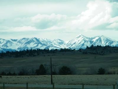
3. The Crazy Mountains across the plains
The Crazy Mountains are located in the Gallatin National Forest, northwest of the town of Big Timber, MT.
Photographed by Rich Pfingsten, March 22, 2010
4. The Crazy Mountains in the distance
The Crazy Mountains are located northwest of Big Timber, MT and are part of the Gallatin National Forest Big Timber Ranger District.
Credits. This page was last revised on June 16, 2016. It was originally submitted on March 22, 2010, by Rich Pfingsten of Forest Hill, Maryland. This page has been viewed 2,214 times since then and 68 times this year. Photos: 1, 2, 3, 4. submitted on March 22, 2010, by Rich Pfingsten of Forest Hill, Maryland. • Bill Pfingsten was the editor who published this page.
