Abu Simbel, Aswan Governorate, Egypt — مصر (Northeast Africa)
The Salvage of Abu Simbel Temples
Photographed by James Hulse, October 13, 2024
1. The Salvage of Abu Simbel Temples Marker
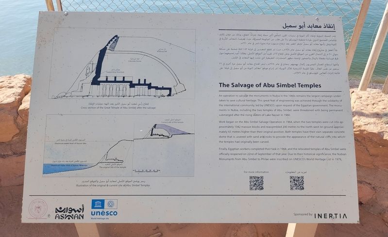
 An operation to salvage the monuments in Nubia in the 1960s remains the largest campaign undertaken to save cultural heritage. This great feat of engineering was achieved through the solidarity of the international community, led by UNESCO, upon request of the Egyptian government. The monuments in Nubia, including the two temples of Abu Simbel, were threatened with being permanent submerged after the rising waters of Lake Nasser in 1960.
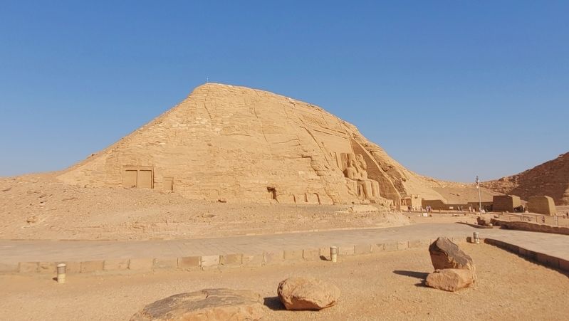
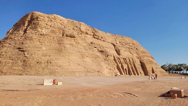
Work began on the Abu Simbel Salvage Operation in 1964, when the two temples were cut into approximately 1042 massive blocks and reassembled 200 metres to the northwest on ground approximately 65 metres higher than their original position. Both temples have their own separate concrete dome that is covered with sand and rocks to provide the appearance of the natural cliffs into which the temples had originally been carved.
Finally, Egyptian workers completed their task in 1968, and the relocated temples of Abu Simbel were officially reopened on 22nd of September of that year. Due to their historical significance, the Nubian Monuments from Abu Simbel to Philae were inscribed on UNESCO's World Heritage List in 1979.
Captions
(Photo #1) Cross section of the Great Temple of Abu Simbel after the salvage
(Photo #2) Illustration of the original & current site of Abu Simbel Temples
إنقاذ معابد أبو سمبل
تعد الحملة الدولية لإنقاذ آثار النوبة في ستينات القرن الماضي أكبر حملة إنقاذ للتراث الثقافي، وذلك من خلال تكاتف ؟ وتضامن المجتمع الدولي بقيادة منظمة اليونسكو بناءً على طلب من الحكومة المصرية، حيث تعرضت المعالم الأثرية في التوبة وعلى رأسها معابد أبو سمبل لخطر الغمر بعد ارتفاع منسوب مياه بحيرة ناصر في عام ١٩٦٠م.
بدأ العمل في مشروع إنقاذ معابد أبو سمبل عام ١٩٦٤م ، حيث تم قطع المعبدين إلى قرابة ١٠٤٢ كتلة ضخمة على مسافة حوالي ٢٠٠ م إلى الشمال الغربي من الموقع الأصلي وعلى ارتفاع ٦٥م تقريباً من الموقع الأصلي. وهكذا أعيد تجميعهما حول قبة خرسانية مغطاة بالرمال والصخور لإضفاء مظهر المنحدرات الطبيعية التي نحتت فيها المعابد في الأصل.
وأخيرا استطاع العمال المصريون إكمال مهمتهم بنجاح في عام ١٩٦٨م ، ليتم افتتاح معابد أبو سمبل مرة أخرى في ٢٢ سبتمبر من نفس العام . نظرًا للقيمة التاريخية للآثار النوبية، تم إدراج موقع معالم النوبة من أبو سمبل إلى فيله" على قائمة التراث العالمي لليونسكو في عام ١٩٧٩م.
(1) قطاع رأسي لمعبد أبو سمبل الكبير بعد انتهاء عمليات الإنقاذ
(2) رسم يوضح الموقع الأصلي المعابد أبو سمبل والموقع الجديد
تعد الحملة الدولية لإنقاذ آثار النوبة في ستينات القرن الماضي أكبر حملة إنقاذ للتراث الثقافي، وذلك من خلال تكاتف ؟ وتضامن المجتمع الدولي بقيادة منظمة اليونسكو بناءً على طلب من الحكومة المصرية، حيث تعرضت المعالم الأثرية في التوبة وعلى رأسها معابد أبو سمبل لخطر الغمر بعد ارتفاع منسوب مياه بحيرة ناصر في عام ١٩٦٠م.
بدأ العمل في مشروع إنقاذ معابد أبو سمبل عام ١٩٦٤م ، حيث تم قطع المعبدين إلى قرابة ١٠٤٢ كتلة ضخمة على مسافة حوالي ٢٠٠ م إلى الشمال الغربي من الموقع الأصلي وعلى ارتفاع ٦٥م تقريباً من الموقع الأصلي. وهكذا أعيد تجميعهما حول قبة خرسانية مغطاة بالرمال والصخور لإضفاء مظهر المنحدرات الطبيعية التي نحتت فيها المعابد في الأصل.
وأخيرا استطاع العمال المصريون إكمال مهمتهم بنجاح في عام ١٩٦٨م ، ليتم افتتاح معابد أبو سمبل مرة أخرى في ٢٢ سبتمبر من نفس العام . نظرًا للقيمة التاريخية للآثار النوبية، تم إدراج موقع معالم النوبة من أبو سمبل إلى فيله" على قائمة التراث العالمي لليونسكو في عام ١٩٧٩م.
(1) قطاع رأسي لمعبد أبو سمبل الكبير بعد انتهاء عمليات الإنقاذ
(2) رسم يوضح الموقع الأصلي المعابد أبو سمبل والموقع الجديد
Erected by Ministry of Tourism & Antiquity, Aswan, unesco and Interia.
Topics. This historical marker is listed in these topic lists: Anthropology & Archaeology • Architecture • Religion & Religious Structures • Waterways & Vessels. A significant historical year for this entry is 1964.
Location. 22° 20.132′ N, 31° 37.548′ E. Marker is in Abu Simbel, Aswan Governorate. It is on Tariaq Bedon Esm. The marker is located on the grounds of the Abu Simbel Temples. Touch for map. Marker is in this post office area: Abu Simbel, Aswan Governorate 12115-01, Egypt. Touch for directions.

Regionally, it is in Africa, specifically in North Africa, in the Middle East, on
this page online
Other nearby markers. At least 2 other markers are within walking distance of this marker: The Great Temple of Abu Simbel (about 180 meters away, measured in a direct line); The Small Temple of Abu Simbel (about 210 meters away).
Also see . . . Abu Simbel. Ministry of Antiquities - Egypt
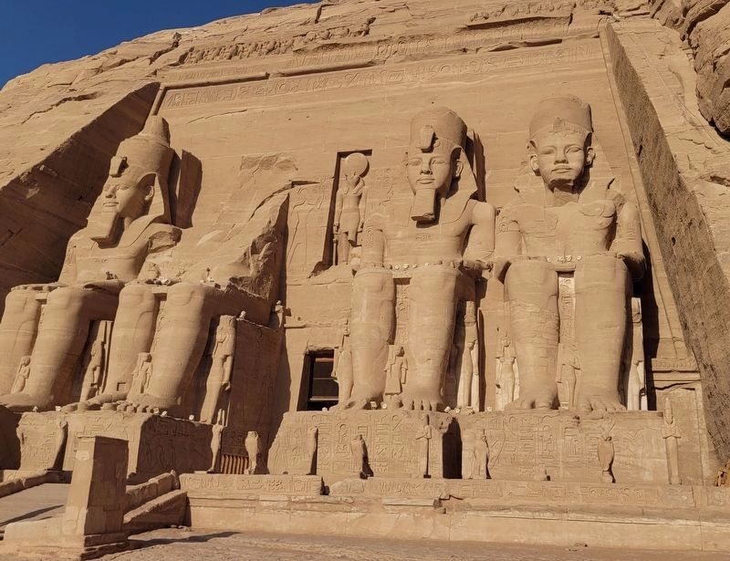
The Great Temple of Abu Simbel, in Nubia near Egypt’s southern border, is among the most awe-inspiring monuments of Egypt. It was cut into the living rock by King Ramesses II (the Great) of the Nineteenth Dynasty, around 1264 BC. The temple is most well known for the four imposing seated colossal statues that dominate its façade. One of these collapsed because of an ancient earthquake, and its fragments can still be seen on the ground.(Submitted on December 2, 2025, by James Hulse of Medina, Texas.)
Photographed by James Hulse, October 13, 2024
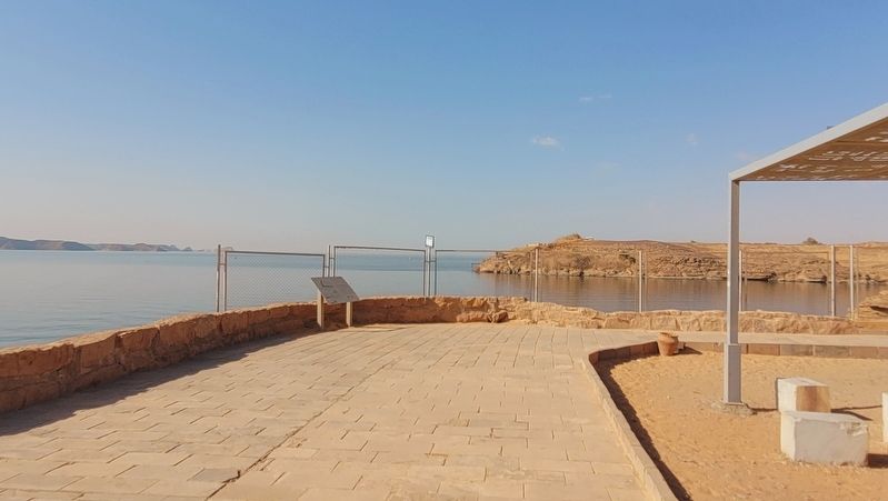
2. The view of the marker next to Lake Nasser
Photographed by James Hulse, October 13, 2024
3. The view of the Great Temple of Abu Simbel
The temple is supported by a large concrete dome with rocks and sand on the top to look like a natural cliff.
Photographed by James Hulse, October 13, 2024
4. The view of the Small Temple of Abu Simbel
The temple is supported by a large concrete dome with rocks and sand on the top to look like a natural cliff.
Photographed by James Hulse, October 13, 2024
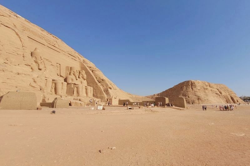
5. The view of both temples along the pathway
Lake Nasser is located to the right of the temples in the photo.
Photographed by James Hulse, October 13, 2024
6. The entrance to the Great Temple of Abu Simbel
Credits. This page was last revised on December 4, 2025. It was originally submitted on December 2, 2025, by James Hulse of Medina, Texas. This page has been viewed 92 times since then and 55 times this year. Photos: 1, 2, 3, 4, 5, 6. submitted on December 4, 2025, by James Hulse of Medina, Texas.
