Chireno in Nacogdoches County, Texas — The American South (West South Central)
Chireno Lower Cemetery

Photographed by Jeff Leichsenring, December 2, 2025
1. Chireno Lower Cemetery Marker
The landscape of the cemetery is traditional with a variety of gravestones, including markers of granite, limestone, and marble surrounded by trees, grass, and irises. The earliest marked grave, that of the baby of M.W. and A.T. Burke, dates to 1861, although there may be earlier unmarked burials. Other noted burials include the reverend Richard A. Menefee (1809-1893) and
this page online
Erected 2009 by Texas Historical Commission. (Marker Number 16732.)
Topics. This historical marker is listed in these topic lists: African Americans • Cemeteries & Burial Sites • Hispanic Americans • Settlements & Settlers. A significant historical year for this entry is 1792.
Location. 31° 29.64′ N, 94° 20.842′ W. Marker is in Chireno, Texas, in Nacogdoches County. It is on Lower Cemetery Road (County Road 447) 0.1 miles east of Main Street (Farm to Market Road 95), on the right when traveling east. Touch for map. Marker is in this post office area: Chireno TX 75937, United States
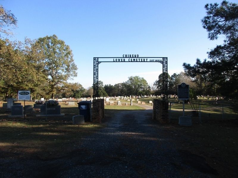
Photographed by Jeff Leichsenring, December 2, 2025
2. Chireno Lower Cemetery and marker

Regionally, this marker is in the American South, specifically in the Deep South, and in the Piney Woods. Globally, it is in North America, a Gulf of Mexico state, the Western Hemisphere, the Western World, and the Anglosphere. Historically, it finds itself in what was once New Spain, the Republic of Texas, one of the Confederate States of America, and the Antebellum South.
Other nearby markers. At least 8 other markers are within 7 miles of this marker, measured as the crow flies: Gingerbread House (approx. 0.4 miles away); Camp Chireno, World War II P.O.W. Camp (approx. 0.4 miles away); Halfway Inn (approx. 1.1 miles away); Kings Highway Camino Real — Old San Antonio Road (approx. 2.4 miles away); a different marker also named Kings Highway Camino Real — Old San Antonio Road (approx. 2½ miles away); a different marker also named Kings Highway Camino Real — Old San Antonio Road (approx. 4.6 miles away); John Balch (approx. 6.8 miles away); Cove Springs Cemetery (approx. 6.8 miles away). Touch for a list and map of all markers in Chireno.
Credits. This page was last revised on December 4, 2025. It was originally submitted on December 3, 2025, by Jeff Leichsenring of Garland, Texas. This page has been viewed 87 times since then and 51 times this year. Photos: 1, 2. submitted on December 3, 2025, by Jeff Leichsenring of Garland, Texas. • James Hulse was the editor who published this page.
