
The Loop District in Chicago in Cook County, Illinois — The American Midwest (Great Lakes)
Chicago's Early Settlers
Photographed by Sean P. Flynn, September 10, 2024
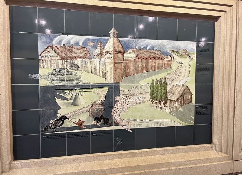
1. Chicago's Early Settlers Marker
1782 Jean Baptiste Point du Sable, an Afro-French Canadian fur trapper settled on the north bank of the river. He peace with the Potawatomis and married Catherine, a member of the tribe. They left in 1803 when the Louisiana Purchase opened up territory to the United States and a new fort was to be built on the south bank of the river.
1804 John Kinzie arrived in Chicago to trade with the Indians, left for a few years but returned by 1816. He purchased du Sable's cabin and enlarged it for his family. His son, John H. Kinzie became an important leader in the city.
1816 The Potawatomi tribe cedes a strip of land ten miles wide on each side of the river from the river mouth to the headwaters of the Illinois, thus giving the United States control of the portage. That same year Fort Dearborn was replaced by a less fortified complex.
In 1818 Wolf Point Tavern was the center of social activity. It existed where the River split to the north and to the south and could be reached by canoe or the first barge ferry on the river.
Erected 2000.
Topics. This historical marker is listed in these topic lists: African Americans
this page online
Location. 41° 53.29′ N, 87° 36.982′ W. Marker is in Chicago, Illinois, in Cook County. It is in The Loop District. It is at the intersection of Chicago Riverwalk and Jean Baptiste Pointe du Sable Lake Shore Drive (U.S. 41), on the right when traveling west on Chicago Riverwalk. The mural is in the underpass beneath Lake Shore Drive. Touch for map. Marker is in this post office area: Chicago IL 60601, United States of America. Touch for directions.

Regionally, this marker is in the American Midwest. Globally, it is in North America, on the Great Lakes, in the Western Hemisphere, in the Western World, and in the Anglosphere. Historically, it finds itself in what was once the Viceroyalty of New France, the territory of the Mississippian Culture, and the Northwest Territory.
Other nearby markers. At least 8 other markers are within walking distance of this marker: The Honorable Joanne H. Alter (about 300 feet away, measured in a direct line); World War II Submarine Veterans Memorial
Photographed by Sean P. Flynn, September 10, 2024
2. The Riverwalk Gateway
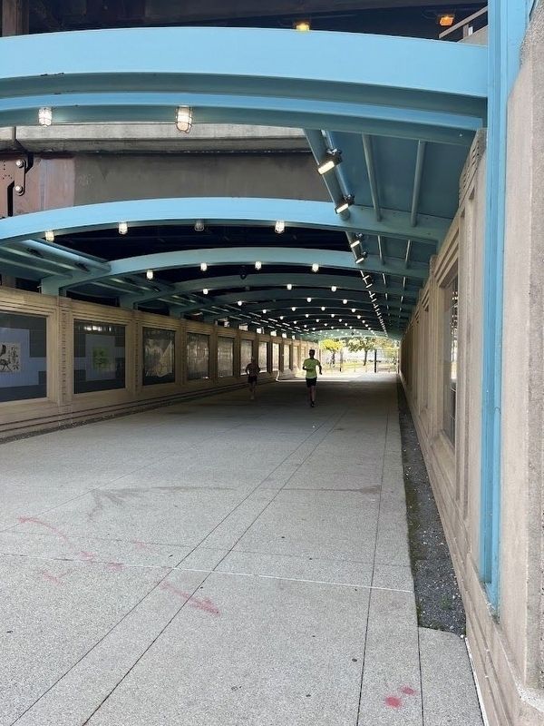
Several murals adorn the walls of this walkway beneath Du Sable Lake Shore Drive.
More about this marker. The mural is one of several erected in the Chicago Riverwalk's tunnel beneath Lake Shore Drive, close to where the Chicago River meets Lake Michigan.
Also see . . . The Beginning of Wolf Point in Chicago, including the history of the Wolf Point Tavern. From the Digital Research Library of Illinois History Journal.
Excerpt: "The origin of the name Wolf Point is unknown. In her 1856 memoir 'Wau-Bun, the Early Day in the Northwest,' Juliette Kinzie states that 'the place was then called Wolf Point, from its having been the residence of an Indian named 'Moa-way,' or 'the Wolf.'"(Submitted on December 5, 2025, by Sean P. Flynn of Oak Park, Illinois.)

Raoul Varin, artist; courtesy of Chicago History Museum (ICHi-012166), circa 1884
3. Jean Baptiste Point du Sable
This portrait was made in the 1880s, about 60 years after du Sable died. There are no known depictions of du Sable dating to his lifetime.
The Pictorial Field Book of the War of 1812 (via Wikimedia Commons), November 3, 2015
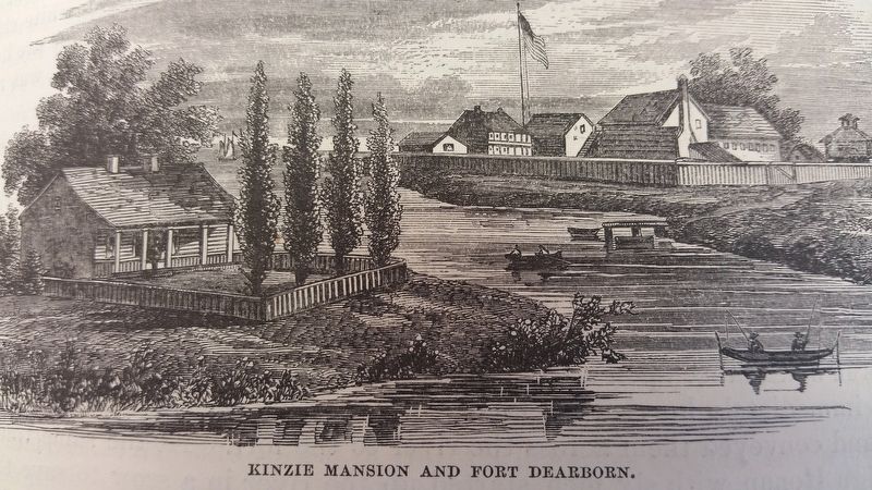
4. Kinzie Mansion and Fort Dearborn
John Kinzie is considered the first white settler in Chicago. This drawing is from the 1868 book titled The Pictorial Field Book of the War of 1812.
Credits. This page was last revised on December 6, 2025. It was originally submitted on December 5, 2025, by Sean P. Flynn of Oak Park, Illinois. This page has been viewed 73 times since then and 45 times this year. Photos: 1. submitted on December 5, 2025, by Sean P. Flynn of Oak Park, Illinois. 2. submitted on December 2, 2025, by Sean P. Flynn of Oak Park, Illinois. 3, 4. submitted on December 5, 2025, by Sean P. Flynn of Oak Park, Illinois.
