St. Augustine in St. Johns County, Florida — The American South (South Atlantic)
British Enslavement
| — | Fort Mose Historic State Park | — |
Photographed by Cosmos Mariner, December 10, 2014
1. British Enslavement Marker
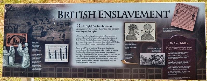
Africans labored on indigo plantations, and as lumbermen and cattlemen. They produced materials for shipbuilding and cleared land. Slaves in Carolina had no recourse to legal and religious protections that governed the treatment of slaves in Spanish Florida. They were not allowed to marry and could not hold property.
By the early 1700s, the number of slaves in the Carolinas far exceeded that of their English overseers. They lived in an unstable frontier society with constant Indian raids and growing conflict between the Spanish and English. Despite constant vigilance, torture, and public executions, many people from Congo and Angola fled enslavement for the promise of freedom in Spanish Florida. Their kinsmen remained behind, eventually developing the Gulla and Geechee cultures in Anglo areas.
The Stono Rebellion
The most significant colonial slave rebellion took place in 1739 in Stono, South Carolina.
• On September 9, a group of “Angolan” (more likely Congo) slaves revolted.
• They killed over 20 English
this page online
• During a “drunken dance” (more likely a Congo war practice), Carolina's governor, William Bull, and his militia attacked.
• Survivors fought for another week, moving toward St. Augustine, until a larger English militia caught and killed most of them.
• Some rebels escaped. If any made it to St. Augustine, they would have been sheltered at Mose.
Topics. This historical marker is listed in these topic lists: African Americans • Colonial Era • Forts and Castles • Waterways & Vessels. A significant historical date for this entry is September 9, 1739.
Location. Marker has been reported permanently removed. It was located near 29° 55.718′ N, 81° 19.516′ W. Marker was in St. Augustine, Florida, in St. Johns County. It was on Fort Mose Trail 0.2 miles east of North Ponce De Leon Boulevard (U.S. 1), on the right when traveling north. Marker is within Fort Mose Historic State Park, beside the sidewalk leading from the parking lot to the visitor center. Touch for map. Marker was at or near this postal address: 15 Fort Mose Trail, Saint Augustine FL 32084, United States
Photographed by Cosmos Mariner, December 10, 2014
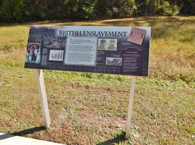
2. British Enslavement Marker (wide view)
We have been informed that this marker is no longer there and will not be replaced. This page is an archival view of what was.
Regionally, this marker was in First Coast and in Greater Jacksonville. It was also in the American South and on the Eastern Seaboard. Globally, it was in the North Atlantic Region, North America, a Gulf of Mexico state, the Western Hemisphere, the Western World, and the Anglosphere. Historically, it found itself in what was once New Spain, the territory of the Mississippian Culture, one of the Confederate States of America, and the Antebellum South.

Other nearby markers. At least 8 other markers are within walking distance of this location: Escape & Flight (a few steps from this marker); El Pueblo de Gracia Real de Santa Teresa de Mose (within shouting distance of this marker); Bloody Mose (within shouting distance of this marker); Fort Mose Site (within shouting distance of this marker); Women of Fort Mose (about 300 feet away, measured in a direct line); Barca Chata (about 300 feet away); On Watch (about 300 feet away); “Slave Catchers” (about 400 feet away). Touch for a list and map
Photographed by Larry Gertner, July 31, 2026
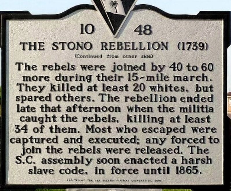
3. The Stono Rebellion
ThoughtCo. Website entry
Click for more information.
Click for more information.
Other markers no longer nearby. Middle Passage (was a few steps from this marker but has been permanently removed); African Origins (was a few steps from this marker but has been permanently removed); Fort Mose I (was a few steps from this marker but has been permanently removed); Fort Mose II (was within shouting distance of this marker but has been permanently removed); Evacuation (was within shouting distance of this marker but has been permanently removed).
More about this marker. This marker has been permanently removed.
The Fort Mose Historical State Park recently went through extensive renovations. The park reopened in May, 2025. During the renovation process all historical markers were replaced with different markers containing additional more current information.
Related markers. Click here for a list of markers that are related to this marker. Fort Mose Historic State Park
Also see . . . Bance Island Opens for slave trade, 11/14/1670. Bance Island (Sierra Leone) was a major launching point of the Middle Passage to America, first settled by English slave traders
From Deagan & MacMahon, 1995
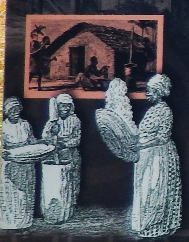
4. Marker detail: Rice became an important crop in coastal lowlands of English Carolina
African slaves, who were rice farmers in their homeland, introduced rice cultivation methods including mortars for crushing and baskets for fanning the rice.
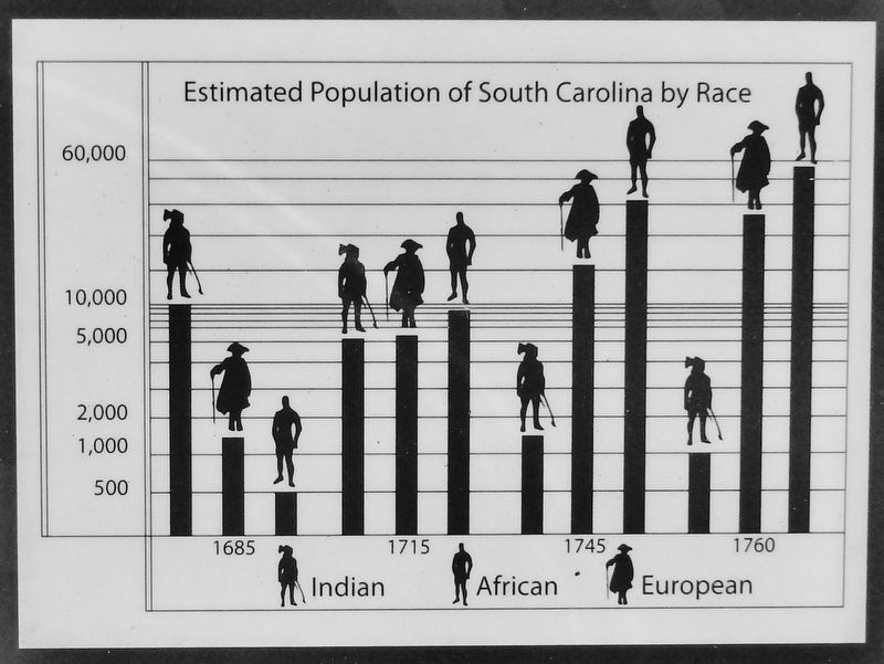
5. Marker detail: Estimated Population of South Carolina by Race
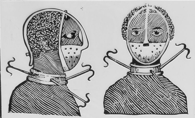
From Branagan, 1805
6. Marker detail: Metal face masks are examples some of the extreme forms of torture Slaves endured
Courtesy of the Library of Congress
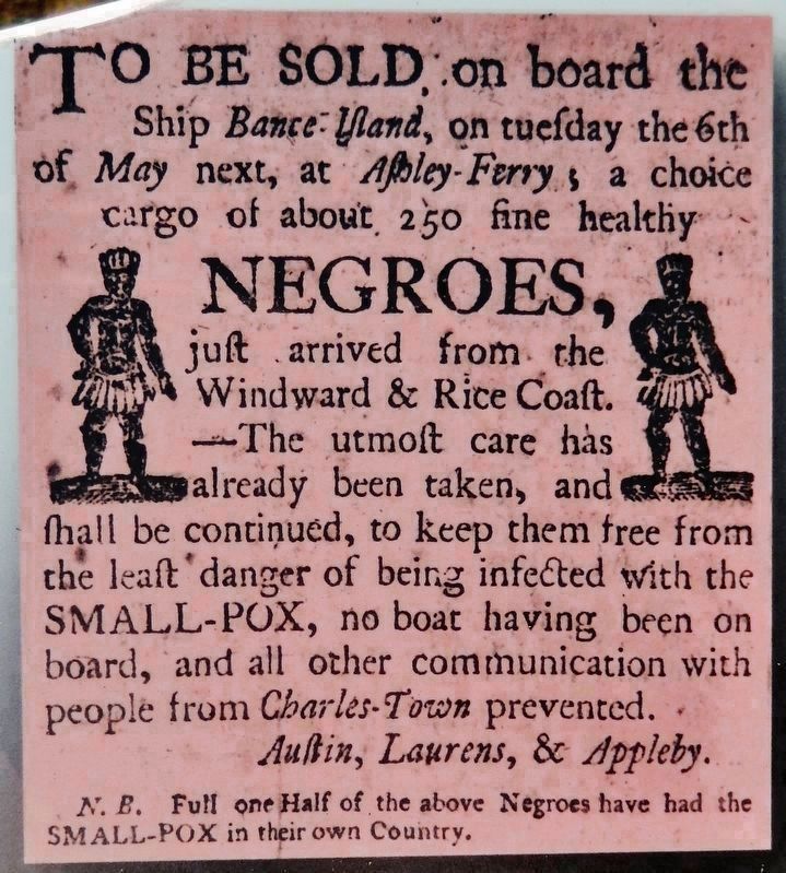
7. Marker detail: Advertisement for the sale of captured Africans
To be sold on board the ship Bance Island, on Tuesday the 6th of May next, at Ashley Ferry, a choice cargo of about 250 fine healthy negroes just arrived from the Windward & Rice Coast. The utmost care has already been taken, and shall be continued, to keep them free from the least danger of being infected with the smallpox, no boat having been on board, and all other communication with people from Charles-Town prevented.
Austin, Laurens, & Appleby.
N.B. Full one-half of the above Negroes have had the smallpox in their own country.
Austin, Laurens, & Appleby.
N.B. Full one-half of the above Negroes have had the smallpox in their own country.
Credits. This page was last revised on July 31, 2026. It was originally submitted on December 1, 2018, by Cosmos Mariner of Cape Canaveral, Florida. This page has been viewed 729 times since then and 41 times this year. Last updated on December 6, 2025, by Brandon D Cross of Flagler Beach, Florida. Photos: 1, 2. submitted on December 1, 2018, by Cosmos Mariner of Cape Canaveral, Florida. 3. submitted on July 31, 2026, by Larry Gertner of New York, New York. 4, 5, 6, 7. submitted on December 1, 2018, by Cosmos Mariner of Cape Canaveral, Florida. • Bernard Fisher was the editor who published this page.
