St. Augustine in St. Johns County, Florida — The American South (South Atlantic)
Middle Passage
| — | Fort Mose Historic State Park | — |

Photographed by Cosmos Mariner, December 10, 2014
1. Middle Passage Marker
What was the Middle Passage?
The Middle Leg of a 3-part Voyage:
1 • Ships left Europe for Africa, with trade goods, such as iron, cloth, glass beads, brandy, and firearms, used to buy enslaved Africans.
2 • The ships left Africa for the Americas, with enslaved Africans later sold for American goods, such as Spanish silver, tobacco, lumber, indigo, and sugar.
3 • The ships sailed back to Europe with the valuable American goods.
The ships carried their valuable human cargos to work in the fast-growing plantation economy of Carolina. Between 1709 and 1760, over 50,000 enslaved Africans disembarked in Carolina, mainly in the port of Charleston. Most of the forced immigrants, including Francisco Menéndez, had been captured or purchased in the Senegambia region or along the Bight of Biafra.
During early years of the Atlantic slave trade, the mortality rate for Africans approached 15% — roughly one in seven died or was killed while crossing the Atlantic.
this page online
Topics. This historical marker is listed in these topic lists: African Americans • Colonial Era • Waterways & Vessels. A significant historical year for this entry is 1709.
Location. Marker has been reported permanently removed. It was located near 29° 55.713′ N, 81° 19.52′ W. Marker was in St. Augustine, Florida, in St. Johns County. It was on Fort Mose Trail 0.2 miles east of North Ponce De Leon Boulevard (U.S. 1), on the right when traveling north. Marker is within Fort Mose Historic State Park, beside the sidewalk leading from the parking lot to the visitor center. Touch for map. Marker was at or near this postal address: 15 Fort Mose Trail, Saint Augustine FL 32084, United States of America.
We have been informed that this marker is no longer there and will not be replaced. This page is an archival view of what was.
Regionally, this marker was in First Coast and in Greater Jacksonville. It was also in the

Courtesy of the John Carter Brown Library at Brown University
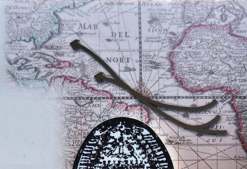
2. Marker detail: Slave trade routes
Map from 1680 with arrows indicating slave trade routes of the Middle Passage between Africa and the Americas.
Other nearby markers. At least 8 other markers are within walking distance of this location: Escape & Flight (a few steps from this marker); El Pueblo de Gracia Real de Santa Teresa de Mose (within shouting distance of this marker); Bloody Mose (within shouting distance of this marker); Fort Mose Site (within shouting distance of this marker); Women of Fort Mose (about 300 feet away, measured in a direct line); Barca Chata (about 400 feet away); On Watch (about 400 feet away); “Slave Catchers” (about 400 feet away). Touch for a list and map of all markers in St. Augustine.
Other markers no longer nearby. African Origins (was here, next to this marker but has been permanently removed); British Enslavement (was a few steps from this marker but has been permanently
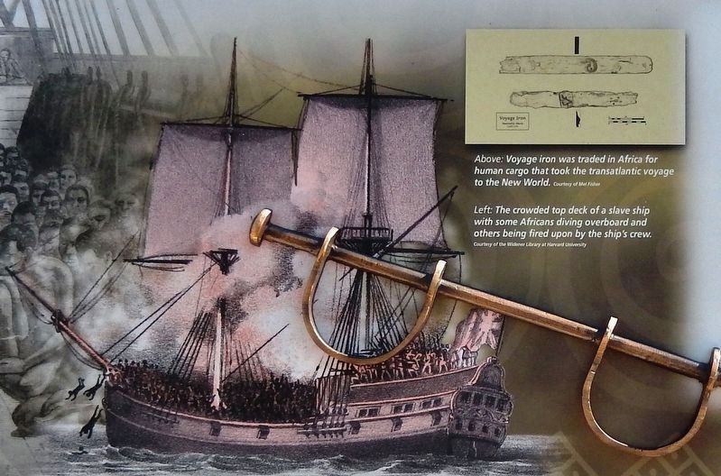
3. Marker detail: Insurrection on a slave ship
More about this marker. This marker has been permanently removed.
The Fort Mose Historical State Park recently went through extensive renovations. The park reopened in May, 2025. During the renovation process all historical markers were replaced with different markers containing additional more current information.
Related markers. Click here for a list of markers that are related to this marker. Fort Mose Historic State Park
Also see . . .
1. The African Slave Trade and the Middle Passage. Along the west coast of Africa, from the Cameroons in the south to Senegal in the north, Europeans built some sixty forts that served as trading posts. European sailors seeking riches brought rum, cloth, guns, and other goods to these posts and traded them for human beings. This human cargo was transported across the Atlantic Ocean and sold
Courtesy of the Library of Congress
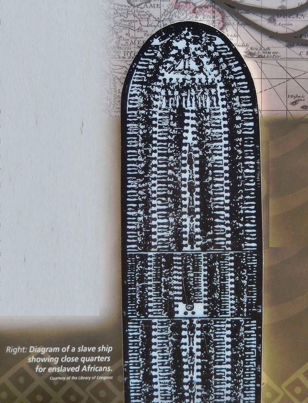
4. Marker detail: Diagram of a slave ship showing close quarters for enslaved Africans
2. The Middle Passage. Two by two the men and women were forced beneath deck into the bowels of the slave ship. The "packing" was done as efficiently as possible. The captives lay down on unfinished planking with virtually no room to move or breathe. Elbows and wrists will be scraped to the bone by the motion of the rough seas. Upon reaching the West Indies, the slaves were fed and cleaned in the hopes of bringing a high price on the block. Those that could not be sold were left for dead. The slaves were then transported to their final destination. It was in this unspeakable manner that between ten and twenty million Africans were introduced to the New World. (Submitted on December 1, 2018, by Cosmos Mariner of Cape Canaveral, Florida.)
3. Middle Passage. Slaver captains anchored chiefly off the Guinea Coast (also called the Slave Coast) for a month to a year to trade for their cargoes of 150 to 600 persons, most of whom had been kidnapped and forced to march to the
Photographed by Cosmos Mariner, December 10, 2014
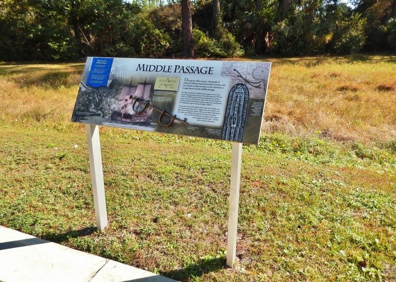
5. Middle Passage Marker (wide view)
Credits. This page was last revised on December 7, 2025. It was originally submitted on December 1, 2018, by Cosmos Mariner of Cape Canaveral, Florida. This page has been viewed 782 times since then and 39 times this year. Last updated on December 7, 2025, by Brandon D Cross of Flagler Beach, Florida. Photos: 1, 2, 3, 4, 5. submitted on December 1, 2018, by Cosmos Mariner of Cape Canaveral, Florida. • Bernard Fisher was the editor who published this page.
