
Rapidan in Culpeper County, Virginia — The American South (Mid-Atlantic)
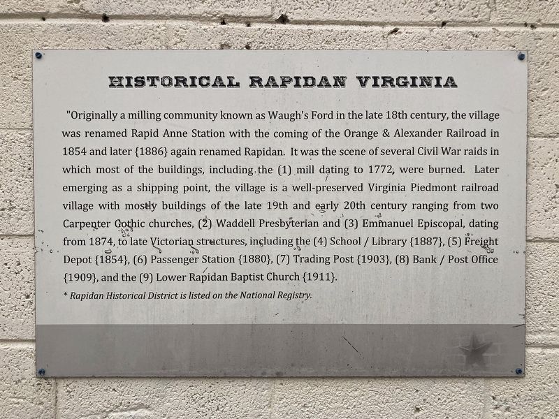
Historical Rapidan Virginia
Photographed by Evan Dwyer, November 15, 2025
1. Historical Rapidan Virginia Marker
*Rapidan Historical District is listed on the National Registry.
Topics. This historical marker is listed in these topic lists: Architecture • Railroads & Streetcars • War, US Civil • Waterways & Vessels.
Location. 38° 18.607′ N,
this page online

Regionally, this marker is in the Washington Metropolitan Area and in Northern Virginia. It is also in the American South, specifically in the Upper South, and in the Mid-Atlantic. Globally, it is in North America, the Western Hemisphere, the Western World, and the Anglosphere. Historically, it finds itself in what was once the territory of the Mississippian Culture, one of the original Thirteen Colonies, one of the Confederate States of America, and the Antebellum South.
Other nearby markers. At least 8 other markers are within 4 miles of this marker, measured as the crow flies: Locust Grove (approx. 1.2 miles away); Pete Hill (approx. 2.3 miles away); Peyton's Ford Road / Woodberry Perimeter Trail (approx. 2.4 miles away); Bloomsbury (approx.
Photographed by Evan Dwyer, November 15, 2025
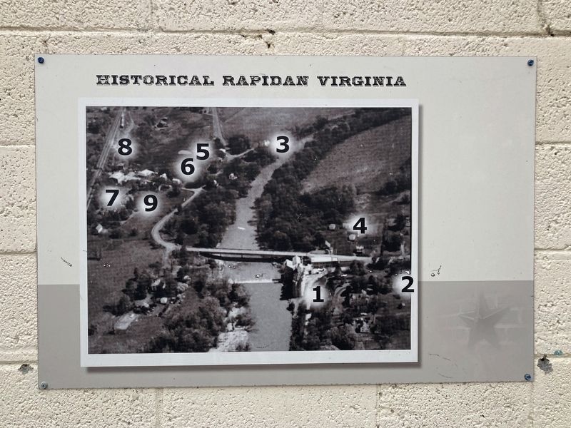
2. Historical Rapidan Virginia Marker
The numbers on this panel correspond to the numbers in parentheses accompanying buildings described in the main panel's text.
More about this marker. Numbers in the marker text reference the numbered aerial photograph on the adjacent panel.
Photographed by Evan Dwyer, November 15, 2025
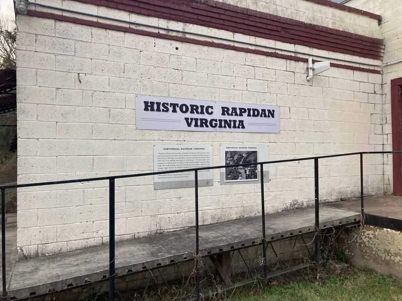
3. Historical Rapidan Virginia Marker
Photographed by Evan Dwyer, November 15, 2025
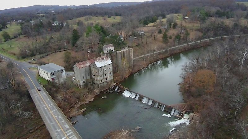
4. Historical Rapidan Virginia
The marker is on the concrete building just across the river next to Rapidan Road. The flour mill referenced in the text is the large abandoned building with silos attached just to the right of it. The old Willis House, expanded in the late 19th century by Henry T. Holladay, is on the hill beyond the silos, partially obscured by trees. The oldest building in the area is the Mill House, the small white building just to the right of the cars parked behind the Willis House.
Photographed by Evan Dwyer, November 15, 2025
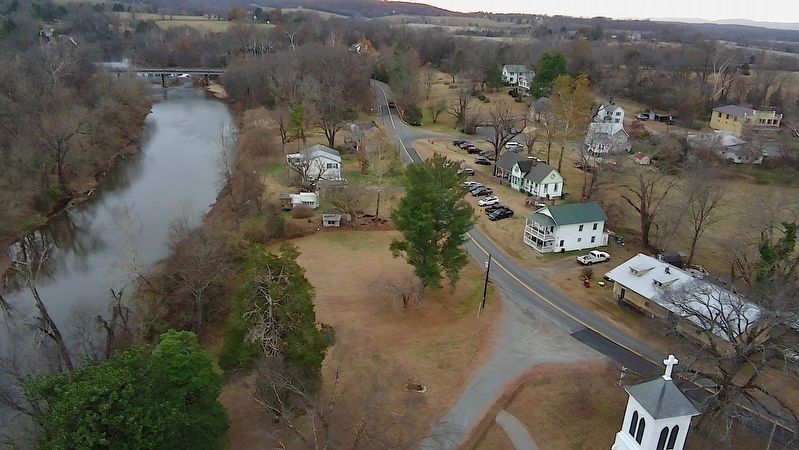
5. Historical Rapidan Virginia
The Culpeper County side of the village. At lower right is the bell tower for Emmanuel Episcopal, attended in 1902 by President Teddy Roosevelt during a stay with the Wilmer family of nearby Horse Shoe Farm. The low, long yellow building just beyond the bell tower is the 1853 Freight Depot, now converted into a duplex apartment. The 1880 passenger depot is the ornate green & white building surrounded by parked vehicles. The yellow two-story commercial structure with facade at upper right is the 1903 trading post. The flour mill and dam are at upper left.
Photographed by Evan Dwyer, November 15, 2025
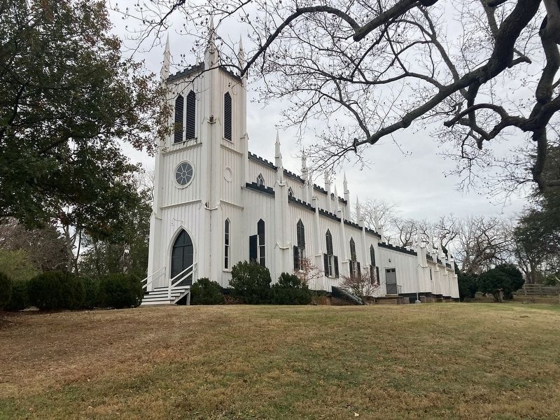
6. Waddell Memorial Presbyterian Church
The architectural jewel of the village is this all-wood 1874 Carpenter Gothic church, on the Orange County side of the river just two parcels southeast of the mill and Willis House.
Credits. This page was last revised on December 15, 2025. It was originally submitted on December 11, 2025, by Evan Dwyer of Richmond, Virginia. This page has been viewed 128 times since then and 100 times this year. Photos: 1, 2, 3, 4, 5, 6. submitted on December 11, 2025, by Evan Dwyer of Richmond, Virginia. • Bernard Fisher was the editor who published this page.
