Stroudsburg in Monroe County, Pennsylvania — The American Northeast (Mid-Atlantic)
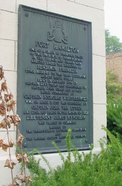
Fort Hamilton
Erected 1930 by Pennsylvania Historic Commission and The Monroe County Historical Society.
Topics and series. This historical marker is listed in these topic lists: Colonial Era • Forts and Castles • War, French and Indian. In addition, it is included in the Pennsylvania Historical and Museum Commission series list. A significant historical month for this entry is January 1756.
Location. 40° 59.058′ N, 75° 11.877′ W. Marker is in Stroudsburg, Pennsylvania, in Monroe County. Marker is at the intersection of Main Street (U.S. 209) and 9th Street, on the left when traveling north on Main Street. Touch for map. Marker is at or near this postal address: 901 Main Street, Stroudsburg PA 18360, United States of America. Touch for directions.
Other nearby markers. At least 5 other markers are within walking distance of this marker. A different marker also named Fort Hamilton (here, next to this marker); Stroud Mansion (a few steps from this marker); a different marker also named Stroud Mansion (within shouting distance of this marker); Friends Burial Ground (about 700 feet away, measured in a direct line); Hollinshead House (approx. 0.2 miles away). Touch for a list and map of all markers in Stroudsburg.
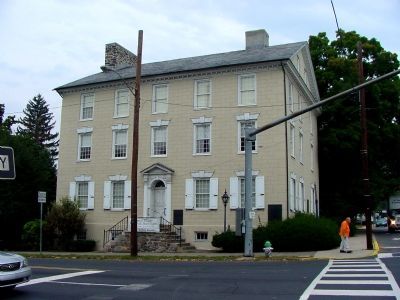
More about this marker. The marker is affixed to the Stroud House, now occupied by the Monroe County Historical Society. It is on the right corner of the house facing Main St.
Also see . . . MarkerQuest - Fort Hamilton. An overview of the fort's history and location. (Submitted on October 20, 2021, by Laura Klotz of Northampton, Pennsylvania.)
Credits. This page was last revised on August 28, 2023. It was originally submitted on November 13, 2005, by J. J. Prats of Powell, Ohio. This page has been viewed 2,495 times since then and 16 times this year. Photos: 1, 2. submitted on November 13, 2005.

