
Near Wheeling in Ohio County, West Virginia — The American South (Appalachia)
Brooke County
⎯⎯⎯
Ohio County
Photographed by Mike Wintermantel, July 7, 2012
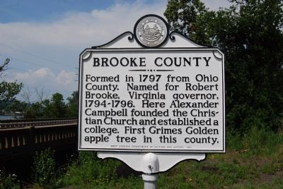
1. Brooke County Marker
Brooke County. Formed in 1797 from Ohio County. Named for Robert Brooke, Virginia governor, 1794-1796. Here Alexander Campbell founded the Christian Church and established a college. First Grimes Golden apple tree in this county.
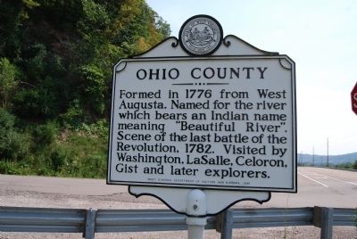
Ohio County. Formed in 1776 from West Augusta. Named for the river which bears an Indian name meaning "Beautiful River". Scene of the last battle of the Revolution, 1782. Visited by Washington, LaSalle, Celoron, Gist and later explorers.
Erected 1981 by West Virginia Department of Culture and History.
Topics and series. This historical marker is listed in these topic lists: Agriculture • Indigenous Peoples and Communities • Political Subdivisions • Religion & Religious Structures. In addition, it is included in the West Virginia Archives and History series list. A significant historical year for this entry is 1797.
Location. 40° 10.967′ N, 80° 40.615′ W. Marker is near Wheeling, West Virginia, in Ohio County. It is at the intersection of Wanwood Avenue (West Virginia Route 2) and Stone Shannon Road, on the right when traveling north on Wanwood Avenue. Touch for map. Marker
this page online

Regionally, this marker is in the Northern Panhandle and in the High Valley. It is also in the American South, specifically in the Upper South, in the Ohio River Valley, in Appalachia, and specifically in Northern Appalachia. Globally, it is in North America, the Western Hemisphere, the Western World, and the Anglosphere. Historically, it finds itself in what was once the territory of the Mississippian Culture.
Other nearby markers. At least 8 other markers are within 5 miles of this marker, measured as the crow flies: Rayland Veterans Memorial (approx. 0.9 miles away in Ohio); Beech Bottom, W.V. World War II Honor Roll (approx. 3.3 miles away); Beech Bottom Iraq War Veterans Memorial (approx. 3.3 miles away); Beech Bottom Fort (approx. 3.3 miles away); West Virginia Flying Corps (approx. 3.8 miles away); Curtis Hall (approx. 4.1 miles away); Shotwell Hall (approx. 4.1 miles away); John F. Kennedy Address at West Liberty State College (approx. 4.2 miles away).
Photographed by Mike Wintermantel, July 7, 2012
2. Ohio County Marker
Photographed by Mike Wintermantel, July 7, 2012
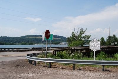
3. Brooke County Marker
Photographed by Mike Wintermantel, July 7, 2012
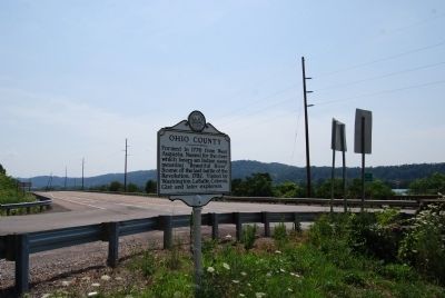
4. Ohio County Marker
Credits. This page was last revised on December 14, 2025. It was originally submitted on July 7, 2012, by Mike Wintermantel of Pittsburgh, Pennsylvania. This page has been viewed 796 times since then and 37 times this year. Last updated on December 12, 2025, by Carl Gordon Moore Jr. of North East, Maryland. Photos: 1, 2, 3, 4. submitted on July 7, 2012, by Mike Wintermantel of Pittsburgh, Pennsylvania. • Devry Becker Jones was the editor who published this page.
