Near Dolores in Montezuma County, Colorado — The American Mountains (Southwest)
Dominguez Pueblo
Photographed by Cosmos Mariner, July 17, 2025
1. Dominguez Pueblo Marker
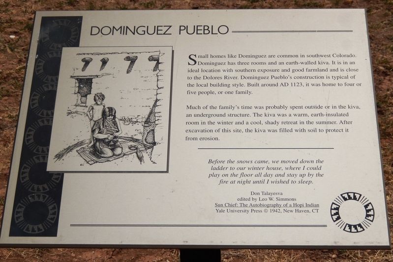
Small homes like Dominguez are common in southwest Colorado. Dominguez has three rooms and an earth-walled kiva. It is in an ideal location with southern exposure and good farmland and is close to the Dolores River. Dominguez Pueblo's construction is typical of the local building style. Built around AD 1123, it was home to four or five people, or one family.
Much of the family's time was probably spent outside or in the kiva, an underground structure. The kiva was a warm, earth-insulated room in the winter and a cool, shady retreat in the summer. After excavation of this site, the kiva was filled with soil to protect it from erosion.
Before the snows came, we moved down the ladder to our winter house, where I could play on the floor all day and stay up by the fire at night until I wished to sleep.
Don Talayesva
edited by Leo W. Simmons
Sun Chief: The Autobiography of a Hopi Indian
Yale University Press © 1942, New Haven, CT
Erected by The Colorado Historical Society, the Bureau of Land Management, the Family of Nellie Mulnix Joy and the Frankston Family.
Topics. This historical marker is listed in these topic lists:
this page online
Location. 37° 28.565′ N, 108° 32.797′ W. Marker is near Dolores, Colorado, in Montezuma County. It can be reached from State Highway 184 at milepost 7, on the right when traveling west. The marker is located in front of the Dominguez Pueblo at the Canyons of the Ancients National Monument Visitor Center. Touch for map. Marker is at or near this postal address: 27501 Colorado Highway 184, Dolores CO 81323, United States of America. Touch for directions.

Regionally, this marker is in the American Mountain West, on the Colorado Plateau, and at the Four Corners. Globally, it is in North America, the Rocky Mountains, the Western Hemisphere, the Western World, and the Anglosphere. Historically, it finds itself in what was once the territory of the Ancestral Puebloans and also Mexico’s Alta California.
Other nearby markers. At least 8 other markers are within walking distance of this marker: A Path Well Traveled (within shouting distance of this marker); Yucca (within shouting distance of this
Photographed by Cosmos Mariner, July 17, 2025
2. Dominguez Pueblo Marker
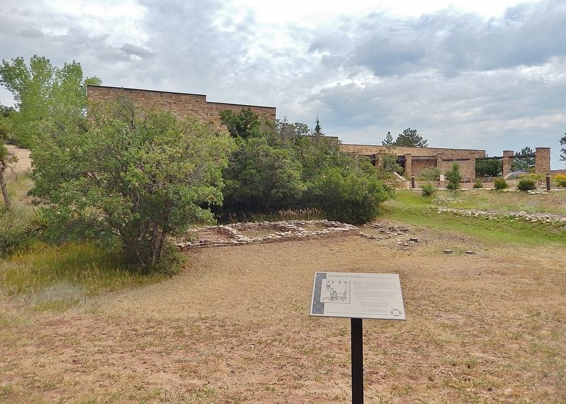
The Dominguez Pueblo ruins are in the background. The Canyons of the Ancients National Monument Visitor Center is in the distant background.
Also see . . .
1. Canyons of the Ancients Visitor Center and Museum (Wikipedia).
Excerpt: Near the Escalante Pueblo is another small prehistoric household called Dominguez Pueblo, an example of independent family homes outside the main pueblo. Discovered at the site were items that shed light on how the people may have lived, including “6,900 turquoise, jet and shell beads; a shell and turquoise frog pendant and mosaics, two fine ceramic vessels, six bone scrapers, a woven mat and many other items.”(Submitted on December 21, 2025, by Cosmos Mariner of Cape Canaveral, Florida.)
The two interpreted prehistoric pueblos on the grounds of the Visitor Center and Museum are named in honor of the two Spanish Franciscan friars, Francisco Atanasio Domínguez and Silvestre Vélez de Escalante, who recorded these ancient archaeological sites during the Domínguez–Escalanteexpedition in 1776.Photographed by Cosmos Mariner, July 17, 20253. Dominguez Pueblo
2. Dominguez Pueblo (Bureau of Land Management).
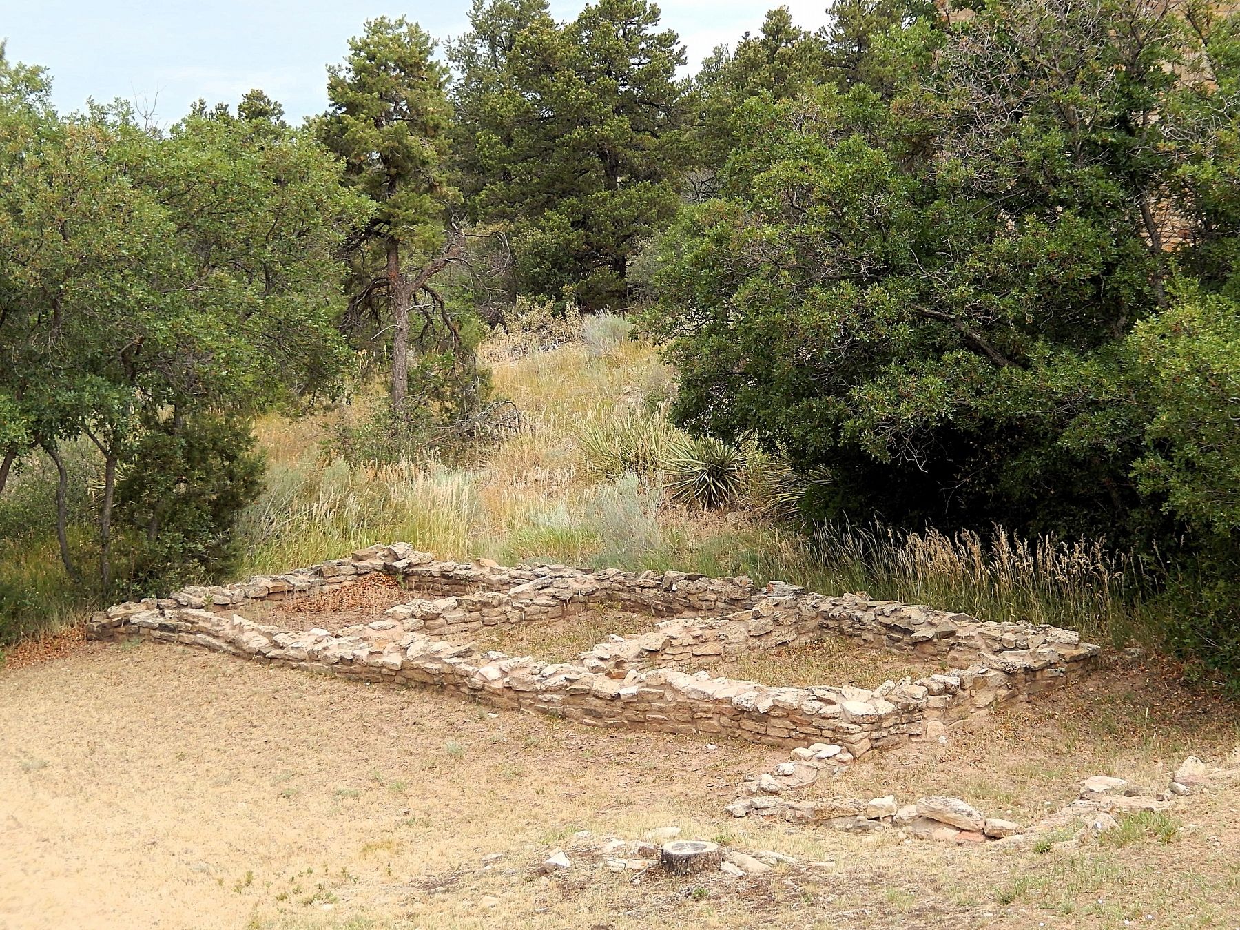
Excerpt: Dominguez Pueblo is an example of the common household style of the Northern San Juan Tradition: a row of small rooms facing a kiva or circular underground chamber. The low stone walls you see would have supported jacal walls made of poles, brush, and earth, with a roof of similar construction. Traces of 18 similar household sites have been found on this hill surrounding the Escalante Pueblo.(Submitted on December 21, 2025, by Cosmos Mariner of Cape Canaveral, Florida.)
The kiva, no longer visible, was about 11 feet in diameter and probably had a roof with a ladder entrance. It may have served as a place for family members to sleep, eat, and/or retreat from bad weather. It was not possible to stabilize the earthen walls of the kiva, so it was backfilled after excavation in the 1970s. Replacing the dirt is often the best way to preserve ancient structures.
Credits. This page was last revised on December 21, 2025. It was originally submitted on December 19, 2025, by Cosmos Mariner of Cape Canaveral, Florida. This page has been viewed 62 times since then and 26 times this year. Photos: 1, 2, 3. submitted on December 21, 2025, by Cosmos Mariner of Cape Canaveral, Florida.
