Cannonball in Sioux County, North Dakota — The American Midwest (Upper Plains)
The Cannonball Community
Photographed by Jimmy Emerson, 2014
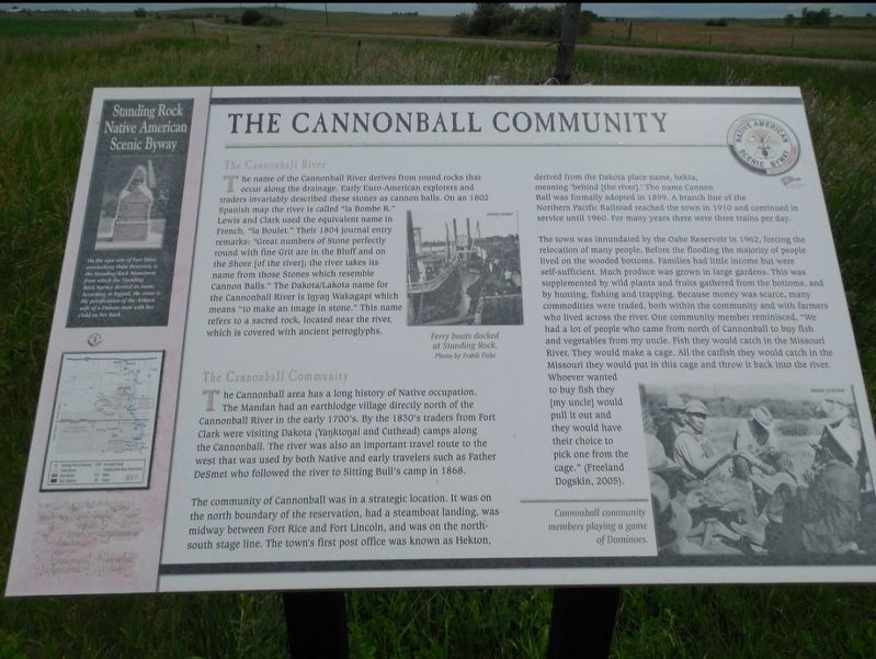
1. The Cannonball Community Marker
The Cannonball River
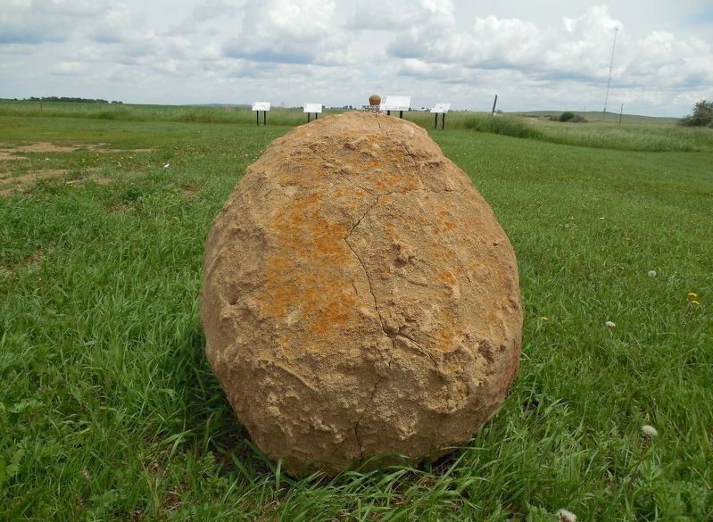
The name of the Cannonball River derives from round rocks that occur along the drainage. Early Euro-American explorers and traders invariably described these stones as cannon balls. On an 1802 Spanish map the river is called "la Bombe R." Lewis and Clark used the equivalent name in French. "la Boulet." Their 1804 journal entry remarks: "Great numbers of Stone perfectly round with fine Grit are in the Bluff and on the Shore (of the river]; the river takes its name from those Stones which resemble Cannon Balls." The Dakota/Lakota name for the Cannonball River is Inyan Wakagapi which means "to make an image in stone." This name refers to a sacred rock, located near the river, which is covered with ancient petroglyphs.
The Cannonball Community
The Cannonball area has a long history of Native occupation. The Mandan had an earthlodge village directly north of the Cannonball River in the early 1700's. By the 1830's traders from Fort Clark were visiting Dakota (Yanktonai and Cuthead) camps along the Cannonball. The river was also an important travel route to the west that was used by both Native and
this page online
The community of Cannonball was in a strategic location. It was on the north boundary of the reservation, had a steamboat landing, was midway between Fort Rice and Fort Lincoln, and was on the north-south stage line. The town's first post office was known as Hekton, derived from the Dakota place name, hekta, meaning 'behind (the river)'. The name CannonBall was formally adopted in 1890. A branch line of the Northern Pacific Railroad reached the town in 1910 and continued in service until 1960. For many years there were three trains per day.
The town was inundated by the Oahe Reservoir in 1962, forcing the relocation of many people. Before the flooding the majority of people lived on the wooded bottoms. Familles had little income but were. self-sufficient. Much produce was grown in large gardens. This was supplemented by wild plants and fruits gathered from the bottoms, and by hunting, fishing and trapping. Because money was scarce, many commodities were traded, both within the community and with farmers who lived across the river. One
Photographed by Jimmy Emerson, 2014
2. The Cannonball Rock and Markers
[Sidebar:]
On the east side of Fort Yates, overlooking Oahe Reservoir, is the Standing Rock Monument from which the Standing Rock Agency derived its name. According to legend, the stone is petrification of the Arikara wife of a Dakota man with her child on her back.
Topics. This historical marker is listed in these topic lists: Exploration • Indigenous Peoples and Communities • Waterways & Vessels. A significant historical year for this entry is 1962.
Location. 46° 23.156′ N, 100° 37.74′ W. Marker is in Cannonball, North Dakota, in Sioux County. It is on 71st Street east of North Dakota Highway 1806, on the right when traveling south. Touch for map. Marker is at or near this postal address: 7908 State Hwy 1806, Cannon Ball ND 58528, United States of America. Touch for directions.

Regionally, this marker is on the Missouri Plateau. It is also in the American Lewis & Clark Corridor, on the prairies, and on the Northern Plains. Globally, it is in North America, the Western Hemisphere, the Western World, and the Anglosphere. Historically, it finds itself in what was once Rupert’s Land and also the Louisiana Purchase.
Other nearby markers. At least 5 other markers are within 9 miles of this marker, measured as the crow flies: Native American Scenic Byway (here, next to this marker); The Parkin Ranch (within shouting distance of this marker); Fort Rice After General Sully's Expeditions (approx. 9 miles away); The Founding of Fort Rice (approx. 9 miles away); Fort Rice (approx. 9.1 miles away).
Credits. This page was last revised on December 20, 2025. It was originally submitted on December 19, 2025, by Jimmy Emerson of Dalton, Georgia. This page has been viewed 82 times since then and 47 times this year. Photos: 1, 2. submitted on December 19, 2025, by Jimmy Emerson of Dalton, Georgia. • Devry Becker Jones was the editor who published this page.
