Downtown Historic in Natchitoches in Natchitoches Parish, Louisiana — The American South (West South Central)
Natchitoches National Historic Landmark District
Jefferson Highway Historic Site

Photographed by James Hulse, December 18, 2025
1. Natchitoches National Historic Landmark District Marker
Natchitoches, the oldest permanent settlement in the Louisiana Purchase territory, was established as a French trade outpost in 1714. The National Historic Landmark District includes many historic homes, churches, and commercial structures.
Erected by Natchitoches Convention and Visitors Bureau.
Topics and series. This historical marker is listed in these topic lists: Colonial Era • Industry & Commerce • Roads & Vehicles • Settlements & Settlers. In addition, it is included in the National Historic Landmarks series list. A significant historical year for this entry is 1714.
Location. 31° 45.767′ N, 93° 5.162′ W. Marker is in Natchitoches, Louisiana, in Natchitoches Parish. It is in Downtown Historic. It is on Front Street south of Lafayette Street, on the right when traveling south. The marker is on the front wall of the Natchitoches Visitors Center. Touch for map. Marker is at or near this postal address: 780 Front Street, Natchitoches LA 71457, United States of America. Touch for directions.

Regionally, this marker is in Central Louisiana. It is also in the American South, specifically in the
this page online
Other nearby markers. At least 8 other markers are within walking distance of this marker: Ducournau Building (within shouting distance of this marker); Roque House (within shouting distance of this marker); a different marker also named Roque House (within shouting distance of this marker); El Camino Real (within shouting distance of this marker); The Historic Cane River (within shouting distance of this marker); Louis Juchereau de St. Denis (within shouting distance of this marker); Natchitoches Historic District (within shouting distance of this marker); Natchitoches Indians (about 300 feet away, measured in a direct line). Touch for a list and map of all markers in Natchitoches.

Photographed by James Hulse, December 18, 2025
2. Natchitoches National Historic Landmark District Marker
The marker is located on the wall of the visitors center.
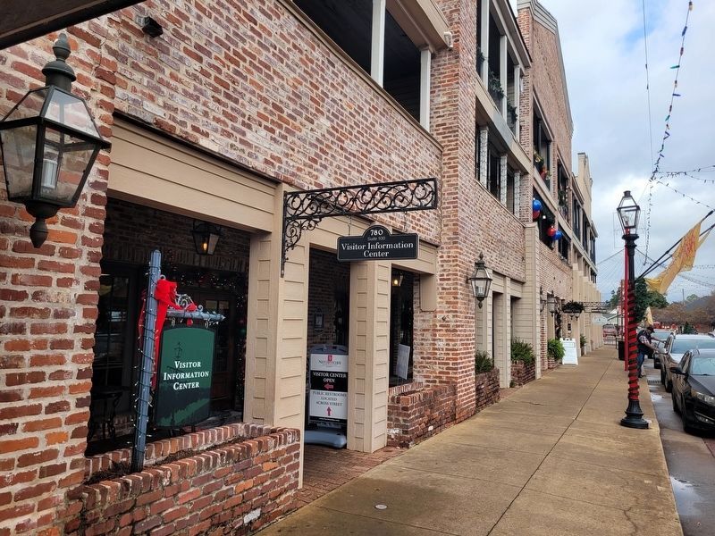
Photographed by James Hulse, December 18, 2025
3. Natchitoches National Historic Landmark District Marker
The view of the visitors center along the street.
Credits. This page was last revised on February 26, 2026. It was originally submitted on December 23, 2025, by James Hulse of Medina, Texas. This page has been viewed 77 times since then and 45 times this year. Photos: 1, 2, 3. submitted on December 23, 2025, by James Hulse of Medina, Texas.
