Sorbonne in Paris in Département de Paris, Île-de-France, France — Western Europe
Jardin médiéval du musée de Cluny
⎯⎯⎯
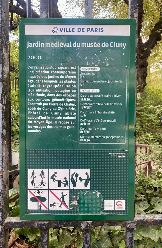
Medieval Garden of the Cluny Museum (2000)
Photographed by Andrew Ruppenstein, July 27, 2022
1. Jardin médiéval du musée de Cluny / Medieval Garden of the Cluny Museum Marker

L'organisation du square est une création contemporaine inspirée des jardins du Moyen Âge, dans lesquels les plantes étaient regroupées selon leur utilisation, potagère ou médicinale, dans des espaces aux contours géométriques. Construit par Pierre de Chalus, abbé de Cluny au XVIe siècle, l'hôtel de Cluny abrite aujourd'hui le musée national du Moyen Âge. Il repose sur les vestiges des thermes gallo-romains.
Erected by Ville de Paris.
Topics and series. This historical marker is listed in these topic lists: Agriculture • Horticulture & Forestry • Parks & Recreational Areas. In addition, it is included in the Parks and Squares of Paris series list.
Location. 48° 51.07′ N, 2° 20.598′ E. Marker is in Paris, Île-de-France, in Département de Paris. It is in Sorbonne. It is at the intersection of Boulevard Saint-Michel and Boulevard Saint-Germain, on the left when traveling south on Boulevard Saint-Michel. Touch for map. Marker is in this post office area: Paris, Île-de-France 75005, France. Touch for directions.

Regionally, it is in the North Atlantic Region, Europe, the European Union, Atlantic Europe, the Schengen Area, Western Europe, a coastal Mediterranean country, and the Western World. Historically, it finds itself in what was once a French colony and also the Roman Empire.
Other nearby markers. At least 8 other markers
this page online
Also see . . . Jardin médiéval du musée de Cluny (Wikipedia). Excerpt (in translation):
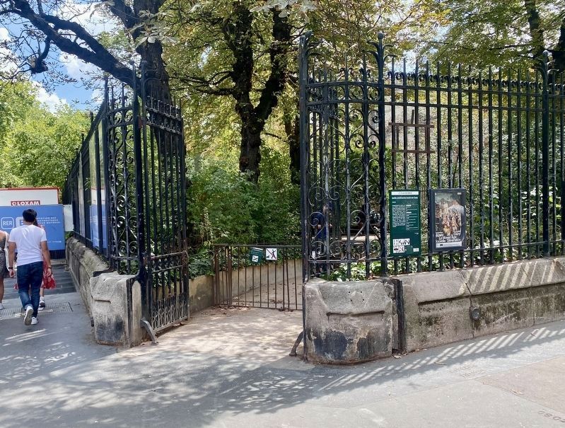
Until the mid-19th century, the former Hôtel de Cluny and the remains of the Cluny baths were contained within a dense urban block bordered to the west by the Rue de la Harpe, to the north by the Rue du Foin, to the east by the Rue Saint-Jacques, and to the south by the Rue des Mathurins (now the Rue Du Sommerard). As part of the transformations of Paris under the Second Empire, the construction of the Boulevard Saint-Michel and the Boulevard Saint-Germain led to the disappearance of the old Rue du Foin (which was joined to the Rue des Noyers in 1851)(Submitted on December 26, 2025.)and the widening of the Rue de la Harpe (absorbed by the Boulevard Saint-Michel) and the Rue Saint-Jacques. The baths and the Hôtel de Cluny were thus exposed, and a public garden was laid out.Photographed by Andrew Ruppenstein, July 27, 20222. Medieval Garden of the Cluny Museum Marker - wide viewThe marker is visible here to the of right the entrance to the garden.
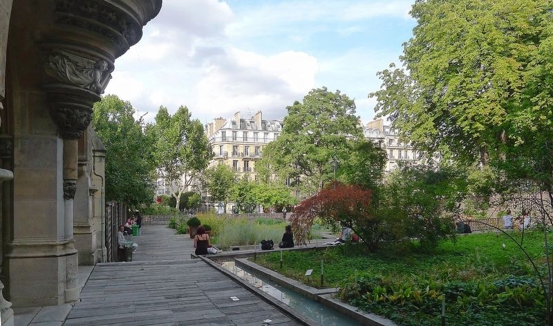
The medieval garden, created in 2000, is a contemporary design inspired by medieval architecture, created by landscape architects Éric Ossart and Arnaud Maurières. No trace remained of the 15th-century urban garden of the Hôtel des Abbés de Cluny, although its precise outline can still be identified through numerous plans and archival documents. In this sense, the contemporary garden, with its axis perpendicular to that of the main building, represents the exact opposite of the medieval design, which featured a small garden whose axis was parallel to the main building.
Photographed by Mbzt (via Wikimedia Commons under CC 3.0 license), August 29, 2012
3. Jardin du Musée de Cluny
Credits. This page was last revised on December 26, 2025. It was originally submitted on December 26, 2025, by Andrew Ruppenstein of Lamorinda, California. This page has been viewed 53 times since then and 22 times this year. Photos: 1, 2, 3. submitted on December 26, 2025, by Andrew Ruppenstein of Lamorinda, California.
