Near Bozeman in Gallatin County, Montana — The American West (Mountains)
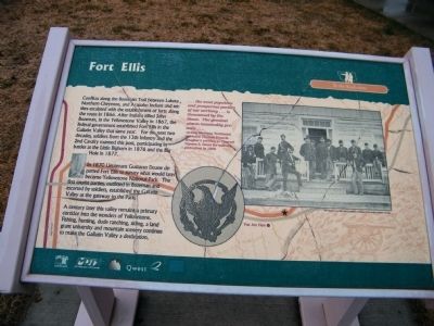
Fort Ellis
To the Headwaters
In 1870 Lieutenant Gustavus Doane departed Fort Ellis to survey what would later become Yellowstone National Park. The first tourist parties, outfitted in Bozeman and escorted by soldiers, established the Gallatin Valley as the gateway to the Park.
A century later this valley remains a primary corridor into the wonders of Yellowstone. Fishing, hunting, dude ranching, skiing, a land grant university and mountain scenery continue to make the Gallatin Valley a destination.
Erected by Montana Department of Transportation (MDT) & Qwest.
Topics and series. This historical marker is listed in these topic lists: Exploration • Forts and Castles • Native Americans • Notable Events • Notable Places • Settlements & Settlers. In addition, it is included in the Lewis & Clark Expedition series list. A significant historical year for this entry is 1866.
Location. 45° 42.742′ N, 111° 3.85′ W. Marker is near Bozeman, Montana, in Gallatin County. Marker is on 19th Avenue near I-90 eastbound entrance ramp (at milepost 305), 0.1 miles east of N. 19th Ave. and E. Valley Center Rd., on the left when traveling south. Located at Bozeman Rest Area along I-90 along with several other historic markers. Touch for map. Marker is in this post office area: Bozeman MT 59718, United States of America. Touch for directions.
Other nearby markers. At least 8 other markers are within walking distance of this marker. Valley of Opportunity (a few steps from this marker); Fur Trade (within shouting distance of this marker); Lewis and Clark (within shouting distance of this marker); First People in the Gallatin Valley (within shouting distance of this marker); Pioneer Museum (within shouting distance of this marker); Trail Through Time (within shouting distance of this marker); Gallatin History Museum (within shouting distance of this marker); Bozeman Veterans Memorial (within shouting distance of this marker). Touch for a list and map of all markers in Bozeman.
More about this marker. This marker is included in the Lewis & Clark Expedition marker series. It is one of six illustrated interpretive signs known as "One Trail Through Time: The Bozeman Rest Area signs" according to Montana's Historical Highway Markers book (Revised and Expanded by Axline 2008)
Marker is cracked in numerous locations.
Regarding Fort Ellis. Marker Quotation: "... the most populous and prosperous portion of our territory...is threatened by the Sioux. The greatest alarm reasonably prevails..." - Acting Montana Territorial Governor Thomas Francis Meagher's petition to General Ulysses S. Grant for military protection in 1866
Photo Caption: "The Officers of Fort Ellis, used by permission of Museum of the Rockies, Bozeman, Montana"
Credits. This page was last revised on October 14, 2020. It was originally submitted on March 22, 2010, by Rich Pfingsten of Forest Hill, Maryland. This page has been viewed 2,270 times since then and 103 times this year. Last updated on March 24, 2010, by Rich Pfingsten of Forest Hill, Maryland. Photo 1. submitted on March 22, 2010, by Rich Pfingsten of Forest Hill, Maryland. • Bill Pfingsten was the editor who published this page.
