Spring Township near Elliottsburg in Perry County, Pennsylvania — The American Northeast (Mid-Atlantic)
Indian Attacks in Shermans Valley
Perry County Bicentennial
| — | 1820 - 2020 | — |
Photographed by Devry Becker Jones (CC0), February 23, 2024
1. Indian Attacks in Shermans Valley Marker
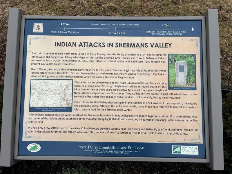
1756: French & Indian War began.
1756-1763: Indians drove settlers form Shermans Valley.
1766: Donegal Presbytery authorized Perry County congregations.
Scotch-Irish settlers moved north from Carlisle to Perry County after the Treaty of Albany in 1754, not realizing the times were still dangerous. Taking advantage of the conflict between Great Britain and France, Delaware Indians returned in force across Pennsylvania in 1756. They attacked isolated cabins and Robinson's Fort, located near present-day Centre Presbyterian Church.
Over 100 men, women, and children had gathered in the fort for safety. One morning in late July 1756, about forty men left the fort to harvest their fields. No one observed the party of twenty-five Indians waiting near the fort. The Indians attacked, killing a young girl and two mothers who were outside the fort looking for cattle.
The raiders captured two young teens. Hugh Gibson and Betsey Henry, carrying them to a camp near Pittsburgh. Frightened settlers retreated south of Blue Mountain for two or three years. Held captive for almost three years, Hugh and three others escaped from
this page online
Indians from the Ohio Valley attacked again in the summer of 1763. Aware of their approach, the settlers fled Shermans Valley. Although the valley was unsafe, many brave men returned to harvest the fields in July to ensure food for their families in the winter.
After Indians attacked isolated cabins north of the Tuscarora Mountain in July, twelve settlers banded together and set off to warn others. They encountered the Indians on the south side of the mountain along Big Buffalo Creek, about two miles west of Ickesburg. In the ensuing battle, five settlers died.
In 1764, only a few settlers lived in the valley. Colonial troops provided security near Elliottsburg and Kistler. By year's end, additional families felt safer and gradually returned. The attacks were over. Still, for years afterward, settlers carried their muskets to church to provide safety.
Erected 2020 by Historical Society of Perry County. (Marker Number 3.)
Topics and series. This historical
Photographed by Devry Becker Jones (CC0), February 23, 2024
2. Indian Attacks in Shermans Valley Marker
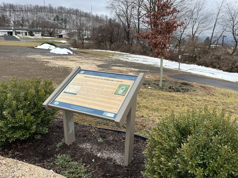
Location. 40° 23.079′ N, 77° 17.86′ W. Marker is near Elliottsburg, Pennsylvania, in Perry County. It is in Spring Township. It can be reached from Shermans Valley Road (Pennsylvania Route 274) 0.4 miles east of Veterans Way ( Route 74), on the right when traveling west. Touch for map. Marker is at or near this postal address: 2471 Shermans Valley Rd, Elliottsburg PA 17024, United States of America. Touch for directions.

Regionally, this marker is in South-Central Pennsylvania, in the Susquehanna Valley, and in Greater Harrisburg. It is also in the American Northeast, in the Mid-Atlantic, in Appalachia, and specifically in Northern Appalachia. Globally, it is in North America, the Western Hemisphere, the Western World, and the Anglosphere. Historically, it finds itself in what was once the Haudenosaunee (Iroquois) Confederacy and also one of the original Thirteen Colonies.
Other nearby markers. At least 8 other markers are within walking distance of this marker: Perry County Covered Bridges (here, next to this marker); Contact Between Widely Different Cultures (here, next to this marker); A New Century (here, next to this marker); WW I and Its Aftermath (here, next to this marker); The First Inhabitants of Perry County (here, next to this marker); Life in the Great Depression (here, next to this marker); Perry Countians in the Revolutionary War (here, next to this marker); Transportation and Natural Resources (here, next to this marker). Touch for a list and map of all markers in Elliottsburg.
Credits. This page was last revised on January 5, 2026. It was originally submitted on February 27, 2024, by Devry Becker Jones of Washington, District of Columbia. This page has been viewed 583 times since then and 142 times this year. Last updated on January 2, 2026, by Mark St. Martin of Kalamazoo, Michigan. Photos: 1, 2. submitted on February 27, 2024, by Devry Becker Jones of Washington, District of Columbia.
