Crawford in Delta County, Colorado — The American Mountains (Southwest)
West Elk Loop
Scenic and Historic Byway
Photographed by Cosmos Mariner, July 20, 2025
1. West Elk Loop Marker
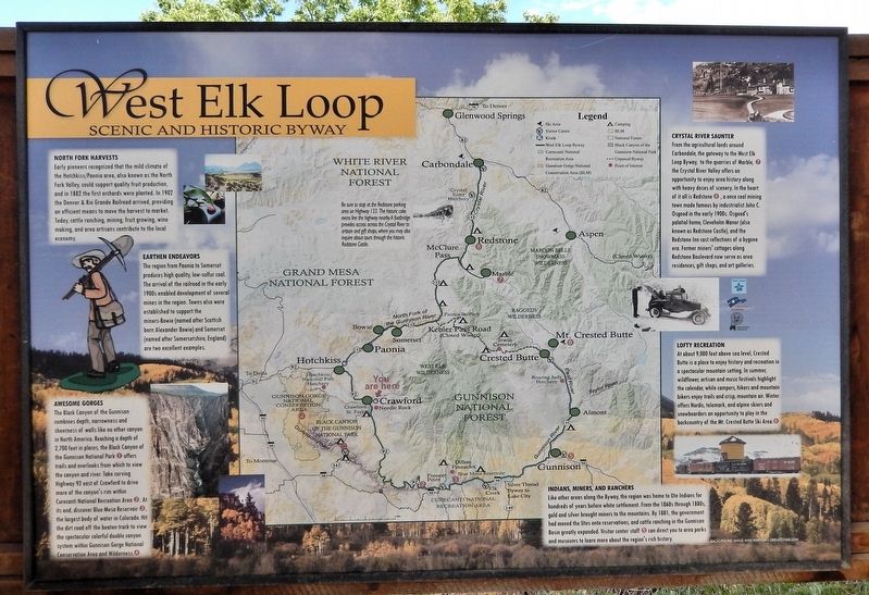
North Fork Harvests
Early pioneers recognized that the mild climate of the Hotchkiss/Paonia area, also known as the North Fork Valley, could support quality fruit production, and in 1882 the first orchards were planted. In 1902 the Denver & Rio Grande Railroad arrived, providing an efficient means to move the harvest to market. Today, cattle ranching, mining, fruit growing, wine making, and area artisans contribute to the local economy.
Earthen Endeavors
The region from Paonia to Somerset produces high quality, low-sulfur coal. The arrival of the railroad in the early 1900s enabled development of several mines in the region. Towns also were established to support the miners — Bowie (named after Scottish born Alexander Bowie) and Somerset (named after Somersetshire, England) are two excellent examples.
Awesome Gorges
The Black Canyon of the Gunnison combines depth, narrowness and sheerness of walls like no other canyon in North America. Reaching a depth of 2,700 feet in places, the Black Canyon of the Gunnison National Park offers trails and overlooks from which to view the canyon and river. Take curving Highway 92 east of
this page online
Crystal River Saunter
From the agricultural lands around Carbondale, the gateway to the West Elk Loop Byway, to the quarries of Marble, the Crystal River Valley offers an opportunity to enjoy area history along with heavy doses of scenery. In the heart of it all is Redstone, a once coal mining town made famous by industrialist John C. Osgood in the early 1900s. Osgood's palatial home, Cleveholm Manor (also known as Redstone Castle), and the Redstone Inn cast reflections of a bygone era. Former miners' cottages along Redstone Boulevard now serve as area residences, gift shops, and art galleries.
Lofty Recreation
At about 9,000 feet above sea level, Crested Butte is a place to enjoy history and recreation in a spectacular mountain setting. In summer, wildflower, artisan and music festivals highlight the calendar, while
Photographed by Cosmos Mariner, July 20, 2025
2. West Elk Loop Marker
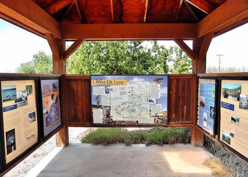
This marker is mounted on the west side of the West Elk Loop Byway interpretive kiosk.
Indians, Miners and Ranchers
Like other areas along the Byway, the region was home to Ute Indians for hundreds of years before white settlement. From the 1860s through 1880s, gold and silver brought miners to the mountains. By 1881, the government had moved the Utes onto reservations, and cattle ranching in the Gunnison Basin greatly expanded. Visitor center staff can direct you to area parks and museums to learn more about the region's rich history.
Topics. This historical marker is listed in these topic lists: Agriculture • Indigenous Peoples and Communities • Industry & Commerce • Railroads & Streetcars. A significant historical year for this entry is 1882.
Location. 38° 42.228′ N, 107° 36.635′ W. Marker is in Crawford, Colorado, in Delta County. It is on State Highway 92 just west of F Street, on the right when traveling west. The marker is mounted in the West Elk Loop Byway interpretive kiosk in front of
Photographed by Cosmos Mariner, July 20, 2025
3. West Elk Loop Byway Interpretive Kiosk
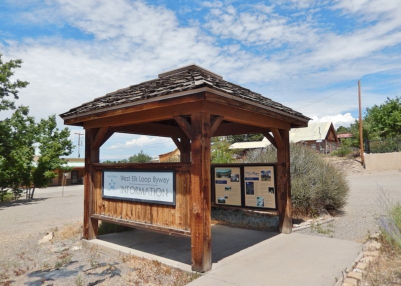
The marker is mounted inside the interpretive kiosk.

Regionally, this marker is in the Western Slope. It is also in the American Mountain West and on the Colorado Plateau. Globally, it is in North America, the Rocky Mountains, the Western Hemisphere, the Western World, and the Anglosphere. Historically, it finds itself in what was once Mexico’s Alta California.
Other nearby markers. At least 8 other markers are within 9 miles of this marker, measured as the crow flies: Agriculture (here, next to this marker); Crawford State Park (here, next to this marker); Crawford (here, next to this marker); a different marker also named West Elk Loop (approx. 8.4 miles away); Hotchkiss-Crawford Historical Museum (approx. 8.8 miles away); Hotchkiss Methodist Episcopal Church (approx. 8.9 miles away); First Hotchkiss School Bell (approx. 8.9 miles away); Hotchkiss Memorial Hall (approx. 8.9 miles away). Touch for a list and map of all markers in Crawford.
Related markers. Click here for a list of markers that are related to this marker. Crawford Country
Credits. This page was last revised on January 17, 2026. It was originally submitted on January 11, 2026, by Cosmos Mariner of Cape Canaveral, Florida. This page has been viewed 73 times since then. Photos: 1, 2, 3. submitted on January 17, 2026, by Cosmos Mariner of Cape Canaveral, Florida.
