Woodberry Forest in Madison County, Virginia — The American South (Mid-Atlantic)
Peyton's Ford Road
⎯⎯⎯
Woodberry Perimeter Trail
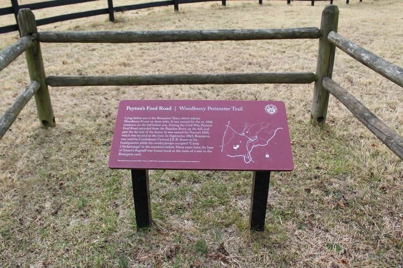
Photographed by Evan Dwyer, January 6, 2026
1. Peyton's Ford Road Marker
This marker honors the memory of Roy L. Smart, Jr., WFS 1940 - loyal alumnus, devoted student of the Civil War, truest of gentlemen.
Erected by Woodberry Forest School.
Topics. This historical marker is listed in these topic lists: Roads & Vehicles • War, US Civil. A significant historical month for this entry is September 1863.
Location. 38° 18.052′ N, 78° 6.533′ W. Marker is in Woodberry Forest, Virginia, in Madison County. It is at the intersection of Brampton Road and Forest Drive, on the left when traveling south
this page online

Regionally, this marker is in Northern Virginia and in the Piedmont. It is also in the American South and specifically in the Upper South. Globally, it is in North America, the Western Hemisphere, the Western World, and the Anglosphere. Historically, it finds itself in what was once the territory of the Mississippian Culture, one of the original Thirteen Colonies, one of the Confederate States of America, and the Antebellum South.
Other nearby markers. At least 8 other markers are within 4 miles of this marker, measured as the crow flies: Fry's/Barnett's Ford Road (approx. 1.4 miles away); Woodberry Forest School (approx. 1½ miles away); Knights of the Golden Horseshoe (approx. 2 miles away); Grave of Gov. James Lawson Kemper (approx. 2.2 miles away); Orange County / Madison County (approx. 2.2 miles away); Historical Rapidan Virginia

Photographed by Evan Dwyer, January 6, 2026
2. Peyton's Ford Road Marker Fence
In the background is ca. 1846 house 'Brampton'; the valley to the left is what the marker refers to as "Camp Chickamauga."
Other markers no longer nearby. Knights of the Golden Horseshoe (was approx. 2 miles away but has been replaced with another marker now near it); Kemper's Grave (was approx. 2.2 miles away but has been replaced with another marker now near it).
Regarding Peyton's Ford Road / Woodberry Perimeter Trail. Brampton was also used as a signal station and was Stuart's headquarters at the time of the Battle of Jack's Shop, to the north in Rochelle. Stuart and his wife both resided in the house during the winter of 1863-64.

circa 2025
3. Brampton, built ca. 1846
Credits. This page was last revised on January 15, 2026. It was originally submitted on January 12, 2026, by Evan Dwyer of Richmond, Virginia. This page has been viewed 75 times since then. Photos: 1, 2, 3. submitted on January 12, 2026, by Evan Dwyer of Richmond, Virginia. • Bernard Fisher was the editor who published this page.
