Charlton Flats in Angeles National Forest in Los Angeles County, California — The American West (Pacific Coastal)
D.A.R. Society’s Fiftieth Anniversary
DAR Forest

Photographed by Craig Baker, circa 2008
1. D.A.R. Society’s Fiftieth Marker
This grove presented by the California State Society of the Daughters of the American Revolution in honor of Mrs. John Whittier Howe Hodge, State Regent 1938-1940, commemorating the D.A.R. Society's Fiftieth Anniversary.
Erected 1940 by California State Society of the Daughters of the American Revolution.
Topics and series. This historical marker is listed in these topic lists: Fraternal or Sororal Organizations • Horticulture & Forestry • Parks & Recreational Areas • Women. In addition, it is included in the Daughters of the American Revolution (DAR) series list. A significant historical year for this entry is 1941.
Location. 34° 17.946′ N, 118° 0.342′ W. Marker is in Angeles National Forest, California, in Los Angeles County. It is in Charlton Flats. It is on Mt Mooney Road near Angeles Crest Highway (California Route 2), on the right when traveling north. Touch for map. Marker is in this post office area: Palmdale CA 93550, United States of America. Touch for directions.

Regionally, this marker is in Greater Los Angeles, in the High Desert, and in the Transverse Ranges. It is also on
this page online
Other nearby markers. At least 8 other markers are within 7 miles of this marker, measured as the crow flies: Vetter Mountain Fire Lookout (approx. 1.3 miles away); Chilao Visitor Center (approx. 1.9 miles away); West Fork Ranger Station (approx. 1.9 miles away); Cogswell Dam (approx. 4½ miles away); The Mount Wilson 100 Inch Telescope (approx. 5.9 miles away); The 100-Inch Hooker Telescope (approx. 5.9 miles away); Michelson Pier on Mount Wilson (approx. 6.1 miles away); Harvard’s Mount Wilson Station (approx. 6.1 miles away). Touch for a list and map of all markers in Angeles National Forest.
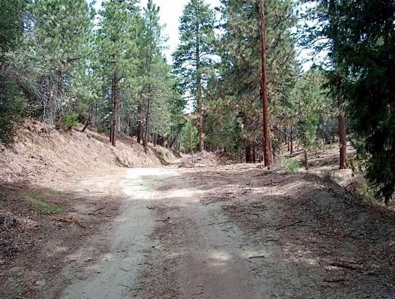
More about this marker. This grove was destroyed by the 2009 Station Fire. The plaque was removed and its current location is unknown.
Also see . . . DAR Forests.
Excerpt:
In 1939, the President General, Mrs. Henry M. Robert, chose the Penny Pine(Submitted on January 21, 2026, by Craig Baker of Sylmar, California.)program as one of her Golden Jubilee National Projects. Each state was to have a memorial forest, beginning in 1939 and culminating in 1941 on the NSDAR 50th Anniversary. Each chapter across the country was to pledge, at the very least, one acre of pine seedlings. Five dollars an acre at a penny each equals 500 trees. The Civilian Conservation Corp (CCC), under the supervision of the U.S. Forestry Service, would do the actual work of planting and care.Photographed by Craig Baker, circa 20082. D.A.R. Society’s Fiftieth Marker
President Franklin D. Roosevelt proposed the CCC in 1933 to solve two problems. It would offer employment to Americans age 18-26, who were out of work because of the failing economy, and it would help the National Forests that were in deplorable condition due to over-harvesting, devastating fires, and little replanting. The CCC would revitalize our National Forests and employ millions of young people.
With new assistance from the CCC, the National Forest Service started its program of replanting and growing pines in National nurseries throughout the country. These pines would be sold to organizations and individuals for a penny each to help share with the cost of the project - hencethe popular term Penny Pines. It was patriotic and popular enough that stores and post offices set up buckets for people to put pennies into, and that's how the NSDAR became involved. Some of the states could not participate due to prolonged droughts in their state and the National Forest Service recommended planting many large trees on private lands.Photographed by Craig Baker, circa 20083. D.A.R. Society Marker LocationThese trees were destroyed by the Station Fire in 2009.
California:
The members dedicated a DAR marker and 50 acres of trees at Charlton Flats on June 18, 1940. Forty-six additional acres were planted in Mendocino National Forest and 1,200 trees were planted in Mt. Ashland watershed and dedicated as a DAR Forest on June 14, 1940.

Credits. This page was last revised on February 2, 2026. It was originally submitted on January 17, 2026, by Craig Baker of Sylmar, California. This page has been viewed 63 times since then. Photos: 1, 2, 3. submitted on January 17, 2026, by Craig Baker of Sylmar, California.
