
Near Richmond in Henrico County, Virginia — The American South (Mid-Atlantic)
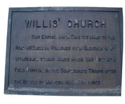
Willis' Church
Photographed by Bernard Fisher
1. Willis' Church Marker
Erected by Battlefield Markers Association. (Marker Number 19.)
Topics and series. This historical marker is listed in these topic lists: Religion & Religious Structures • War, US Civil. In addition, it is included in the Freeman Markers (Richmond Battlefields) series list. A significant historical date for this entry is July 1, 1862.
Location. 37° 26.092′ N, 77° 14.136′ W. Marker is near Richmond, Virginia, in Henrico County. It is on Willis Church Road (Virginia Route 156) 0.8 miles south of Charles City Road Road, on the right when traveling south. Located 500 feet south of the Glendale National Cemetery. Touch for map. Marker is at or near this postal address: 8360 Willis Church Rd, Henrico VA 23231, United States of America. Touch for directions.

Regionally, this marker is in the Piedmont and in Central Virginia. It is also in the American South, specifically in the Upper South, and on the Eastern
this page online
Other nearby markers. At least 8 other markers are within walking distance of this marker: A National Cemetery System (about 400 feet away, measured in a direct line); Glendale National Cemetery (about 400 feet away); Seven Days Battles (approx. 0.2 miles away); a different marker also named Seven Days Battles (approx. ¼ mile away); Battle of Glendale (approx. 0.6 miles away); a different marker also named Seven Days’ Battles (approx. ¾ mile away); Glendale (Frayser’s Farm) (approx. 0.8 miles away); Riddell's Shop (approx. 0.8 miles away). Touch for a list and map of all markers in Richmond.
Additional keywords. Freeman Markers, Richmond Battlefield Parks Corporation, Douglas Southall Freeman
Photographed by Bernard Fisher, July 5, 2003
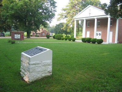
2. Willis' Church Marker
Credits. This page was last revised on January 19, 2026. It was originally submitted on December 7, 2008, by Bernard Fisher of Richmond, Virginia. This page has been viewed 2,455 times since then and 41 times this year. Last updated on January 18, 2026, by Mike McKeown of Baltimore, Maryland. Photos: 1, 2. submitted on December 7, 2008, by Bernard Fisher of Richmond, Virginia.
