Gambles Hill in Richmond, Virginia — The American South (Mid-Atlantic)
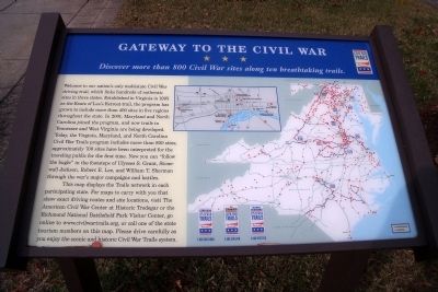
Gateway to the Civil War
Discover more than 800 Civil War sites along ten breathtaking trails.
Photographed by Bernard Fisher, October 25, 2009
1. Gateway to the Civil War Marker
Welcome to our nation’s only multistate Civil War driving trail, which links hundreds of authentic sites in three states. Established in Virginia in 1995 as the Route of Lee’s Retreat trail, the program has grown to include more than 400 sites in five regions throughout the state. In 2001, Maryland and North Carolina joined the program, and now trails in Tennessee and West Virginia are being developed. Today, the Virginia, Maryland, and North Carolina Civil War Trails program includes more than 800 sites; approximately 700 sites have been interpreted for the traveling public for the first time. Now you can “follow the bugle” in the footsteps of Ulysses S. Grant, Stonewall Jackson, Robert E. Lee, and William T. Sherman through the war’s major campaigns and battles.
This map displays the Trails network in each participating state. For maps to carry with you that show exact driving routes and site locations, visit The American Civil War Center at Historic Tredegar or the Richmond National Battlefield Park Visitor Center, go online to www.civilwartrails.org, or call one of the state tourism numbers on this map. Please
this page online
Erected by Civil War Trails.
Topics and series. This historical marker is listed in this topic list: War, US Civil. In addition, it is included in the Virginia Civil War Trails series list. A significant historical year for this entry is 1995.
Location. Marker has been permanently removed. It was located near 37° 32.097′ N, 77° 26.755′ W. Marker was in Richmond, Virginia. It was in Gambles Hill. It could be reached from Tredegar Street 0.1 miles west of South 5th Street. This panel is located in the parking lot of the American Civil War Center at Historic Tredegar and the Richmond National Battlefield Park Visitor Center. Touch for map. Marker was at or near this postal address: 470 Tredegar Street, Richmond VA 23219, United States of America.
We have been informed that this marker is no longer there and will not be replaced. This page is an archival view of what was.
Regionally, this marker was in Central Virginia. It was also in the American South and specifically in the Upper South. Globally, it was in North America, the Western Hemisphere,

Photographed by Bernard Fisher, October 25, 2009
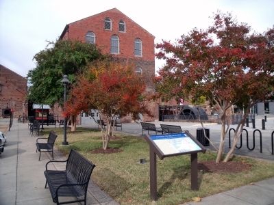
2. Richmond National Battlefield Park Tredegar Iron Works Visitor Center.
Other nearby markers. At least 2 other markers are within walking distance of this location: Hurricane Agnes (within shouting distance of this marker); What’s That? (within shouting distance of this marker). Touch for a list and map of all markers in Richmond.
Other markers no longer nearby. Overshot Waterwheel (was within shouting distance of this marker but has been permanently removed); Southern Firepower (was within shouting distance of this marker but has been reported to have been replaced with another marker now near it); a different marker also named Southern Firepower (was within shouting distance of this marker but has been permanently removed); Historic Tredegar (was within shouting distance of this marker but has been permanently removed); a different marker also named Overshot Waterwheel (was within shouting distance of this marker but has been reported to have been replaced
Photographed by Bernard Fisher, October 25, 2009
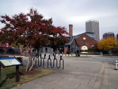
3. The American Civil War Center at Historic Tredegar.
Also see . . .
1. Civil War Trails. (Submitted on October 25, 2009.)
2. Richmond National Battlefield Park. (Submitted on October 25, 2009.)
3. The American Civil War Center at Historic Tredegar.

Photographed by Bernard Fisher, October 25, 2009
4. Richmond Civil War sites.
Credits. This page was last revised on January 20, 2026. It was originally submitted on October 25, 2009, by Bernard Fisher of Richmond, Virginia. This page has been viewed 1,529 times since then and 25 times this year. Last updated on January 19, 2026, by Evan Dwyer of Richmond, Virginia. Photos: 1, 2, 3, 4. submitted on October 25, 2009, by Bernard Fisher of Richmond, Virginia. • Devry Becker Jones was the editor who published this page.
