Valley Falls in Cumberland in Providence County, Rhode Island — The American Northeast (New England)
Nine Men’s Misery
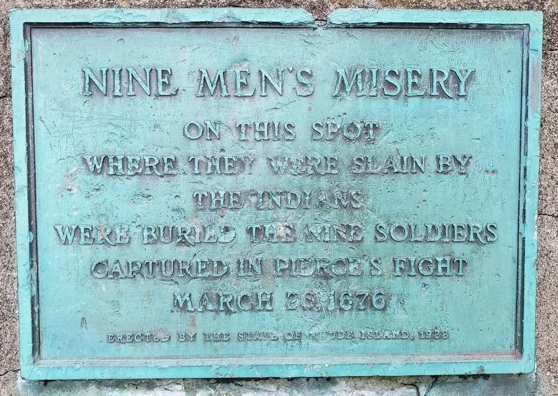
Photographed by F. Robby, August 31, 2019
1. Nine Men’s Misery Marker
On this spot where they were slain by the Indians were buried the nine soldiers captured in Pierce’s fight March 26, 1676.
Erected 1928 by The State of Rhode Island.
Topics and series. This memorial is listed in these topic lists: Colonial Era • Wars, US Indian. In addition, it is included in the King Philip's War 1675-1676 series list. A significant historical date for this entry is March 26, 1676.
Location. 41° 56.386′ N, 71° 24.396′ W. Memorial is in Cumberland, Rhode Island, in Providence County. It is in Valley Falls. It can be reached from Diamond Hill Road (Rhode Island Route 114) one mile south of Angell Road ( Route 116), on the right when traveling south. From the entrance to the property, drive to the far back right and park, then take trail to marker. Touch for map. Memorial is at or near this postal address: 24 Salvas Court, Cumberland RI 02864, United States of America. Touch for directions.

Regionally, this memorial is in the Blackstone Valley and in Greater Providence. It is also in the American Northeast, in New England, and on the Eastern Seaboard. Globally, it is in the North Atlantic Region, North
this page online
Other nearby markers. At least 8 other markers are within 3 miles of this marker, measured as the crow flies: Monastery Bell (approx. 0.4 miles away); Banking on the Riverbank's Value (approx. 1.4 miles away); Kelly’s Mill Left an Impression (approx. 1.4 miles away); Gate Operator (approx. 1.9 miles away); Water Turbine Runner (approx. 1.9 miles away); World War I Memorial (approx. 2.3 miles away); In Memory of Our Townsmen (approx. 2.3 miles away); Albion Dam (approx. 2½ miles away). Touch for a list and map of all markers in Cumberland.
Regarding Nine Men’s Misery. The cairn behind the marker was built in 1928 to prevent disturbances of the graves which had apparently become frequent. The site and surrounding woods are said to be haunted.
Related marker. Click here for another marker that is related to this marker.
Also see . . .
1. Wiki entry on Nine Men's Misery. (Submitted on October 12, 2007.)
2. King Philip’s War: Nine Men’s Misery.
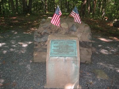
Photographed by F. Robby, August 7, 2004
2. Nine Men's Misery Marker
Jason Allard goes on location amd tells “a story about colonialism, war and nine executions”, and the myths about the burial site behind a monastery in Cumberland, RI.(Submitted on December 25, 2025, by G.W.Bartlett of Hingham, Massachusetts.)
3. Cpt Michael Pierce - Find-a-Grave.
He was born in England about 1605-1615. He was in Hingham, Mass. before 1645/6 when his first child was baptized. Pierce, of Scituate, Mass, had been appointed Captain in 1669 by the colony court, having been an Ensign under Capt. Miles Standish. The ambush of Captain Michael Pierce and his soldiers occurred on Sunday, March 26 1676, near the Blackstone River near today's Central Falls, Rhode Island in a skirmish that was part of King Philip's War.[This record also includes information about others who died at the battle, in the photos.] (Submitted on April 11, 2026, by G.W.Bartlett of Hingham, Massachusetts.)
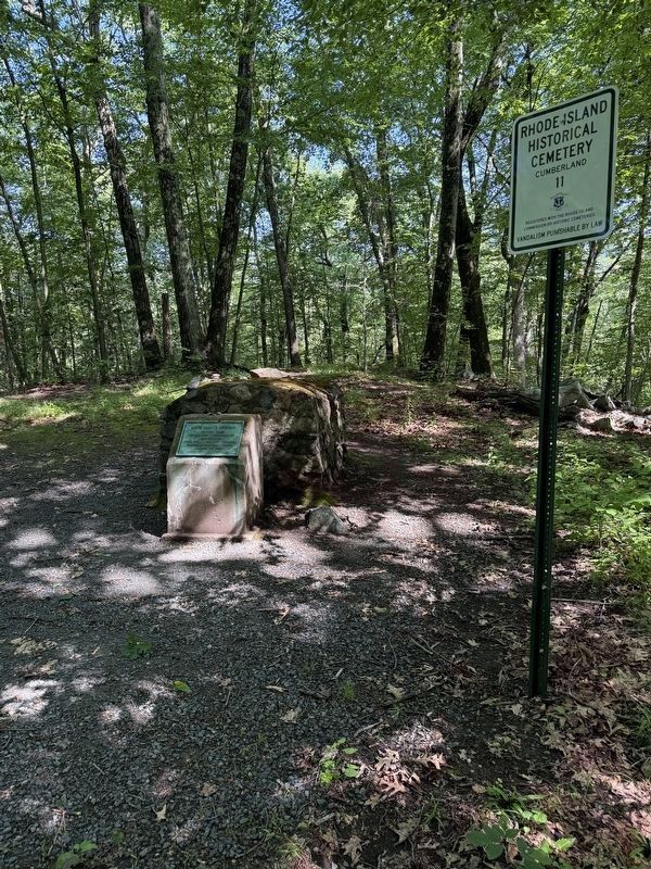
Photographed by G.W.Bartlett, July 2, 2026
3. Nine Men’s Misery Marker
A sign has been placed at this site indicating its status as a recognized historical cemetery.
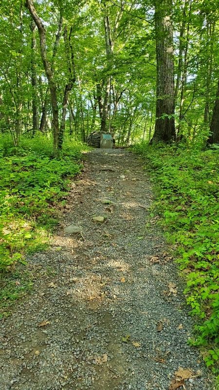
Photographed by F. Robby, August 31, 2019
4. Nine Men’s Misery Marker
Photographed by G.W.Bartlett, June 28, 2026
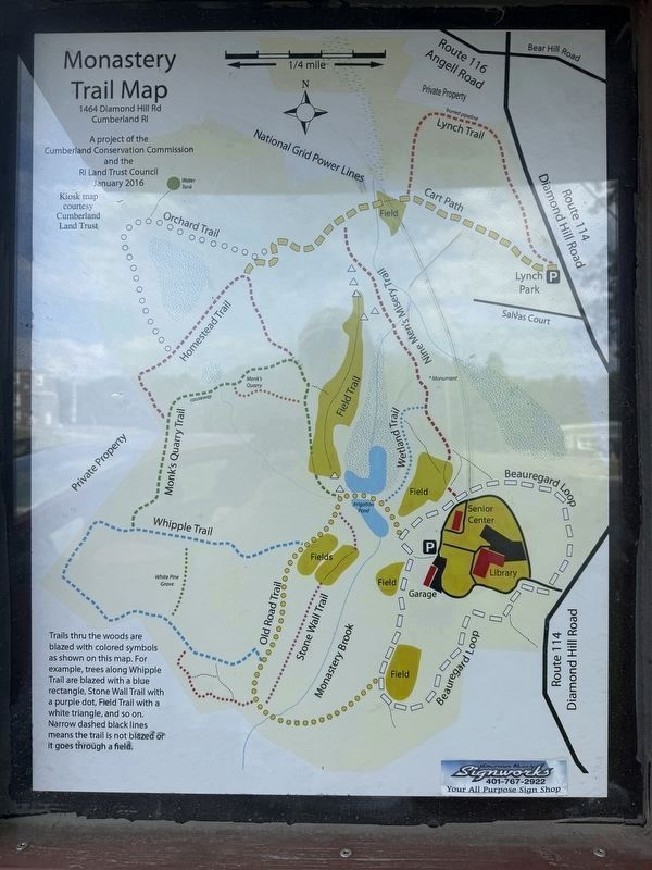
5. Nine Men’s Misery Marker
There is a trail map posted that accurately locates the marker along the trail. Some common map apps may inaccurately suggest it is in the swamp near the Wetland Trail. It is off the well maintained gravel Nine Men’s Misery Trail as pictured here. Trees along the trail are marked with red trail marker paint.
Photographed by G.W.Bartlett, June 28, 2026
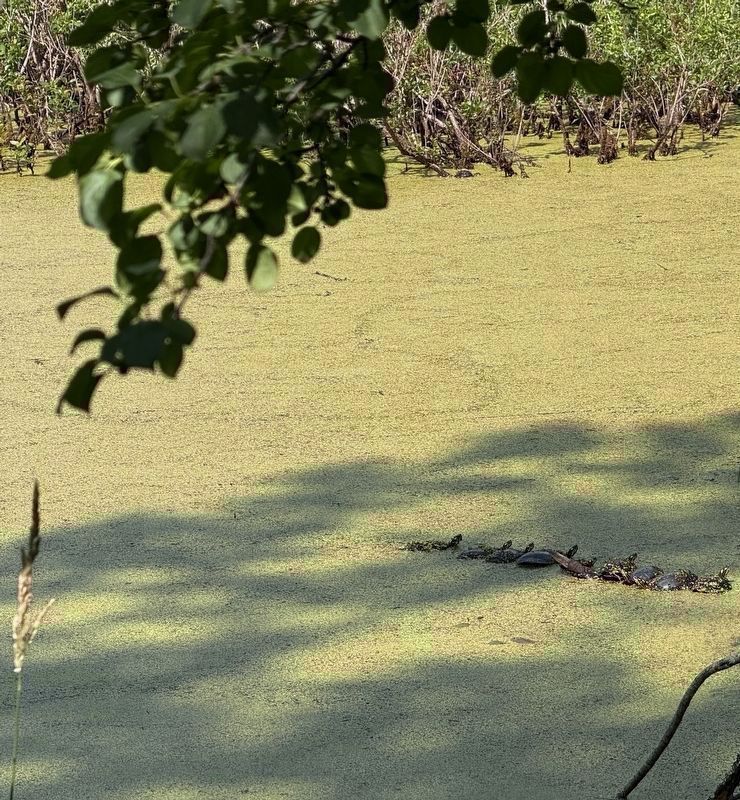
6. Nine Turtles' Ecstacy
Nine young turtles bask on a branch in the heat of a summer day in the swampland alongside Old Road Trail and Wetland Trail on the Cumberland Monastery grounds not far from the Nine Men's Misery marker.
Credits. This page was last revised on July 11, 2026. It was originally submitted on October 12, 2007, by F. Robby of Baltimore, Maryland. This page has been viewed 5,075 times since then and 231 times this year. Last updated on April 11, 2026, by G.W.Bartlett of Hingham, Massachusetts. Photos: 1. submitted on September 1, 2019, by F. Robby of Baltimore, Maryland. 2. submitted on October 12, 2007, by F. Robby of Baltimore, Maryland. 3. submitted on July 2, 2026, by G.W.Bartlett of Hingham, Massachusetts. 4. submitted on September 1, 2019, by F. Robby of Baltimore, Maryland. 5. submitted on June 28, 2026, by G.W.Bartlett of Hingham, Massachusetts. 6. submitted on June 29, 2026, by G.W.Bartlett of Hingham, Massachusetts. • Devry Becker Jones was the editor who published this page.
