Fermanagh Township in Mifflintown in Juniata County, Pennsylvania — The American Northeast (Mid-Atlantic)
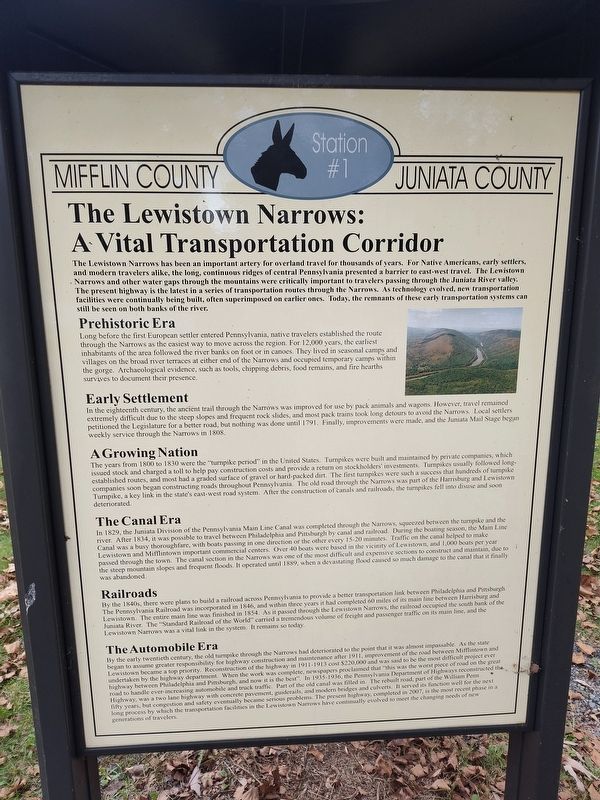
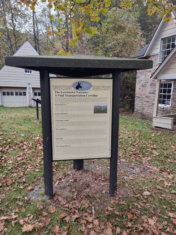
The Lewistown Narrows: A Vital Transportation Corridor
Mifflin County Juniata County
Photographed by Craig Doda, October 19, 2025
1. The Lewistown Narrows: A Vital Transportation Corridor Marker
Prehistoric Era
Long before the first European settler entered Pennsylvania, native travelers established the route through the Narrows as the easiest way to move across the region. For 12,000 years, the earliest inhabitants of the area followed the river banks on foot or in canoes. They lived in seasonal camps and villages on the broad river terraces at either end of the Narrows and occupied temporary camps within the
this page online
Early Settlement
In the eighteenth century, the ancient trail through the Narrows was improved for use by pack animals and wagons. However, travel remained extremely difficult due to the steep slopes and frequent rock slides, and most pack trains took long detours to avoid the Narrows. Local settlers petitioned the Legislature for a better road, but nothing was done until 1791. Finally, improvements were made, and the Juniata Mail Stage began weekly service through the Narrows in 1808.
A Growing Nation
The years from 1800 to 1830 were the "turnpike period" in the United States. Turnpikes were built and maintained by private companies, which issued stock and charged a toll to help pay construction costs and provide a return on stockholders' investments. Turnpikes usually followed long- established routes, and most had a graded surface of gravel or hard-packed dirt. The first turnpikes were such a success that hundreds of turnpike companies soon began constructing roads throughout Pennsylvania. The old
Photographed by Craig Doda, October 19, 2025
2. The Lewistown Narrows: A Vital Transportation Corridor Marker
The Canal Era
In 1829, the Juniata Division of the Pennsylvania Main Line Canal was completed through the Narrows, squeezed between the turnpike and the river. After 1834, it was possible to travel between Philadelphia and Pittsburgh by canal and railroad. During the boating season, the Main Line Canal was a busy thoroughfare, with boats passing in one direction of the other every 15-20 minutes. Traffic on the canal helped to make Lewistown and Mifflintown important commercial centers. Over 40 boats were based in the vicinity of Lewistown, and 1,000 boats per year passed through the town. The canal section in the Narrows was one of the most difficult and expensive sections to construct and maintain, due to the steep mountain slopes and frequent floods. It operated until 1889, when a devastating flood caused so much damage to the canal that it finally was abandoned.
Railroads
By the 1840s, there were plans to build a railroad across Pennsylvania to provide a better transportation link between Philadelphia and Pittsburgh. The Pennsylvania Railroad was incorporated in 1846, and within three years it had completed 60 miles of its main line between Harrisburg and Lewistown. The entire main line was finished in 1854. As it passed through the Lewistown Narrows, the railroad occupied the south bank of the Juniata River. The "Standard Railroad of the World" carried a tremendous volume of freight and passenger traffic on its main line, and the Lewistown Narrows was a vital link in the system. It remains so today.
The Automobile Era
By the early twentieth century, the old turnpike through the Narrows had deteriorated to the point that it was almost impassable. As the state began to assume greater responsibility for highway construction and maintenance after 1911, improvement of the road between Mifflintown and Lewistown became a top priority. Reconstruction of the highway in 1911-1913 cost $220,000 and was said to be the most difficult project ever undertaken by the highway department. When the work was complete, newspapers proclaimed that "this was the worst piece of road on the great highway between Philadelphia and Pittsburgh, and now it is the best". In 1935-1936, the Pennsylvania Department of Highways reconstructed the road to handle ever-increasing automobile and truck traffic. Part of the old canal was filled in. The rebuilt road, part of the William Penn Highway, was a two lane highway with concrete pavement, guide rails, and modern bridges and culverts. It served its function well for the next fifty years, but congestion and safety eventually became serious problems. The present highway, completed in 2007, is the most recent phase in a long process by which the transportation facilities in the Lewistown Narrows have continually evolved to meet the changing needs of new generations of travelers. (Marker Number Station #1.)
Topics. This historical marker is listed in these topic lists: Industry & Commerce • Railroads & Streetcars • Roads & Vehicles • Settlements & Settlers • Waterways & Vessels. A significant historical year for this entry is 1791.
Location. 40° 36.618′ N, 77° 26.62′ W. Marker is in Mifflintown, Pennsylvania, in Juniata County. It is in Fermanagh Township. It is at the intersection of William Penn Highway and Reservoir Road, on the right when traveling north on William Penn Highway. Located in Lewistown Narrows Canal Park. Touch for map. Marker is at or near this postal address: 17 William Penn Highway, Mifflintown PA 17059, United States of America. Touch for directions.

Regionally, this marker is in the American Northeast, in the Mid-Atlantic, in Appalachia, and specifically in Northern Appalachia. Globally, it is in North America, the Western Hemisphere, the Western World, and the Anglosphere. Historically, it finds itself in what was once the Haudenosaunee (Iroquois) Confederacy and also one of the original Thirteen Colonies.
Other nearby markers. At least 8 other markers are within 4 miles of this marker, measured as the crow flies: Pennsylvania Mainline Canal Juniata Division (here, next to this marker); The Lewistown Narrows in Prehistory (here, next to this marker); The Lock-Keeper (a few steps from this marker); Feeder Pond and Spillway (a few steps from this marker); Lift Lock No. 13 (within shouting distance of this marker); Lewistown Narrows Canal Park (about 300 feet away, measured in a direct line); Mifflintown (approx. 3½ miles away); Westminster Presbyterian Cemetery World War Memorial Avenue of Trees (approx. 3.6 miles away). Touch for a list and map of all markers in Mifflintown.
Credits. This page was last revised on February 19, 2026. It was originally submitted on January 26, 2026, by Craig Doda of Napoleon, Ohio. This page has been viewed 64 times since then. Photos: 1, 2. submitted on January 26, 2026, by Craig Doda of Napoleon, Ohio. • Andrew Ruppenstein was the editor who published this page.
