Wailuku in Maui County, Hawaii — Hawaiian Island Archipelago (Pacific Ocean)
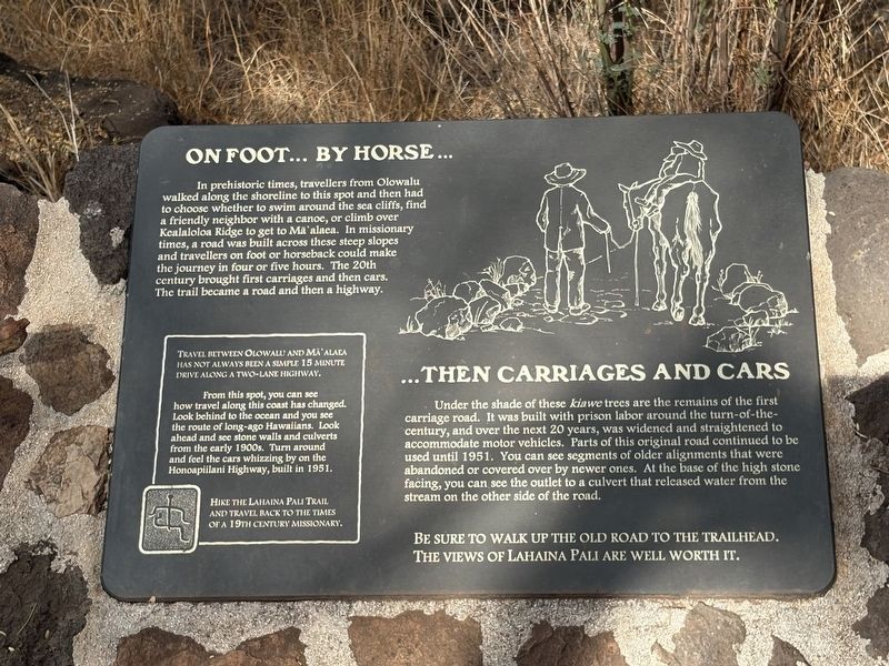
On Foot...By Horse... ...Then Carriages and Cars
Photographed by Darren Jefferson Clay, December 7, 2025
1. On Foot...By Horse... ...Then Carriages and Cars Marker
Under the shade of these kiawe trees are the remains of the first carriage road. It was built with prison labor around the turn-of-the- century, and over the next 20 years, was widened and straightened to accommodate motor vehicles. Parts of this original road continued to be used until 1951. You can see segments of older alignments that were abandoned or covered over by newer ones. At the base of the high stone facing, you can see the outlet to a culvert that released water from the stream on the other side of the road.
Be sure to walk up the old road to the trailhead. The views of Lahaina are well worth it.
Travel
this page online
From this spot, you can see how travel along this coast has changed. Look behind to the ocean and you see the route of long-ago Hawaiians. Look ahead and see stone walls and culverts from the early 1900s. Turn around and feel the cars whizzing by on the Honoapiilani Highway, built in 1951.
Hike the Lahaina Pali Trail and travel back to the times of a 19th century missionary.
Topics. This historical marker is listed in these topic lists: Indigenous Peoples and Communities • Roads & Vehicles.
Location. 20° 47.505′ N, 156° 33.832′ W. Marker is in Wailuku, Hawaii, in Maui County. It can be reached from Lahaina Pali Trail - eastern half, on the right when traveling west. Touch for map. Marker is at or near this postal address: 22 Lahaina Pali Trail - eastern half, Wailuku HI 96793, United States of America. Touch for directions.

Regionally, this marker is in Lahaina and West Maui. Globally, it is in North America, in Polynesia, in the Pacific Ocean, in North Pacific,

Photographed by Darren Jefferson Clay, December 7, 2025
2. On Foot...By Horse... ...Then Carriages and Cars Marker
Other nearby markers. At least 8 other markers are within 7 miles of this marker, measured as the crow flies: Welcome to the Lahaina Pali Trail (here, next to this marker); Ko Lalo Kuilani Aloha (approx. 2.1 miles away); Scandinavian Migration to Hawaii (approx. 2.8 miles away); Master Navigators (approx. 3.3 miles away); Submarine Communications Buoy (approx. 3.4 miles away); Guardian of Sea-Going People (approx. 3.4 miles away); Battle of Kepaniwai - Uniting the Islands (approx. 6.2 miles away); Nā Wai 'Ehā - The Four Waters of Maui (approx. 6.2 miles away). Touch for a list and map of all markers in Wailuku.
Credits. This page was last revised on February 1, 2026. It was originally submitted on January 31, 2026, by Darren Jefferson Clay of Duluth, Georgia. This page has been viewed 50 times since then. Photos: 1, 2. submitted on January 31, 2026, by Darren Jefferson Clay of Duluth, Georgia. • Andrew Ruppenstein was the editor who published this page.
