
Crow Wing State Park in Crow Wing County, Minnesota — The American Midwest (Upper Plains)
The Meeting Place
Photographed by McGhiever, June 27, 2025
1. The Meeting Place Marker
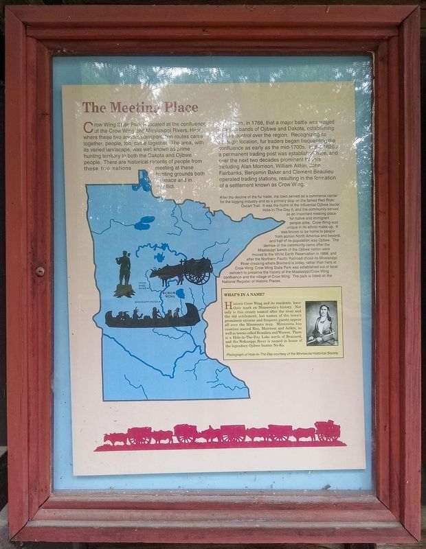
Crow Wing State Park is located at the confluence of the Crow Wing and Mississippi Rivers. Here, where these two ancient transportation routes came together, people, too, came together. The area, with its varied landscape, was well known as prime hunting territory to both the Dakota and Ojibwe people. There are historical records of people from these two nations meeting at these hunting grounds both in peace and in conflict.
It was here, in 1768, that a major battle was waged between bands of Ojibwe and Dakota, establishing Ojibwe control over the region. Recognizing its strategic location, fur traders began frequenting the confluence as early as the mid-1700s. In the 1820s a permanent trading post was established here, and over the next two decades prominent traders including Alan Morrison, William Aitkin, John Fairbanks, Benjamin Baker and Clement Beaulieu operated trading stations, resulting in the formation of a settlement known as Crow Wing.
After the decline of the fur trade, the town served as a commerce center for the logging industry and as a primary stop on the famed Red River Oxcart Trail. It was the
this page online
What's in a Name?
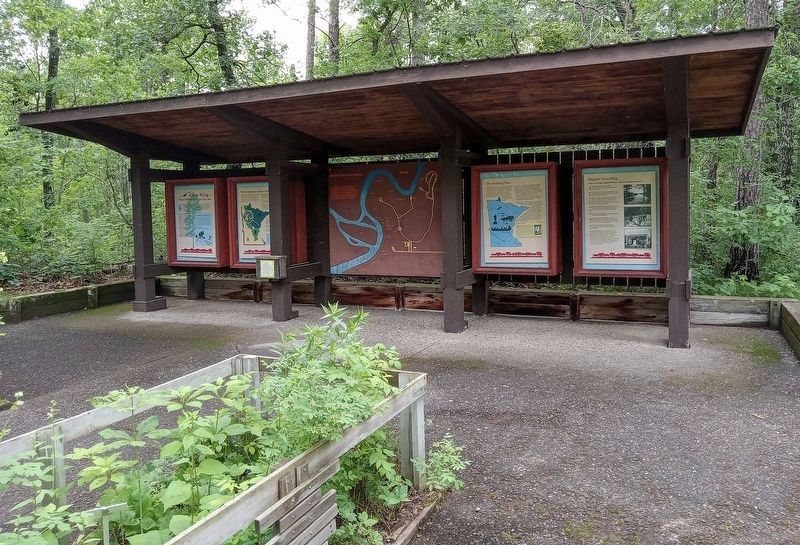
Historic Crow Wing and its residents have their mark on Minnesota's history. Not only is this county named after the river and the old settlement, but names of the town's prominent citizens and frequent guests appear all over the Minnesota map. Minnesota has counties named Rice, Morrison and Aitkin, as well as towns called Beaulieu andWarren. There is a Hole-In-The-Day Lake north of Brainerd, and the Nokasippi River is named in honor of the legendary Ojibwe hunter No-Ka.Photographed by McGhiever, June 27, 20252. The Meeting Place marker (2nd from right) in the park's Wildflower Discovery Garden
Photograph of Hole-In-The-Day courtesy of the Minnesota Historical Society
Erected by Minnesota Department of Natural Resources.
Topics. This historical marker is listed in these topic lists: Indigenous Peoples and Communities • Industry & Commerce • Settlements & Settlers • Wars, Non-US. A significant historical year for this entry is 1768.
Location. 46° 16.407′ N, 94° 19.962′ W. Marker is in Crow Wing, Minnesota, in Crow Wing County. It is in Crow Wing State Park. It can be reached from the road to the campground north of State Park Road (County Road 27), on the left when traveling north. The marker is in the Wildflower Discovery Garden just northwest of the visitor contact station. Touch for map. Marker is at or near this postal address: 3097 State Park Rd, Brainerd MN 56401, United States of America. Touch for directions.

Regionally, this marker is in Minnesota’s Northland. It is also in the American Midwest, in the Corn Belt, and in the Great River Road Region. Globally, it is in North America, the Great North Woods, the Western Hemisphere, the Western World, and the Anglosphere. Historically, it finds itself in what was once Rupert’s Land, the territory of the Mississippian Culture, and the Northwest Territory.
Other nearby markers. At least 8 other markers are within walking distance of this marker: Welcome to Crow Wing State Park (here, next to this marker); Where Minnesota Comes Together (here, next to this marker); Crow Wing… (here, next to this marker); Old Crow Wing (a few steps from this marker); The Red River Trade (approx. 0.2 miles away); The Red River Routes (approx. 0.2 miles away); a different marker also named Old Crow Wing (approx. 0.2 miles away); The Woods Trail (approx. 0.2 miles away). Touch for a list and map of all markers in Crow Wing.
Credits. This page was last revised on February 1, 2026. It was originally submitted on February 1, 2026, by McGhiever of Minneapolis, Minnesota. This page has been viewed 65 times since then. Photos: 1, 2. submitted on February 1, 2026, by McGhiever of Minneapolis, Minnesota.
