Markham in Matagorda County, Texas — The American South (West South Central)
Japanese Farmers in Matagorda County
Photographed by Dave W, January 31, 2026
1. Japanese Farmers in Matagorda County Marker
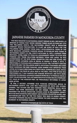
The rice industry in Matagorda County began in Nov. 1899 when A. P. Borden of Pierce first broke ground three miles outside Bay City. The following month, the Matagorda County Rice & Irrigation Company began preparations to plant 600 acres of rice for the following year. During these early developmental years of the rice industry, Japanese farmers began to establish rice farms in Matagorda County. In 1906, Hiroto Katayama (b. 1873), a banker from Okayama, Japan, came to Texas as a government agent to study rice farming and trade relations between Texas and Japan. He was accompanied by his wife Shigu, daughter Hisa and son Zitano, and seven other Japanese men; M. Okura, M. Ogama, H. Mura, S. Ohta, T. Nishayama, H. Fugihara and K. Nakamura. In Aug. 1906, the party arrived in Houston and the following month, Katayama purchased 500 acres near Markham for rice farming. Using Shinriki rice imported from Japan, Katayama’s rice farm was profitable, earning $12 a sack, which was double the price of local rice in the area. This type of rice was preferred as it was hardier and disease resistant, and with more modern technology, Japanese farmers were able to produce double crop yields per acre. The last mention of Katayama was in a February 1911 issue of the Houston Post. He presumably returned to Japan soon after.
In 1916, a second Japanese rice farming operation began in Matagorda County. The land was purchased by Seito and Kiyoaki Saibara, the father and son farmers from Webster. While Seito owned the farm machinery, his son owned the livestock and managed the whole operation. Kiyoaki lived in Matagorda County with his wife Shimayo, sons Robert and Warren, daughter Mabel and mother-in-law Yasu. By 1930 the family was back in Harris County. Japanese farmers helped revolutionize the rice industry and the economy
this page online
Erected 2022 by Texas Historical Commission. (Marker Number 23722.)
Topics. This historical marker is listed in these topic lists: Agriculture • Asian Americans • Immigration • Industry & Commerce. A significant historical month for this entry is November 1899.
Location. 28° 57.65′ N, 96° 3.935′ W. Marker is in Markham, Texas, in Matagorda County. It is at the intersection of Broadway (Farm to Market Road 1468) and 4th Street, on the right when traveling north on Broadway. Touch for map. Marker is at or near this postal address: 571 Broadway, Markham TX 77456, United States of America. Touch for directions.

Regionally, this marker is in the American South and on the Gulf Coast. Globally, it is in North America, a Gulf of Mexico state, the Western Hemisphere, the Western World, and the Anglosphere. Historically, it finds itself in what was once New Spain, the Republic of Texas, one of the Confederate States of America, and the Antebellum South.
Other nearby markers. At least 8 other markers are within 6 miles of this marker, measured as the crow flies: J.S. Abercrombie Mineral Company (a few
Photographed by Dave W, January 31, 2026
2. Japanese Farmers in Matagorda County Marker
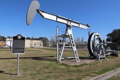
Marker seen here in park next to old oil well.
Credits. This page was last revised on February 2, 2026. It was originally submitted on February 2, 2026, by Dave W of Co, Colorado. This page has been viewed 53 times since then. Photos: 1, 2. submitted on February 2, 2026, by Dave W of Co, Colorado. • Devry Becker Jones was the editor who published this page.
