Shady Spring in Raleigh County, West Virginia — The American South (Appalachia)
Environmental Engineers
New River Gorge National Park and Preserve
| — | National Park Service, U.S. Department of the Interior | — |
Photographed by Tom Bosse, September 21, 2025
1. Environmental Engineers Marker
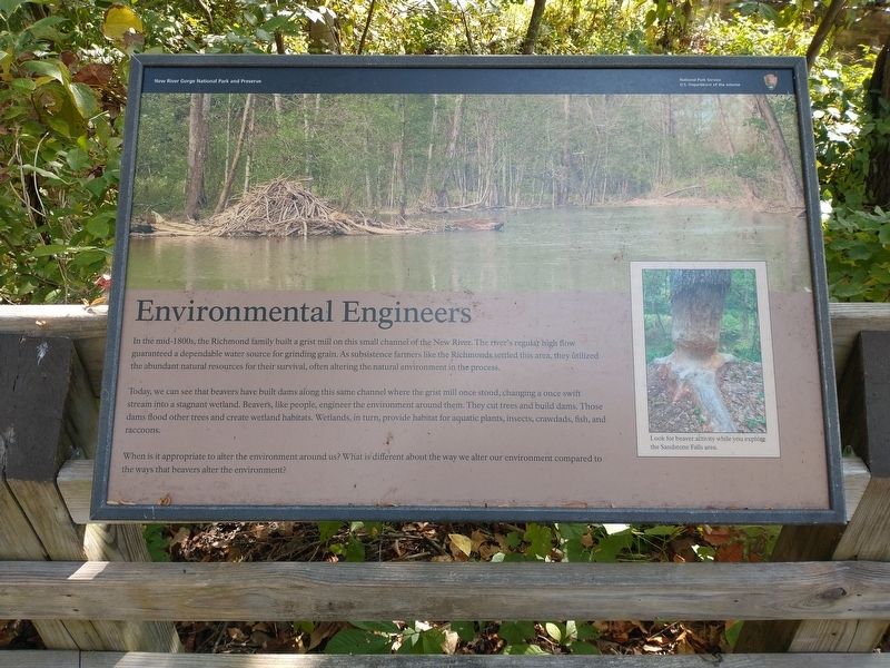
In the mid-1800s, the Richmond family built a grist mill on this small channel of the New River. The river's regular high flow guaranteed a dependable water source for grinding grain. As subsistence farmers like the Richmonds settled this area, they utilized the abundant natural resources for their survival, often altering the natural environment in the process.
Today, we can see that beavers have built dams along this same channel where the grist mill once stood, changing a once swift stream into a stagnant wetland. Beavers, like people, engineer the environment around them. They cut trees and build dams. Those dams flood other trees and create wetland habitats. Wetlands, in turn, provide habitat for aquatic plants, insects, crawdads, fish, and raccoons.
When is it appropriate to alter the environment around us? What is different about the way we alter our environment compared to the ways that beavers alter the environment?
Erected by National Park Service, U.S. Department of the Interior.
Topics. This historical marker is listed in these topic lists: Industry & Commerce • Natural Features •
this page online
Location. 37° 45.541′ N, 80° 54.304′ W. Marker is in Shady Spring, West Virginia, in Raleigh County. It is on Sandstone Falls Boardwalk south of New River Road, on the left when traveling south. Marker is located near Sandstone Falls in the New River Gorge National Park & Preserve. Touch for map. Marker is at or near this postal address: 60 Sandstone Fall Park Rd, Meadow Bridge WV 25976, United States of America. Touch for directions.

Regionally, this marker is in the New River Gorge. It is also in the American South, specifically in the Upper South, in Appalachia, and specifically in Southern Appalachia. Globally, it is in North America, the Western Hemisphere, the Western World, and the Anglosphere. Historically, it finds itself in what was once the territory of the Mississippian Culture.
Other nearby markers. At least 8 other markers are within 6 miles of this marker, measured as the crow flies: William Richmond Homeplace / Sandstone Falls (approx. one mile away); Lelia Pearl Bragg Laska Chamberlain (approx. 1.3 miles away);
Photographed by Tom Bosse, September 21, 2025
2. Environmental Engineers Marker
Credits. This page was last revised on February 4, 2026. It was originally submitted on February 4, 2026, by Tom Bosse of Jefferson City, Tennessee. This page has been viewed 31 times since then. Photos: 1, 2. submitted on February 4, 2026, by Tom Bosse of Jefferson City, Tennessee. • Devry Becker Jones was the editor who published this page.
