Warrenville in DuPage County, Illinois — The American Midwest (Great Lakes)
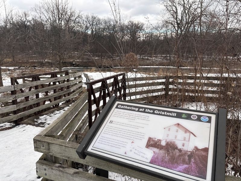
Gathering at the Gristmill

Photographed by Sean P. Flynn, February 6, 2026
1. Gathering at the Gristmill Marker
"The first settlers took land in the timber and along the streams. For one thing they doubted the value of soil on the open prairie; for another, they needed water power for their saw- and gristmills."
DuPage County: A Descriptive and Historical Guide
Between 1847 and 1887, the manmade channel below made Warrenville a booming economic and social center.
This "millrace" directed the power of the West Branch DuPage River to a waterwheel, which turned gears inside a gristmill. Area farmers brought corn, rye, wheat and other "grist" to the mill, which ground the crops into flour or meal. One prosperous mill that operated here, the Warrenville Roller Mills, ran night and day and still turned people away.
A farmer could wait in line for hours to drop off his harvest but used the time to visit and catch up on the latest news. Many even brought their children, who often swam in the millpond upstream.
Erected by Forest Preserve District of DuPage County.
Topics. This historical marker is listed in these topic lists: Agriculture • Industry & Commerce • Settlements & Settlers • Waterways & Vessels. A significant historical year for this entry is 1847.
Location. 41° 49.286′ N,
this page online

Regionally, this marker is in Greater Chicago. It is also in the American Midwest. Globally, it is in North America, on the Great Lakes, in the Western Hemisphere, in the Western World, and in the Anglosphere. Historically, it finds itself in what was once the territory of the Mississippian Culture and also the Northwest Territory.
Other nearby markers. At least 8 other markers are within walking distance of this marker: Site of Julius M. Warren’s Saw Mill and Warrenville’s Grist Mill (within shouting distance of this marker); A Dam Struggle (within shouting distance of this marker); Recipe for a River (within shouting distance of this marker); Jackson Street (about 800 feet away, measured in a direct line); Third Street (approx. 0.2 miles away); Fourth Street
Photographed by Sean P. Flynn, February 6, 2026
2. Gathering at the Gristmill Marker
The small bridge nearby goes over the millrace that powered the mill.
Also see . . . Warrenville Grove. The official page from the Forest Preserve District of DuPage County includes a history of the park. (Submitted on February 9, 2026, by Sean P. Flynn of Oak Park, Illinois.)

Photographed by Sean P. Flynn, February 6, 2026
3. Millrace at Warrenville Grove
This rear view of the marker shows the Warrenville Grove parking lot in the far background. The millrace runs beneath the small bridge near the marker.
Credits. This page was last revised on February 9, 2026. It was originally submitted on February 6, 2026, by Sean P. Flynn of Oak Park, Illinois. This page has been viewed 70 times since then. Photos: 1. submitted on February 6, 2026, by Sean P. Flynn of Oak Park, Illinois. 2, 3. submitted on February 9, 2026, by Sean P. Flynn of Oak Park, Illinois.
