Keyport in Monmouth County, New Jersey — The American Northeast (Mid-Atlantic)
The Benjamin C. Terry Park
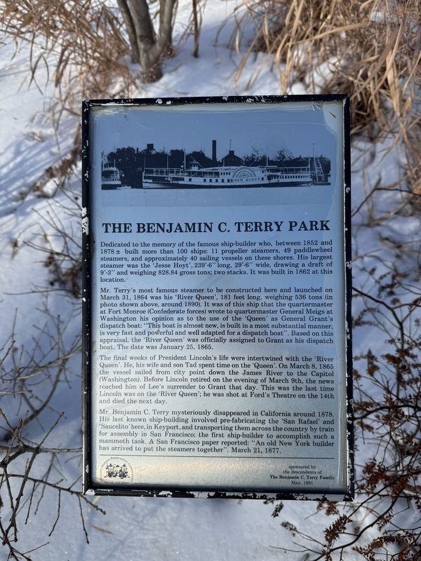
Dedicated to the memory of the famous ship-builder who, between 1852 and 1878 ± built more than 100 ships: 11 propeller steamers, 49 paddlewheel steamers,, and approximately 40 sailing vessels on these shores. His largest steamer was the 'Jesse Hoyt', 239'-6" long, 29'-6" wide, drawing a draft of 9'-3" and weighing 828.84 gross tons; two stacks. It was built in 1862 at this location.
Mr. Terry's most famous steamer to be constructed here and launched on March 31, 1864 was his 'River Queen', 181 feet long, weighing 536 tons (in photo shown above, around 1890). It was of this ship that the quartermaster at Fort Monroe (Confederate forces) wrote to quartermaster General Meigs at Washington his opinion as to the use of the 'Queen' as General Grant's dispatch boat: "This boat is almost new, is built in a most substantial manner, is very fast and powerful and well adapted for a dispatch boat". Based on this appraisal, the 'River Queen' was officially assigned to Grant as his dispatch boat. The date was January 25, 1865.
The final weeks of President Lincoln's life were intertwined with the 'River Queen'. He, his wife and
this page online
Mr. Benjamin C. Terry mysteriously disappeared to California around 8178. His last known ship-building involved pre-fabricating the 'San Rafael' and 'Saucelito' here, in Keyport, and transporting them across the country by train for assembly in San Francisco; the first ship-builder to accompany such a mammoth task. A San Francisco paper reported: "An old New Yorker builder has arrived to put the steamers together". March 21, 1877.
Erected 1991 by Keyport Historic Preservation Commission; sponsored by the descendants of The Benjamin C. Terry Family.
Topics and series. This historical marker is listed in these topic lists: Industry & Commerce • War, US Civil • Waterways & Vessels. In addition, it is included in the Former U.S. Presidents: #16 Abraham Lincoln,
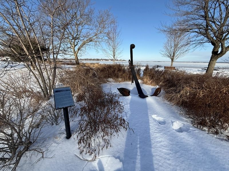
Location. 40° 26.431′ N, 74° 11.676′ W. Marker is in Keyport, New Jersey, in Monmouth County. It can be reached from Cedar Street north of Pine Street, on the left when traveling north. Touch for map. Marker is at or near this postal address: 42 Cedar St, Keyport NJ 07735, United States of America. Touch for directions.

Regionally, this marker is in Central Jersey and in the New York City Metropolitan Area. It is also in the American Northeast, in the Mid-Atlantic, and on the Eastern Seaboard. Globally, it is in the North Atlantic Region, North America, the Western Hemisphere, the Western World, and the Anglosphere. Historically, it finds itself in what was once New Netherland and also one of the original Thirteen Colonies.
Other nearby markers. At least 8 other markers are within 4 miles of this marker, measured as the crow flies: Keyport (approx. 0.2 miles away); Civil War · Spanish War · World War Memorial (approx. half a mile away); Roll of Honor (approx. half a mile away); Veterans Memorial (approx. 0.6 miles away); Aeromarine (approx. 0.6 miles away); Liberty Tree Memorial (approx. 0.7 miles away); Bowne-Provost Family Cemetery (approx. 3.4 miles away); Mt. Pleasant Cemetery (approx. 3.4 miles away). Touch for a list and map of all markers in Keyport.
Credits. This page was last revised on February 8, 2026. It was originally submitted on February 8, 2026, by Devry Becker Jones of Washington, District of Columbia. This page has been viewed 105 times since then. Photos: 1, 2. submitted on February 8, 2026, by Devry Becker Jones of Washington, District of Columbia.
