Midtown - Downtown in Columbia in Richland County, South Carolina — The American South (South Atlantic)
Randolph Cemetery
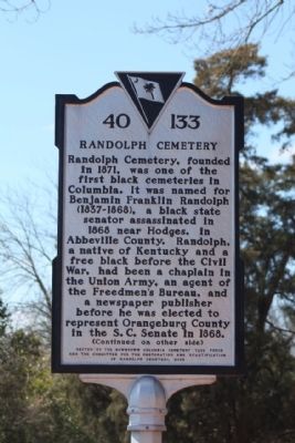
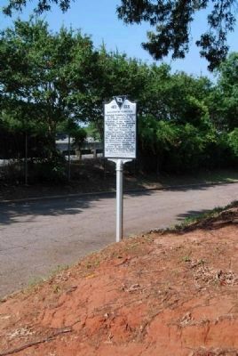
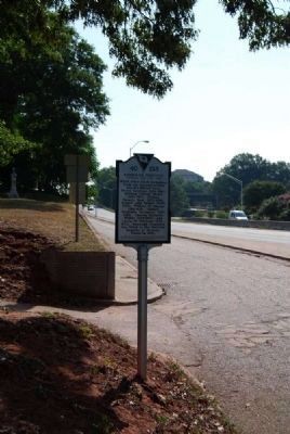
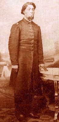
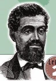
Randolph Cemetery, founded in 1871, was one of the first black cemeteries in Columbia. It was named for Benjamin Franklin Randolph (1837-1868), a black state senator assassinated in 1868 near Hodges, in Abbeville County. Randolph, a native of Kentucky and a free black before the Civil War, had been a chaplain in the Union Army, an agent of the Freedmen’s Bureau, and a newspaper publisher before he was elected to represent Orangeburg County in the S.C. Senate in 1868.
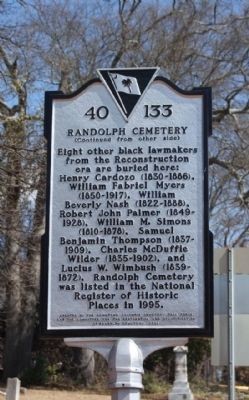
Eight other black lawmakers from the Reconstruction era are buried here: Henry Cardozo (1830-1886), William Fabriel Myers (1850-1917), William Beverly Nash (1822-1888), Robert John Palmer (1849-1928), William M. Simons (1810-1878), Samuel Benjamin Thompson (1837-1909), Charles McDuffie Wilder (1835-1902), and Lucius W. Wimbush (1839-1872). Randolph Cemetery was listed in the National Register of Historic Places in 1995.
Erected 2006 by Downtown Columbia Task Force and the Committee for the Restoration and Beautification of Randolph Cemetery. (Marker Number 40-133.)
Topics. This historical marker is listed in these topic lists: African Americans • Cemeteries & Burial Sites • War, US Civil. A significant historical year for this entry is 1871.
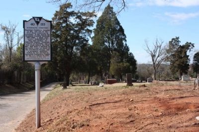
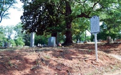
Location. 34° 0.578′ N, 81° 3.126′ W. Marker is in Columbia, South Carolina, in Richland County. It is in Midtown - Downtown. Marker is on Frontage Road, on the right when traveling west. Located at the western terminus of Elmwood Avenue (US 76). Touch for map. Marker is in this post office area: Columbia SC 29201, United States of America. Touch for directions.
Other nearby markers. At least 10 other markers are within walking distance of this marker. George Elmore (about 400 feet away, measured in a direct line); Benjamin Franklin Randolph Monument (about 700 feet away); Howard School Site (approx. 0.3 miles away); State Fairgrounds (approx. 0.4 miles away); Cemetery of the Columbia Hebrew Benevolent Society (approx. 0.4 miles away); Lace House (approx. half a mile away); Richard Samuel Roberts House (approx. half a mile away); Harriett Cornwell Tourist Home (approx. half a mile away); The Figure Eight in South Carolina (approx. half a mile away); Sir William Berkeley (approx. half a mile away). Touch for a list and map of all markers in Columbia.
Regarding Randolph Cemetery. Randolph Cemetery is an African American cemetery in Columbia established by the Randolph Cemetery Association in 1872 and expanded in 1899. Named for Benjamin Franklin Randolph (d. 1868), an African American member of the South Carolina State Senate who was assassinated during Reconstruction, the cemetery reflects the political turmoil of the period when it was established. It is the final resting place of eight other African American leaders who served in the South Carolina Senate or House of Representatives during the era and contains the graves of numerous other leaders of Columbia’s late nineteenth and early twentieth century African American community. Randolph Cemetery is also a fine example of a late nineteenth century and early twentieth century vernacular cemetery, for its markers and landscape illustrate the burial customs of Columbia’s African American community during this period. Gravemarker types and materials are varied. Manufactured gravemarkers include aluminum mortuary markers, bronze or stone tablets, granite or marble obelisks, brick crypts, granite headstones and footstones, ledgers, and table-top stones. Homemade gravemarkers include such elements as concrete blocks, ceramic bathroom tiles, piles of bricks, and concrete tablets crudely inscribed or marked with marking pens or stick-on mailbox letters. Many graves are within enclosures such as low brick walls, wrought iron fences, short white picket fences, or white metal garden fences. Some gravemarkers have been lost to vandalism or neglect. Listed in the National Register January 20, 1995.(South Carolina Department of Archives and History)
Also see . . .
1. Randolph Cemetery. Randolph Cemetery is an African American cemetery in Columbia
established by the Randolph Cemetery Association in 1872 and expanded in 1899. (Submitted on July 26, 2011, by Brian Scott of Anderson, South Carolina.)
2. Historic Randolph Cemetery. The Committee for the Restoration and Beautification of Randolph Cemetery (CRBRC) is currently made-up of both the descendants of those persons interred at Historic Randolph Cemetery and interested members of the public. (Submitted on July 26, 2011, by Brian Scott of Anderson, South Carolina.)
3. Freedmen's Bureau. The Freedmen's Bureau, was a U.S. federal government agency that aided distressed freedmen (freed slaves) in 1865–1869, during the Reconstruction era of the United States. (Submitted on July 26, 2011, by Brian Scott of Anderson, South Carolina.)
4. Political Assassination in South Carolina by A.V. Huff, Jr. Keynote address presented, 29 Apr. 2006, at the 70th Annual Meeting of the University South Caroliniana Society. (Submitted on July 26, 2011, by Brian Scott of Anderson, South Carolina.)
5. Reconstruction Era of the United States. In the History of the United States, the term Reconstruction Era has two senses; the first covers the entire nation in the period 1865–1877 following the Civil War; the second one, covers the transformation of the Southern United States from 1863 to 1877, with the
reconstruction of state and society in the former Confederacy. (Submitted on July 26, 2011, by Brian Scott of Anderson, South Carolina.)
Additional commentary.
1. Charles McDuffie Wilder
Charles McDuffie Wilder is well known as a founder of Randolph, a delegate to the Constitutional Convention of 1866, and the Columbia Postmaster for 16 years. His son, Charles H.P. Wilder, died around the age of five and is also buried in Randolph. (A Small Sample of Burials at Randolph Cemetery: What Their Stories Tell Us About the Cemetery and African American Life in Columbia by Michael Trinkley, Ph.D and Debi Hacker (2007), pgs 1, 61-62.)
— Submitted September 15, 2011, by Brian Scott of Anderson, South Carolina.
2. Randolph Cemetery - National Register Nomination Form (1994)
Description
Randolph Cemetery is a late nineteenth century black cemetery in Columbia, South Carolina. It was established by the Randolph Cemetery Association as a three-acre tract in 1872; the Association purchased an additional acre in 1899. The four acres that now comprise the tract have roughly rectangular boundaries, measuring approximately 400' x 700'. The
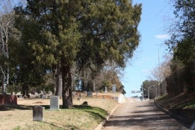
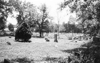
cemetery is bounded on the south by Elmwood Avenue and the right-of-way for U.S. Interstate Highway 126, on the west by the Southern Railroad tracks, and on the north and east by land owned by Elmwood Cemetery. Although located within the city limits of Columbia, the setting is a combination of both urban and rural settings. There is a busy highway at the cemetery's southern edge, but underdeveloped land, the Columbia Canal, and the Broad River to the west. beyond the northern boundary is a heavily-wooded section of Elmwood Cemetery. Adjacent to the eastern boundary a developed section of Elmwood Cemetery is visible. Burials have taken place throughout the four acres. Orientation of most graves is east-west; placements of graves is somewhat irregular. Most gravestones are tablets or headstones. A few are flush markers. Depressions and mounds throughout the cemetery indicate that some graves are unmarked. The site presents a rather disheveled look, with many tombstones leaning or settling. Vandalism has occurred in the cemetery and approximately five percent of the existing markers have been broken or toppled. A small area at the western end of the site is overgrown. The rest of the site is maintained.
The topography of the cemetery is uneven, with many sunken or mounded graves. Burials still take place and fresh are mounded with red clay. The tract slopes from the eastern to the western edge at an approximate angle of 30 degrees overall. The upper quarter descends steeply. Randolph Cemetery is not a designed landscape. With the exception of some flowering plants (roses and daffodils) that are planted on graves, the vegetation is unplanned. The ground is covered with weeds and wild flowers. Large cedars and oaks predominate, and some saplings grow from graves. The site also contains several tree stumps and dead trees. Near the midsection of the site and along the northern boundary is an area used as a dumping ground for old floral arrangements and yard trash. It is screened from the cemetery by a stand of bamboo and other vegetation.
Cultural features include a drive, fencing, and gravemarkers. An asphalt drive forms a semicircle through the cemetery with both outlets on Elmwood Avenue. The north and east sides of Randolph Cemetery are bordered by land owed by Elmwood Cemetery and the boundary is delineated by a fence composed of concrete fence post and wire fencing topped with barbed wire. The fence is dilapidated and in some areas the wire is no longer extant.
Gravemarker types and materials are varied. Manufactured gravemarkers include aluminium mortuary markers, bronze or stone tablets, ceramic bathroom tiles, piles of bricks, and concrete tablets crudely inscribed or marked with marking pens or stick-on mailbox letters. Some graves have footstones, usually inscribed with a nickname or to indicate a family relationship. Many graves are within enclosures such as low brick walls, wrought iron fences, short white picket fences, or white metal garden fences. Some plots are covered with gravel. Many graves are covered with artificial flowers. There is a granite monument to George Elmore near his gravestone, and a memorial obelisk to honor Benjamin Franklin Randolph, for whom the cemetery is named. The earliest burials date from 1868, when the land was still held by Elmwood Cemetery Company, but most date from the period between 1872 and ca. 1940.
Aside from the vandalism, the present appearance of Randolph Cemetery would correspond to its historic appearance. The topography has not changed; the vegetation, which is for the most part natural rather than planned, would be similar; the current driveway postdates 1899, as it traverses the acre added that year. It is possible that the original cemetery had no driveway, as none is shown in historic maps of Columbia. Some gravemarkers have been lost to vandalism or neglect. The integrity of the site has not been adversely affected by the asphalt drive or by the loss of several gravemarkers. Burials still take place, but the modern gravemarkers are in keeping with the site. Due to the haphazard maintenance of the site over the years there have been no inappropriate additions to the cemetery in the name of "beautification."
The ethnic and vernacular character of Randolph Cemetery is further enhanced by its being one of three adjacent cemeteries on Elmwood Avenue -- from east to west. St. Peter's Cemetery (a Roman Catholic burying ground), Elmwood Cemetery, and Randolph Cemetery. Elmwood Cemetery is an excellent example of the nineteenth century cemetery movement, with its spacious landscaped grounds, winding drives, and ornamental gravemarkers. Elmwood Cemetery is easily visible from Randolph Cemetery and presents an interesting contrast to it. Its presence helps to establish Randolph Cemetery in its historic and ethnic context.
Significance
Randolph Cemetery is a black cemetery in Columbia, South Carolina, established by the Randolph Cemetery Association in 1872 and expanded in 1899. Named for Benjamin Franklin Randolph (d. 1868), a black member of the South Carolina State Senate who was assassinated during Reconstruction (1865-1877), the cemetery reflects the political turmoil of the period in which it was established and the growing sense of community among recently freed blacks.[1] It is the final resting place of eight other black leaders who served in the South Carolina Senate of South Carolina House of Representatives during the era and contains the graves of numerous other leaders of Columbia's
late nineteenth and early twentieth century black community. Randolph Cemetery is also a fine example of a late nineteenth century and early twentieth century vernacular cemetery, for its markers and landscape illustrate the burial customers of Columbia's black community during this period. It is eligible for listing in the National Register of Historic Places under Criterion A for its association with the ethnic heritage of black South Carolinians and for its association with the political history of South Carolina during Reconstruction. It is also eligible for listing under Criteria Consideration D because it derives its significance from graves of persons of transcendent importance in the community.
Randolph Cemetery was established in January 1872 by a group of black civic leaders in Columbia. Incorporated as Randolph Cemetery Association, the group bought three acres of land from the adjoining Elmwood Cemetery for $900.[2] In 1899 the Randolph Cemetery Association bought an additional acre from Elmwood Cemetery.[3]
Randolph Cemetery fell into disrepair in the middle decades of the twentieth century, and at one time was used as a local dumping ground. The City of Columbia began to clear the land for construction in 1959, resulting in further damage to the historic cemetery. A group of concerned citizens organized the Committee
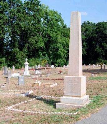
Photographed By Brian Scott, July 25, 2011
10. Benjamin Franklin Randolph Monument
Inscription Reads
Inscription Reads
B.F. Randolph
Late State Senator
for Orangeburg County,
and Chairman Republican
State Central Committee,
who died at Hodges Station
Abbeville County
at the hands of assassins
on Friday Oct. 13
A.D. 1868.
Benjamin Franklin Randolph and Other Reconstruction Legislators
Benjamin Franklin Randolph, the legislator for whom the cemetery was named, was born a free black in Kentucky in the early 1820s, grew up in Ohio, and was educated at Oberlin College. Randolph became a Methodist minister and came to South Carolina during the Civil War as chaplain of the Twenty-sixth U.S. Colored troops, a black regiment in the United States Army which was stationed on Hilton Head Island and in the Beaufort area. When the war ended in 1865 Randolph remained in South Carolina, residing first in Charleston, where he founded one newspaper, the Charleston Journal, and served as associate editor of another, the Charleston Advocate. Randolph also served briefly as an agent of the Freedman's Bureau before being assigned to a Columbia church in 1868, a position which he never accepted. Randolph moved to Orangeburg District and became active in politics, serving as a delegate to the South Carolina Constitutional Convention of 1868 and as a South Carolina State Senator from Orangeburg District for the term 1868-1870. He also served on the executive committee of the South Carolina Republican
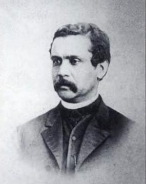
South Carolina Postcards Vol VIII: Camden by Howard Woody, circa 1871
11. Rev. Henry Weston Cardozo
1830-1886
1830-1886
Born in Charleston, the eldest son of Lydia Weston (c. 1805-1864), who was of African and Native-American ancestry, and Isaac Nunez Cordozo (1792-1855), who descended from a Sephardic (Jewish) family of Purtugal. Henry was elected to the South Carolina state senate twice (1870-1874). He was the auditor of Kershaw County from 1868 until 1869, and chairman of the Kershaw County Republican Party in 1870. He became a minister in the Methodist Episcopal church, as did his son Rev. Isaac Numez Cardozo (1856-1898).
"...three white men rose up, dismounted and fired on Randolph, mortally wounding him in three places. Although it was broad daylight, the murders were not recognized, and made their escape. The body of Randolph was taken to Columbia."[6]
The Columbia Daily Phoenix reported that the funeral service took place on Sunday, October 18th, at the African Methodist Episcopal Church at the corner of Sumter and Taylor Streets, "after which a procession was formed and marched to the cemetery, where the body was interred."[7] Though most published sources and oral tradition maintained that Randolph was buried at Randolph Cemetery, there is uncertainty about his burial here since title to the property was not held by the Randolph Cemetery Association until 1872. At least three other graves in the cemetery, however, predate Randolph's death in 1868, and it is possible that other remains were buried there as well before the association was formally chartered.[8]
A monument to Randolph's memory at the entrance to the cemetery reads:
B.F. Randolph
Late State Senator
for Orangeburg County,
and Chairman Republican
State Central Committee,
who died at Hodges Station
Abbeville County
at the hands of assassins
on Friday Oct. 13
A.D. 1868.
It is most likely that this monument is a cenotaph rather than a gravemarker, but in any event, the association was chartered and the cemetery was established as a memorial to Randolph.
— Submitted September 15, 2011, by Brian Scott of Anderson, South Carolina.
Credits. This page was last revised on February 16, 2023. It was originally submitted on March 30, 2010, by Mike Stroud of Bluffton, South Carolina. This page has been viewed 2,451 times since then and 40 times this year. Photos: 1, 2, 3, 4, 5. submitted on March 30, 2010, by Mike Stroud of Bluffton, South Carolina. 6, 7, 8. submitted on July 26, 2011, by Brian Scott of Anderson, South Carolina. 9. submitted on March 30, 2010, by Mike Stroud of Bluffton, South Carolina. 10. submitted on July 26, 2011, by Brian Scott of Anderson, South Carolina. 11. submitted on September 14, 2011, by Brian Scott of Anderson, South Carolina. 12. submitted on September 15, 2011, by Brian Scott of Anderson, South Carolina. • Craig Swain was the editor who published this page.
