Buena Vista in Chaffee County, Colorado — The American Mountains (Southwest)
Historic Vistas
| — | Collegiate Peaks Scenic and Historic Byway | — |

Photographed by Cosmos Mariner, July 22, 2025
1. Historic Vistas Marker
The Ute People made this land home. Next came Spanish military expeditions and French fur trappers. The fledgling U.S. sent its own explorers west into the Rocky Mountains in the early 1800s.
In 1806 the Zebulan Pike expedition explored the Buena Vista area.
Kit Carson came here as a young fur trapper and later as a guide for John C. Fremont's 1840s western expeditions.
Three railroads arrived in Buena Vista to transport goods and people and to carry ore from the gold and silver mines. The Denver, South Park & Pacific, Colorado Midland, and Denver & Rio Grande railroads built stations and the town flourished.
President Benjamin Harrison arrived on the 1891 Presidential Train. He spoke from the train about the valley's mining and agricultural resources and was presented with three six-pound trout caught at Thompson's Lake.
The small community here was first called Cottonwood and later Mahonville, for one of the earliest settlers. By its incorporation in 1879 the town was named Buena Vista, as suggested by Alsina “Sadie” Dearheimer. Buena Vista is Spanish for “good view,” but residents have always anglicized the pronunciation.
this page online
The Law and the Lawless
In 1880 voters decided to move the county seat from Granite to Buena Vista. Granite citizens were reluctant, so Buena Vista boosters took the safe containing the county records and put it on a night train to BV. The grand Chaffee County Courthouse was built on East Main Street in 1883, now the Buena Vista Heritage Museum.
Stories tell of a rugged and violent settlement in which arguments were settled by gunfire and lynchings. Following the first town election in November 1879 the new Mayor and trustees built a jail and wrote ordinances on profanity, firearms, vagrancy, untended animals (alive and dead), and disorderly conduct.
But law and order wasn’t easy in a town with gamblers, brothels, and 68 saloons! Several early marshals lasted barely a week before resigning. The town hired famous gunman Bat Masterson who was paid $30 per week for three weeks to run off ruffians. Masterson's posters warned that he would shoot outlaws on sight.
A notorious citizen was Elizabeth “Cock-eyed Liz” Spurgen, who opened a “palace of joy” just west of the courthouse.
Courtesy Buena Vista Heritage
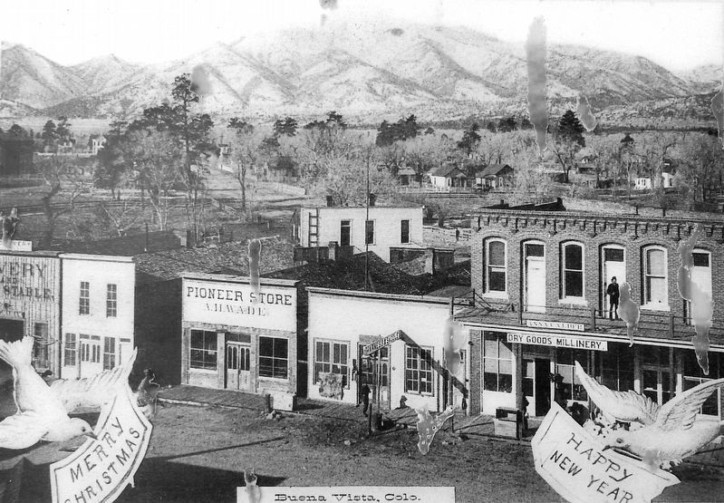
2. Marker detail: Early Main Street East
False front wood buildings outnumbered the brick buildings on early Main Street.
[photo captions]
• The Ute People
• Zebulon Pike
• Kit Carson
• Denver and Rio Grande Railroad Tracks
• President Benjamin Harrison
• Early East Main Street
• The BV town fathers turned out for the 1888 hanging of outlaw Nicolo Feminella.
• Chaffee County Courthouse, 1883-1928
• Bat Masterson
• Palace Manor
You’re traveling the Collegiate Peaks Scenic and Historic Byway
For visitor information:
www.colorado.com/byways/collegiate-peaks
Heart of the Rockies Chamber of Commerce
Buena Vista Area Chamber of Commerce
Look for the Collegiate Peaks Scenic Byway Brochure for scenic, historic and cultural features and twelve Byway Exploration Routes.
Erected by Federal Highway Administration, National Scenic Byways and Greater Arkansas River Nature Association.
Topics and series. This historical marker is listed in these topic lists: Indigenous Peoples and Communities • Law Enforcement • Railroads & Streetcars • Settlements & Settlers. In addition, it is included in the Former U.S. Presidents: #23 Benjamin Harrison

Courtesy Buena Vista Heritage
3. Marker detail: Denver & Rio Grande Tracks
Location. 38° 50.516′ N, 106° 7.974′ W. Marker is in Buena Vista, Colorado, in Chaffee County. It is at the intersection of U.S. 24 and West Main Street, on the right when traveling south on U.S. 24. The marker is beside the sidewalk, at the southeast corner of McPhelemy Park. Touch for map. Marker is at or near this postal address: 220 US Highway 24 North, Buena Vista CO 81211, United States of America. Touch for directions.

Regionally, this marker is in the Arkansas River Valley, in the Colorado High Rockies and on the Continental Divide. It is also in the American Mountain West. Globally, it is in North America, the Rocky Mountains, the Western Hemisphere, the Western World, and the Anglosphere.
Other nearby markers. At least 8 other markers are within walking distance of this marker: Putting Down Roots (here, next to this marker); Mountain Getaways (here, next to this marker); William Joseph Walsh (a few steps from this marker); World War I Memorial (within shouting distance of this marker); Grace Church (about 400 feet away, measured in a direct line); Town Hall
Photographed by Cosmos Mariner, July 22, 2025
4. Historic Vistas Marker
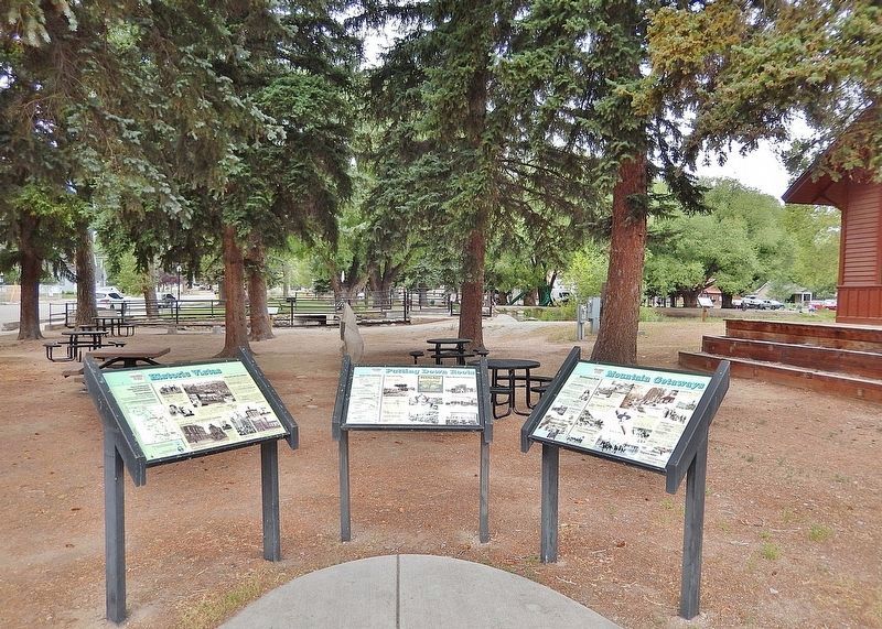
Looking west from US Highway 24 across the south end of Mcphelemy Park. The Historic Buena Vista Railroad Depot is partially visible in the right background. This marker is the leftmost of three interpretive panels at this location.
Related markers. Click here for a list of markers that are related to this marker.
Also see . . .
1. Buena Vista History (Wikipedia).
Excerpt: The Arkansas River Valley and the area of what would become Buena Vista was first settled in 1864 by settlers drawn to the area by the plentiful water which made the land suitable for agriculture. The Buena Vista, Colorado, post office opened on September 18, 1879. In 1888, Chaffee County voters moved the county seat from Granite to Buena Vista, but in 1928 voters moved the county seat to Salida which then had a larger population. By 1894, Buena Vista had electricity, telephone service, streetlights, parks, cemeteries, and schools. Travelers, speculators, and miners traveling up the Arkansas Valley towards Leadville made Buena Vista a popular stagecoach stop, and railroad depot following the 1890s. While certainly experiencing economic ups and downs, the valley's agricultural economy has made the area more resistant to the “boom, bust” cycle of mining towns.(Submitted on February 11, 2026, by Cosmos Mariner of Cape Canaveral, Florida.)
2. Collegiate Peaks Byway website.
Excerpt: Colorado's Collegiate Peaks byway could be called "the Avenue of Fourteeners." Along its entire length, the Collegiate Peaks continuously rise above the 14,000-foot mark and include such summits as Mount Princeton, Mount Yale and Mount Harvard. In fact, it’s the highest concentration of 14,000-plus-foot peaks in the United States.(Submitted on February 11, 2026, by Cosmos Mariner of Cape Canaveral, Florida.)
Credits. This page was last revised on February 11, 2026. It was originally submitted on February 10, 2026, by Cosmos Mariner of Cape Canaveral, Florida. This page has been viewed 89 times since then. Photos: 1, 2, 3, 4. submitted on February 11, 2026, by Cosmos Mariner of Cape Canaveral, Florida.
