Near Gordonsville in Orange County, Virginia — The American South (Mid-Atlantic)
Grave Yards
| — | Bracketts Farm Heritage Trail | — |

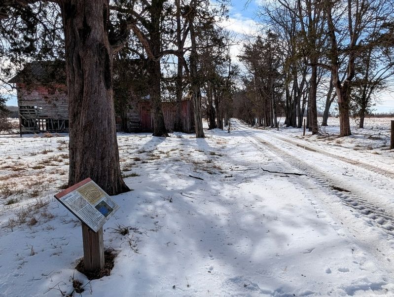
Photographed by Bernard Fisher, February 11, 2026
1. Grave Yards Marker
In 1860, Thomas S. Watson hired a local surveyor to draw a map of his property. The map, pictured below, indicates two "Grave Yards" near the tobacco barn.
Today, the Watson-Taylor family cemetery is clearly marked with gravestones and an iron fence. There are no markings of a second burial site outside the family cemetery, contrary to what the map shows. This has prompted curiosity as to who may be buried in the second grave yard. Could it possibly be an unmarked enslaved persons grave yard?
Respectfully, no excavation will be completed at this location. However, ground penetrating radar (GPR) has been used over a section of ground which is believed to be the second grave yard, see the photo pictured at right.
The radar markings, indicated by the lighter blue in the photo, are facing the same direction. A radar return with this kind of uniformity suggests a burial site.
Research is actively ongoing to find documentation that clarifies the actual location of grave yards for enslave persons here at Bracketts.
Interesting Fact
Using GPR to locate ancient burial sites is a developing science. A special tool
this page online
By the hand of Thomas S. Watson... 1860 Death of my Negros
"September 10, 1860—Old Cupid died, he was about 85 years old. He told me, that by counting the funerals of the first Watson (in this country)… he had seen six generations of Watsons."
"January 10, 1861 — Charlotte's little daughter (born last April) died of pneumonia."
"February 9, 1861 — my wife counted up, carefully, and told me that, since we were married, say in the last 14 years, we have lost twenty young negros!! This is unprecedented mortality, in this neighborhood. I am sure tis not owing to any neglect for on estates here, where there are no masters and mistresses to help, only overseers to attend to everything, the slaves nearly doubled in the same time."
"May 6, 1861 — My manAbram died, having been sick for just nine days, pneumonia."Photographed by Bernard Fisher, February 11, 20262. Grave Yards Marker

Erected by Bracketts Farm.
Topics. This historical marker is listed in these topic lists: African Americans • Anthropology & Archaeology • Cemeteries & Burial Sites. A significant historical year for this entry is 1860.
Location. 38° 2.156′ N, 78° 10.188′ W. Marker is near Gordonsville, Virginia, in Orange County. It is on Bracketts Farm Road half a mile west of Nolting Road, on the left when traveling south. Touch for map. Marker is at or near this postal address: 1117 Bracketts Farm Rd, Gordonsville VA 22942, United States of America. Touch for directions.

Regionally, this marker is in Northern Virginia and in the Piedmont. It is also in the American South and specifically in the Upper South. Globally, it is in North America, the Western Hemisphere, the Western World, and the Anglosphere. Historically, it finds itself in what was once the territory of the Mississippian Culture, one of the original Thirteen Colonies, one of the Confederate States of America, and the Antebellum South.
Other nearby markers. At least 8 other markers are within 3
Photographed by Bernard Fisher, February 11, 2026
3. Grave Yards Marker
Also see . . . Bracketts Farm - Located in the heart of the Green Springs National Historic Landmark District. (Submitted on February 12, 2026.)

Photographed by Bernard Fisher, February 11, 2026
4. Grave Yard
Credits. This page was last revised on February 12, 2026. It was originally submitted on February 12, 2026, by Bernard Fisher of Richmond, Virginia. This page has been viewed 84 times since then. Photos: 1, 2, 3, 4. submitted on February 12, 2026, by Bernard Fisher of Richmond, Virginia.
