Near Yoakum in DeWitt County, Texas — The American South (West South Central)
Hebron Community
Photographed by Dave W, February 14, 2026
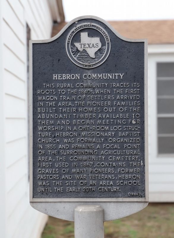
1. Hebron Community Marker
This rural community traces its roots to the 1840s, when the first wagon train of settlers arrived in the area. The pioneer families built their homes out of the abundant timber available to them and began meeting for worship in a one-room log structure. Hebron Missionary Baptist Church was formally organized in 1855 and remains a focal point of the surrounding agricultural area. The community cemetery, first used in 1867, contains the graves of many pioneers, former pastors, and war veterans. Hebron was the site of an area school until the early 20th century.
Erected 1984 by Texas Historical Commission. (Marker Number 2425.)
Topics. This historical marker is listed in these topic lists: Agriculture • Immigration • Religion & Religious Structures • Settlements & Settlers. A significant historical year for this entry is 1855.
Location. 29° 9.504′ N, 97° 2.574′ W. Marker is near Yoakum, Texas, in DeWitt County. It can be reached from Hebron Church Road (County Road 267) one mile east of Farm to Market Road 682. Touch for map. Marker is at or near this postal address: 915 Hebron Church Rd, Yoakum TX 77995,
this page online

Regionally, this marker is in the Hill Country. It is also in the American South. Globally, it is in North America, a Gulf of Mexico state, the Western Hemisphere, the Western World, and the Anglosphere. Historically, it finds itself in what was once New Spain, the Republic of Texas, and one of the Confederate States of America.
Other nearby markers. At least 8 other markers are within 11 miles of this marker, measured as the crow flies: Nancy Shows (within shouting distance of this marker); Terryville (approx. 1.4 miles away); County Line School, Church, and Cemetery (approx. 3.9 miles away); The United Methodist Church of Hope (approx. 4.8 miles away); Hope Baptist Church (approx. 4.9 miles away); Ruins of Brushy Creek Church (approx. 10.2 miles away); St. Joseph Catholic Cemetery (approx. 10.3 miles away); First Methodist Church of Yoakum (approx. 10.3 miles away). Touch for a list and map of all markers in Yoakum.
Additional commentary.
1. Marker Location
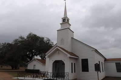
Marker cannot be seen from the road as it is on the opposite side in front of church.
— Submitted February 15, 2026, by Dave W of Co, Colorado.
Photographed by Dave W, February 14, 2026
2. Hebron Community Marker
Credits. This page was last revised on February 15, 2026. It was originally submitted on February 15, 2026, by Dave W of Co, Colorado. This page has been viewed 35 times since then. Photos: 1, 2. submitted on February 15, 2026, by Dave W of Co, Colorado. • James Hulse was the editor who published this page.
