Yorktown in York County, Virginia — The American South (Mid-Atlantic)
French Trench
The 1781 Siege of Yorktown
| — | Colonial National Historical Park | — |
Photographed by Carl Clifford, March 2, 2009
1. French Trench Marker
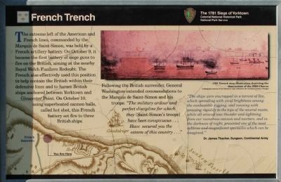
The extreme left of the American and French lines, commanded by the Marquis de Saint-Simon, was held by a French artillery battery. On October 9, it became the first battery of siege guns to fire on the British, aiming at the nearby Royal Welch Fusiliers Redoubt. The French also effectively used this position to help contain the British within their defensive lines and to harass British ships anchored between Yorktown and Gloucester Point. On October 10, using superheated cannon balls, called hot shot, the French battery set fire to three British ships. Following the British surrender, General Washington extended commendations to the Marquis de Saint-Simon and his troops: “The military ardour and perfect discipline for which they [Saint-Simon’s troops] have been conspicuous … Have secured you the esteem of the country …”
“The ships were enwrapped in a torrent of fire, which spreading with vivid brightness among the combustible rigging, and running with amazing rapidity to the tops of the several masts, while all around was thunder and lightning for our numerous cannon and mortars, and in the darkness of night, presented one of the most sublime and magnificent spectacles which can be imagined.”
Dr.
this page online
Erected by National Park Service, U.S. Department of the Interior.
Topics and series. This historical marker is listed in these topic lists: Notable Events • Notable Places • War, US Revolutionary. In addition, it is included in the Former U.S. Presidents: #01 George Washington series list. A significant day of the year for for this entry is October 9.
Location. 37° 14.453′ N, 76° 31.275′ W. Marker is in Yorktown, Virginia, in York County. It is on Fusiliers Redoubt Ramp east of Colonial National Historical Parkway (County Road 1020), on the left when traveling east. Touch for map. Marker is at or near this postal address: 100C Water St, Yorktown VA 23690, United States of America. Touch for directions.

Regionally, this marker is on Virginia’s Peninsula, in Coastal Virginia, and in the Hampton Roads Metropolitan Area. It is also in the American South, specifically in the Upper South, in the Tidewater, and on the Eastern Seaboard. Globally, it is in the North Atlantic Region, North America, the Western Hemisphere, the Western World, and the Anglosphere. Historically, it finds
Photographed by Bill Coughlin, August 12, 2008
2. Yorktown Marker
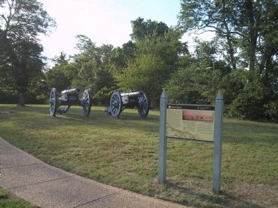
Other nearby markers. At least 8 other markers are within walking distance of this marker: The Washington-Rochambeau Route to Victory (a few steps from this marker); French Forces Memorial (a few steps from this marker); Yorktown French Memorial (within shouting distance of this marker); a different marker also named French Trench (within shouting distance of this marker); Fusiliers Redoubt (about 300 feet away, measured in a direct line); Washington-Rochambeau Route (about 700 feet away); Massachusetts (approx. 0.2 miles away); Maryland (approx. 0.2 miles away). Touch for a list and map of all markers in Yorktown.
More about this marker. The bottom of the marker features a map of the French batteries in relation to the vessels that they set afire. The location of the marker is also indicated. The upper right of the marker contains a reproduction of a “1781 French map illustration depicting the destruction of the HMS Charon. Lithograph courtesy of the
Photographed by Bill Coughlin, August 12, 2008
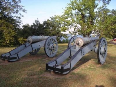
3. French Artillery
The York River, site of the ships that were set on fire on October 10 by the French cannon's hot shot, can be seen in the background.
Also see . . .
1. Yorktown Battlefield. National Park Service. (Submitted on September 1, 2008, by Bill Coughlin of Woodland Park, New Jersey.)
2. The Battle of Yorktown 1781. A British perspective of the Battle of Yorktown from BritishBattles.com. (Submitted on September 1, 2008, by Bill Coughlin of Woodland Park, New Jersey.)
Photographed by Carl Clifford, March 2, 2009
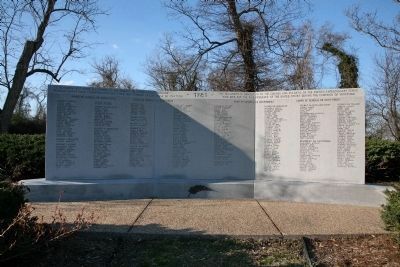
4. Souvenir Français memorial
South face of the Souvenir Français memorial.
Inscription along top: Ce monument est dédié aux soldats et marins du corps expéditionnaire français morts pour l'independance des Etats-Unis pendant la campagne de Yorktown.
This monument is dedicated to the soldiers and sailors of the French expeditionary corps who died for the independance of the United States during the Yorktown campaign.
Photographed by Evan Dwyer, January 5, 2026
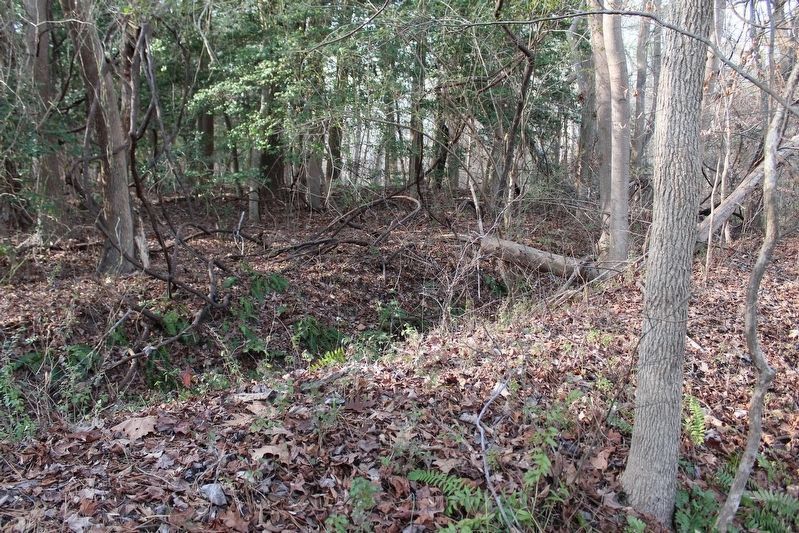
5. French Trench
Though the marker doesn't indicate its actual position, the remnant of the French Trench is directly west (left) - but hidden in the woods. It flanks the Colonial Parkway on-ramp on both sides. This view is is of the lower end of the trench south of the on-ramp (southwest of the marker).
Photographed by Evan Dwyer, January 5, 2026
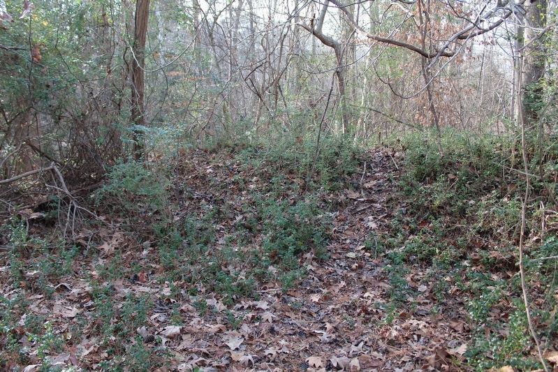
6. French Trench
This is the section of earthworks nearest the marker. If the visitor walks on the old road trace (looks like a shallow swale between the French Memorial & Parkway on-ramp) towards the treeline, this exterior parapet greets them where the "road" ends. On the back end of this parapet is a quite deep - but extremely overgrown - interior trench; the French Trench.
Credits. This page was last revised on February 26, 2026. It was originally submitted on September 1, 2008, by Bill Coughlin of Woodland Park, New Jersey. This page has been viewed 1,727 times since then and 55 times this year. Last updated on February 15, 2026, by Evan Dwyer of Richmond, Virginia. Photos: 1. submitted on March 20, 2009, by Carl Clifford of Arlington, Virginia. 2, 3. submitted on September 1, 2008, by Bill Coughlin of Woodland Park, New Jersey. 4. submitted on March 20, 2009, by Carl Clifford of Arlington, Virginia. 5, 6. submitted on February 15, 2026, by Evan Dwyer of Richmond, Virginia. • Devry Becker Jones was the editor who published this page.
