Pagosa Springs in Archuleta County, Colorado — The American Mountains (Southwest)
Chimney Rock
Photographed by Cosmos Mariner, July 13, 2025
1. Chimney Rock Marker
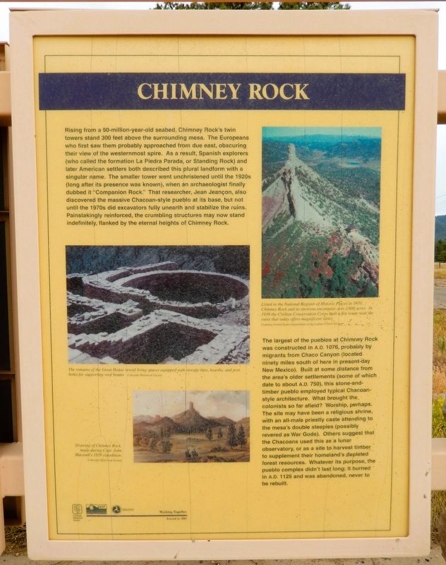
Rising from a 90-million-year-old seabed. Chimney Rock's twin towers stand 300 feet above the surrounding mesa. The Europeans who first saw them probably approached from due east, obscuring their view of the westernmost spire. As a result, Spanish explorers (who called the formation La Piedra Parada, or Standing Rock) and later American settlers both described this plural landform with a singular name. The smaller tower went unchristened until the 1920s (long after its presence was known), when an archaeologist finally dubbed it “Companion Rock.” That researcher, Jean Jeançon, also discovered the massive Chacoan-style pueblo at its base, but not until the 1970s did excavators fully unearth and stabilize the ruins. Painstakingly reinforced, the crumbling structures may now stand indefinitely, flanked by the eternal heights of Chimney Rock.
The largest of the pueblos at Chimney Rock was constructed in A D. 1076, probably by migrants from Chaco Canyon (located ninety miles south of here in present-day New Mexico). Built at some distance from the area's older settlements (some of which date to about A.D. 750), this stone-and-timber
this page online
[photo caption]
Drawing of Chimney Rock, made during Capt. John Macomb’s 1859 expedition.
Erected 2001 by Colorado Historical Society, Colorado Department of Transportation and Federal Highway Administration.
Topics and series. This historical marker is listed in these topic lists: Anthropology & Archaeology • Architecture • Exploration • Indigenous Peoples and Communities. In addition, it is included in the History Colorado series list. A significant historical year for this entry is 1076 CE.
Location. 37° 13.887′ N, 107° 6.424′ W. Marker is in Pagosa Springs, Colorado, in Archuleta County.
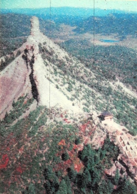
Courtesy US Department of Agriculture Forest Service
2. Marker detail: Chimney Rock

Regionally, this marker is on the Continental Divide. It is also in the American Mountain West and at the Four Corners. Globally, it is in North America, the Rocky Mountains, the Western Hemisphere, the Western World, and the Anglosphere. Historically, it finds itself in what was once the territory of the Ancestral Puebloans.
Other nearby markers. At least 8 other markers are within 11 miles of this marker, measured as the crow flies: Pagosa Springs (here, next to this marker); The Old Spanish Trail (here, next to this marker); a different marker also named Pagosa Springs (approx. 5.8 miles away); Hatcher Hardware (approx. 5.8 miles away); Metropolitan Hotel (approx. 5.9 miles away); Liberty Theatre (approx. 5.9 miles away); Goodman Building (approx. 5.9 miles away); People and Place (approx.

Colorado Historical Society
3. Marker detail: Great House
The remains of the Great House reveal living spaces equipped with storage bins, hearths, and post holes for supporting roof beams.
Related markers. Click here for a list of markers that are related to this marker. Chimney Rock
Also see . . . Chimney Rock National Monument (Wikipedia).
Excerpt: The Ancestral Puebloan site was a community inhabited between Durango and Pagosa Springs about 1,000 years ago with about 200 rooms. Rooms in the buildings were used for living, work areas and ceremonial purposes. Housing approximately 2,000 ancient Pueblo Indians between AD 925 and 1125, the settlement included a Great House Pueblo with round ceremonial rooms, known as kivas, and 36 ground-floor rooms. The Chaco culture which inhabited the Chimney Rock area was hierarchical, with a priest class overseeing the area's inhabitants.(Submitted on February 22, 2026, by Cosmos Mariner of Cape Canaveral, Florida.)
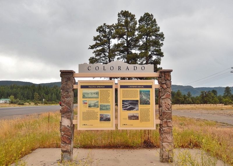
The construction of the Great House Pueblo at the top of the ridge, close to Chimney Rock and its neighbor Companion Rock, had a large ceremonial role in the later years of Chacoan presence. As the moon makes its lunar cycle across the sky over a period of 18.6 years, it appears in a lunar standstill between the two rocks for approximately 16 months.Evidence suggests that Great House Pueblo was first built in AD 1076 during a lunar standstill and expanded and finished in AD 1093 during another. Archaeologists believe that Great House Pueblo was mainly ceremonial in nature, with only one or two families living in its rooms.Photographed by Cosmos Mariner, July 13, 20254. Chimney Rock MarkerThis marker is the rightmost of two interpretive panels on the east side of the Colorado Department of Transportation kiosk in Pagosa Springs.
The inhabitants of Chimney Rock abandoned the site in 1125, burning the buildings when they left. Their modern-day descendants consider the site sacred with the spirits of their ancestors and have asked the Forest Service to refrain from further excavation out of respect. Utilizing the provisions of the Antiquities Act, U.S. president Barack Obama elevated the archeological site to the status of a national monument on September 21, 2012.
Credits. This page was last revised on February 22, 2026. It was originally submitted on February 20, 2026, by Cosmos Mariner of Cape Canaveral, Florida. This page has been viewed 87 times since then. Photos: 1, 2, 3, 4. submitted on February 22, 2026, by Cosmos Mariner of Cape Canaveral, Florida.
