Natalia in Medina County, Texas — The American South (West South Central)
Natalia

Photographed by Dave W, February 21, 2026
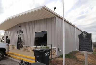
1. Natalia Marker
Natalia was established in 1913 as part of the Medina Irrigation Company's development of land west of San Antonio. The irrigation project constructed a canal and ditch system, laid out the town, and converted brush and cotton country into productive vegetable farms. Land agents promoted sales of irrigated farm tracts through train excursions from San Antonio and Laredo, bringing land seekers from across the nation. Incorporated in 1968, the City of Natalia was named (although misspelled) for Natalie Pearson, the daughter of Medina Dam engineer Fred Stark Pearson.
Erected 1996 by Texas Historical Commission. (Marker Number 15131.)
Topics. This historical marker is listed in these topic lists: Agriculture • Settlements & Settlers • Waterways & Vessels. A significant historical year for this entry is 1913.
Location. 29° 11.573′ N, 98° 51.581′ W. Marker is in Natalia, Texas, in Medina County. It is at the intersection of 2nd Street (State Highway 132) and Miller Street, on the right when traveling south on 2nd Street. Touch for map. Marker is at or near this postal address: 2107 132 N North, Natalia TX 78059,
this page online

Regionally, this marker is in the Hill Country and in the San Antonio Metropolitan Area. Globally, it is in North America, a Gulf of Mexico state, the Western Hemisphere, the Western World, and the Anglosphere. Historically, it finds itself in what was once New Spain, the Republic of Texas, and one of the Confederate States of America.
Other nearby markers. At least 8 other markers are within 5 miles of this marker, measured as the crow flies: A different marker also named Natalia (about 300 feet away, measured in a direct line); Natalia Veterans Memorial (about 400 feet away); Natalia Independent School District (approx. 0.4 miles away); Robert Lee Bobbitt (approx. 2.1 miles away); a different marker also named Robert Lee Bobbitt (approx. 2.1 miles away); Trimble Cemetery (approx. 3 miles away); Devine Evergreen Cemetery (approx. 3.6 miles away); Devine Lodge, No. 590 (approx. 4.4 miles away). Touch for a list and map of all markers in Natalia.
Photographed by Dave W, February 21, 2026
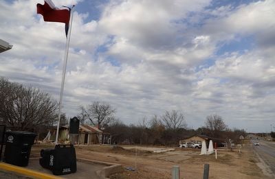
2. Natalia Marker
Looking north along 2nd St (TX-132).
Photographed by Dave W, February 21, 2026
3. Natalia Marker
Credits. This page was last revised on February 22, 2026. It was originally submitted on February 22, 2026, by Dave W of Co, Colorado. This page has been viewed 51 times since then. Photos: 1, 2, 3. submitted on February 22, 2026, by Dave W of Co, Colorado. • James Hulse was the editor who published this page.
