Buckhead in Atlanta in Fulton County, Georgia — The American South (South Atlantic)
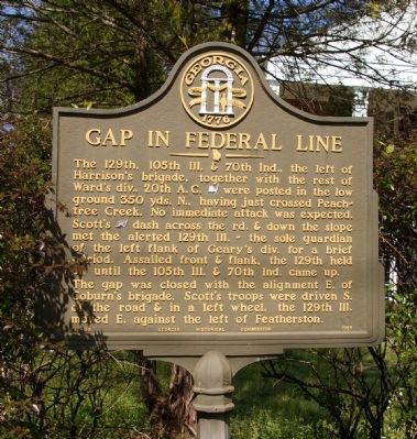
Gap in Federal Line
The gap was closed with the alignment E. of Coburn’s brigade. Scott’s troops were driven S. of the road & in a left wheel, the 129th Ill. moved E. against the left of Featherston.
Erected 1955 by Georgia Historical Commission. (Marker Number 060-38.)
Topics and series. This historical marker is listed in this topic list: War, US Civil. In addition, it is included in the Georgia Historical Society series list.
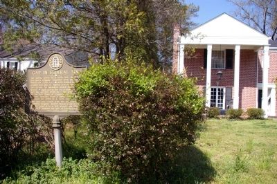
Location. 33° 48.563′ N, 84° 24.044′ W. Marker is in Atlanta, Georgia, in Fulton County. It is in Buckhead. Marker is on Collier Road, 0.1 miles east of Redland Road NW, on the right when traveling west. The marker is in the front yard of a private home. Touch for map. Marker is at or near this postal address: 423 Collier Road, Atlanta GA 30309, United States of America. Touch for directions.
Other nearby markers. At least 8 other markers are within walking distance of this marker. Collier's Mill (about 500 feet away, measured in a direct line); Harrison’s Brigade (about 600 feet away); Scott's Brigade (about 600 feet away); Battle of Peach Tree Creek (approx. 0.2 miles away); The Federal Forces Engaged/The Confederate Forces Engaged (approx. 0.2 miles away); The Federal Advance (approx. 0.2 miles away); The Federal Advance, Cont./The Change of Command (approx. 0.2 miles away); The Confederate Attack (approx. 0.2 miles away). Touch for a list and map of all markers in Atlanta.
Regarding Gap in Federal Line. This skirmish was part of the Battle of Peachtree Creek.
Credits. This page was last revised on February 8, 2023. It was originally submitted on April 2, 2010, by David Seibert of Sandy Springs, Georgia. This page has been viewed 917 times since then and 27 times this year. Photos: 1, 2. submitted on April 2, 2010, by David Seibert of Sandy Springs, Georgia. • Craig Swain was the editor who published this page.

