Near Goose Creek in Berkeley County, South Carolina — The American South (South Atlantic)
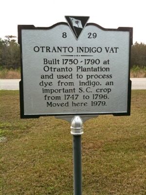
Otranto Indigo Vat
Photographed by Cindy Bullard, March 29, 2010
1. Otranto Indigo Vat Marker
Erected 1994 by Berkeley County Historical Society. (Marker Number 8-29.)
Topics. This historical marker is listed in these topic lists: Agriculture • Colonial Era. A significant historical year for this entry is 1747.
Location. 32° 59.031′ N, 79° 55.95′ W. Marker is near Goose Creek, South Carolina, in Berkeley County. It is on Brushy Park Road, on the right when traveling north. Marker is located at Gate 1 of Brushy Park Industrial Complex. Touch for map. Marker is in this post office area: Goose Creek SC 29445, United States of America. Touch for directions.

Regionally, this marker is in the Lowcountry and in Santee Cooper Country. It is also in the American South, specifically in the Deep South, and on the Eastern Seaboard. Globally, it is in the North Atlantic Region, North America, the Western Hemisphere, the Western World, and the Anglosphere. Historically, it finds itself in what was once the territory of the Mississippian Culture, one of the original Thirteen
this page online
Other nearby markers. At least 8 other markers are within 6 miles of this marker, measured as the crow flies: Liberty Hall Plantation (approx. 4.7 miles away); St. Thomas Church (approx. 4.7 miles away); Howe Hall Plantation / Howe Hall (approx. 4.9 miles away); Brabant Plantation (approx. 5.2 miles away); Bowen's Corner (approx. 5½ miles away); Howe Hall Plantation / Howe Hall Elementary School (approx. 5.6 miles away); Boochawee Hall (approx. 5.6 miles away); The Yamasee War At Goose Creek, 1715 (approx. 5.8 miles away). Touch for a list and map of all markers in Goose Creek.
Photographed by Cindy Bullard, March 29, 2010
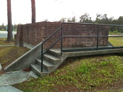
2. Otranto Indigo Vat
Photographed by Cindy Bullard, March 29, 2010
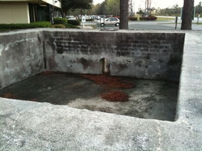
3. Otranto Indigo Vat (top view)
Photographed by Cindy Bullard, March 29, 2010
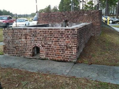
4. Otranto Indigo Vat (lower section)
Credits. This page was last revised on June 16, 2016. It was originally submitted on April 4, 2010, by David Bullard of Seneca, South Carolina. This page has been viewed 4,556 times since then and 209 times this year. Photos: 1, 2, 3, 4. submitted on April 4, 2010, by David Bullard of Seneca, South Carolina. • Craig Swain was the editor who published this page.
