Hazen in Prairie County, Arkansas — The American South (West South Central)
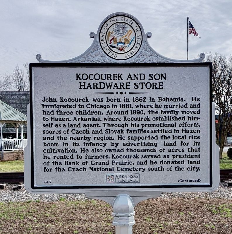
Kocourek and Son Hardware Store
Photographed by Ashley Sides, February 18, 2026
1. Kocourek and Son Hardware Store Marker
Kocourek also operated a hardware store in Hazen. In 1906, he replaced his old wooden store with a larger brick building. In addition to hardware, Kocourek and Son Hardware sold furniture and farm equipment and was a leading mercantile establishment in Hazen for decades. After John Kocourek’s death in 1936, his son Frank J. and then his grandson Frank H. (“Dink”) carried on the family business. In 1980, it was sold to Conley and June House, who continued to operate the store under the name Kocourek and Son until its closure
this page online
Erected 2025 by Hazen Historical Society; Arkansas Heritage. (Marker Number 46.)
Topics and series. This historical marker is listed in these topic lists: Agriculture • Immigration • Industry & Commerce • Settlements & Settlers. In addition, it is included in the Arkansas Heritage, and the National Register of Historic Places (NRHP) series lists. A significant historical year for this entry is 1906.
Location. 34° 46.843′ N, 91° 34.83′ W. Marker is in Hazen, Arkansas, in Prairie County. It is on East Front 0 miles east of North Hazen Avenue, on the right when traveling east. Touch for map. Marker is at or near this postal address: 110 E Front, Hazen AR 72064, United States of America. Touch for directions.

Regionally, this marker is in the American South, specifically in the Upper South, and in the Mississippi Delta. Globally, it is in North America, the Western Hemisphere, the Western World, and the Anglosphere. Historically,

Photographed by Ashley Sides, February 18, 2026
2. Kocourek and Son Hardware Store Marker
Other nearby markers. At least 8 other markers are within 7 miles of this marker, measured as the crow flies: Dr. William Cogswell Hazen (here, next to this marker); Hazen Rock Island Railroad Depot (about 300 feet away, measured in a direct line); Central Arkansas & Eastern RR and the Cotton Belt Route (approx. 0.2 miles away); DeValls Bluff: A Key Union Base (approx. 6.9 miles away); Common Ground for Many Soldiers (approx. 6.9 miles away); War on the White River (approx. 6.9 miles away); Why DeValls Bluff (approx. 6.9 miles away); DeValls Bluff in the Civil War (approx. 6.9 miles away). Touch for a list and map of all markers in Hazen.

Photographed by Ashley Sides, February 18, 2026
3. Kocourek and Son Hardware Store Marker
Photographed by Ashley Sides, February 18, 2026
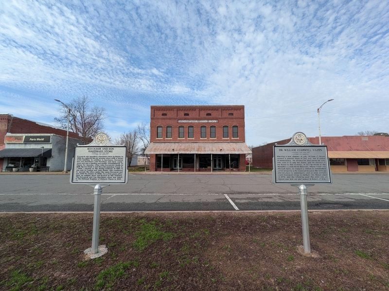
4. Kocourek and Son Hardware Store Marker next to Dr. William Cogswell Hazen Marker
Credits. This page was last revised on March 12, 2026. It was originally submitted on March 10, 2026, by Ashley Sides of Little Rock, Arkansas. This page has been viewed 35 times since then. Photos: 1. submitted on March 10, 2026, by Ashley Sides of Little Rock, Arkansas. 2. submitted on March 10, 2026. 3, 4. submitted on March 10, 2026, by Ashley Sides of Little Rock, Arkansas. • Andrew Ruppenstein was the editor who published this page.
