Near Chancellorsville in Spotsylvania County, Virginia — The American South (Mid-Atlantic)
Chancellor Cemetery
The Battle of Chancellorsville
Fredericksburg and Spotsylvania National Military Park
| — | National Park Service, U.S. Department of the Interior | — |
Photographed by Craig Swain, November 10, 2007
1. Chancellor Cemetery Marker
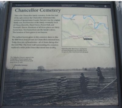
This is the Chancellor family cemetery. In the first half of the 19th century the Chancellors dominated this section of Spotsylvania County. Fairview was the original family seat, but branches of the family eventually lived at Chancellorsville, Hazel Grove, Forest Hall, and Dowdall's Tavern. Residents of all those places are likely buried here. Not buried here are the family's slaves. The location of their graves is not known.
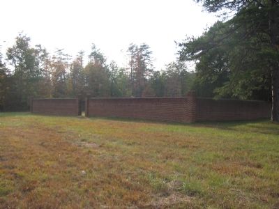
The earliest known grave in the cemetery dates to 1812. By 1860 there were at least six Chancellors interred here. Today there are 25 headstones - all of them dating after the Civil War. The brick wall surrounding the cemetery replaced a white picket fence that stood here in 1863.
Erected by National Park Service, U.S. Department of the Interior.
Topics. This historical marker is listed in these topic lists: Cemeteries & Burial Sites • War, US Civil. A significant historical year for this entry is 1812.
Location. 38° 18.453′ N, 77° 38.523′ W. Marker is near Chancellorsville, Virginia, in Spotsylvania County. It can be reached from Plank Road (Virginia Route 3) east of Bullock Road, on the
this page online

Regionally, this marker is in the Washington Metropolitan Area, in Northern Virginia, and in the Piedmont. It is also in the American South, specifically in the Upper South, in the Mid-Atlantic, and on the Eastern Seaboard. Globally, it is in the North Atlantic Region, North America, the Western Hemisphere, the Western World, and the Anglosphere. Historically, it finds itself in what was once the territory of the Mississippian Culture, one of the original Thirteen Colonies, one of the Confederate States of America, and the Antebellum South.
Other nearby markers. At least 8 other markers are within walking distance of this marker: Fairview (a few steps from this marker); Ordeal of the Wounded (a few steps from this marker); Artillery Duel (within shouting distance of this marker); Jackson's Impact

Photographed by Bill Coughlin, April 18, 2023
2. The Chancellor Cemetery can be seen beyond the Marker
More about this marker. The background of the marker is a photograph "taken from the Orange Plank Road, 600 yards ahead of you, ca. 1876" with the Chancellor Cemetery in the background. A map of the area is on the upper right of the marker showing "Chancellorsville, Hazel Grove, and Fairview all burned during the war; Dowdall's Tavern was gone by 1869. Only Forest Hall still stands."
Regarding Chancellor Cemetery. This is one of several markers for the Battle of Chancellorsville at Hazel Grove and Fairview, the central part of the battle. See the Hazel Grove - Fairview Virtual Tour by Markers in the links section for a listing of related markers on the tour.
Also see . . .
1. Battle of Chancellorsville. National Park Service website entry (Submitted on November 18, 2007, by Craig Swain of Leesburg, Virginia.)
2. Hazel Grove - Fairview Virtual Tour by Markers.
Photographed by Craig Swain, November 10, 2007
3. Looking Past the Site of Fairview at the Cemetery
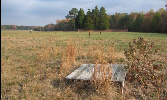
The cemetery is in the center right distant and the marker is on the left. The wooden platform in the foreground - does it cover an old well used at Fairview?
3. Tour of Fairview at Chancellorsville. This Robert Koch page offers photos of the Fairview site prior to clearing done in the last ten years. The text for the older NPS marker was transcribed from photos on his site. (Submitted on December 25, 2008, by Craig Swain of Leesburg, Virginia.)
Additional commentary.
1. Older National Park Service Marker
An older 1960s or 70s era marker stood near the location of this current marker. It read:
The
Photographed by Craig Swain, November 10, 2007
4. Chancellor Cemetery
— Submitted December 25, 2008, by Craig Swain of Leesburg, Virginia.
Photographed by Craig Swain, November 10, 2007
5. Headstones in the Chancellor Cemetery
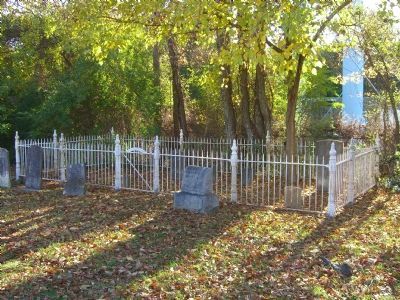
Photographed by Kevin W., November 18, 2007
6. Dr. J. E. Chancellor Family Plot
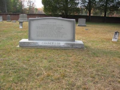
Not all the Chancellors are buried in Chancellorsville. Dr. Chancellor and his family were buried behind the old Berea Christian Church (now the Spotsylvania County Museum) in nearby Spotsylvania Courthouse. Dr. Chancellor was in charge of several hospitals in Charlottesville during the Civil War and was later a professor at the University of Virginia.
Credits. This page was last revised on March 15, 2026. It was originally submitted on November 18, 2007, by Craig Swain of Leesburg, Virginia. This page has been viewed 2,274 times since then and 76 times this year. Last updated on March 15, 2026, by Evan Dwyer of Richmond, Virginia. Photos: 1. submitted on November 18, 2007, by Craig Swain of Leesburg, Virginia. 2. submitted on April 24, 2023, by Bill Coughlin of Woodland Park, New Jersey. 3, 4, 5. submitted on November 18, 2007, by Craig Swain of Leesburg, Virginia. 6. submitted on December 3, 2007, by Kevin W. of Stafford, Virginia. • Devry Becker Jones was the editor who published this page.
Editor’s want-list for this marker. Photo of Forest Hall • Can you help?
