Fort Garland in Costilla County, Colorado — The American Mountains (Southwest)
Six Miles of Separation
— Two U.S. Forts —
Photographed by Cosmos Mariner, July 11, 2025
1. Six Miles of Separation Marker
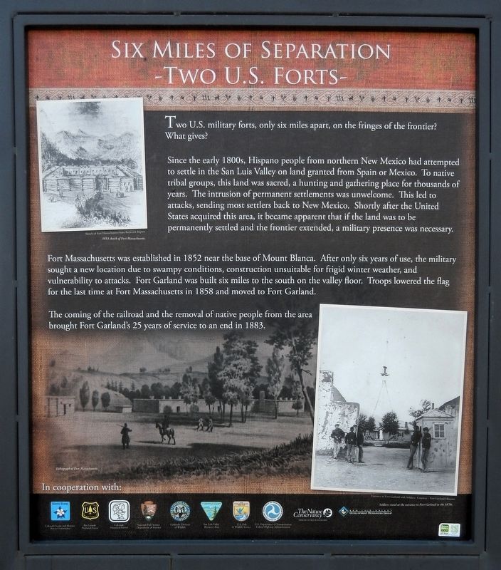
Two U.S. military forts, only six miles apart, on the fringes of the frontier? What gives?
Since the early 1800s, Hispano people from northern New Mexico had attempted to settle in the San Luis Valley on land granted from Spain or Mexico. To native tribal groups, this land was sacred, a hunting and gathering place for thousands of years. The intrusion of permanent settlements was unwelcome. This led to attacks, sending most settlers back to New Mexico. Shortly after the United States acquired this area, it became apparent that if the land was to be permanently settled and the frontier extended, a military presence was necessary.
Fort Massachusetts was established in 1852 near the base of Mount Blanca. After only six years of use, the military sought a new location due to swampy conditions, construction unsuitable for frigid winter weather, and vulnerability to attacks. Fort Garland was built six miles to the south on the valley floor. Troops lowered the flag for the last time at Fort Massachusetts in 1858 and moved to Fort Garland.
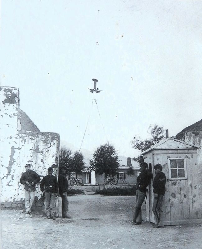
The coming of the railroad and the removal of native people from the area brought Fort Garland's
this page online
[background photo caption] Lithograph of Fort Massachusetts.
Erected by Colorado Scenic and Historic Byways Commission, Colorado Historical Society, Colorado Department of Transportation, and The Nature Conservancy.
Topics. This historical marker is listed in these topic lists: Forts and Castles • Hispanic Americans • Indigenous Peoples and Communities • Settlements & Settlers. A significant historical year for this entry is 1852.
Location. 37° 27.069′ N, 105° 22.246′ W. Marker is in Fort Garland, Colorado, in Costilla County. It is on U.S. 160 at milepost 262.2, 3.9 miles east of Miranda Avenue (State Highway 159), on the right when traveling west. The marker is in the Los Caminos Antiguos Scenic & Historic Byway interpretive kiosk on the north side of US Highway 160. Touch for map. Marker is in this post office area: Fort Garland CO 81133, United States of America. Touch for directions.

Regionally, this marker is in the San Juan Mountains and in the San Luis Valley. It is also in the American Mountain West. Globally, it is in North America, the Rocky Mountains, the
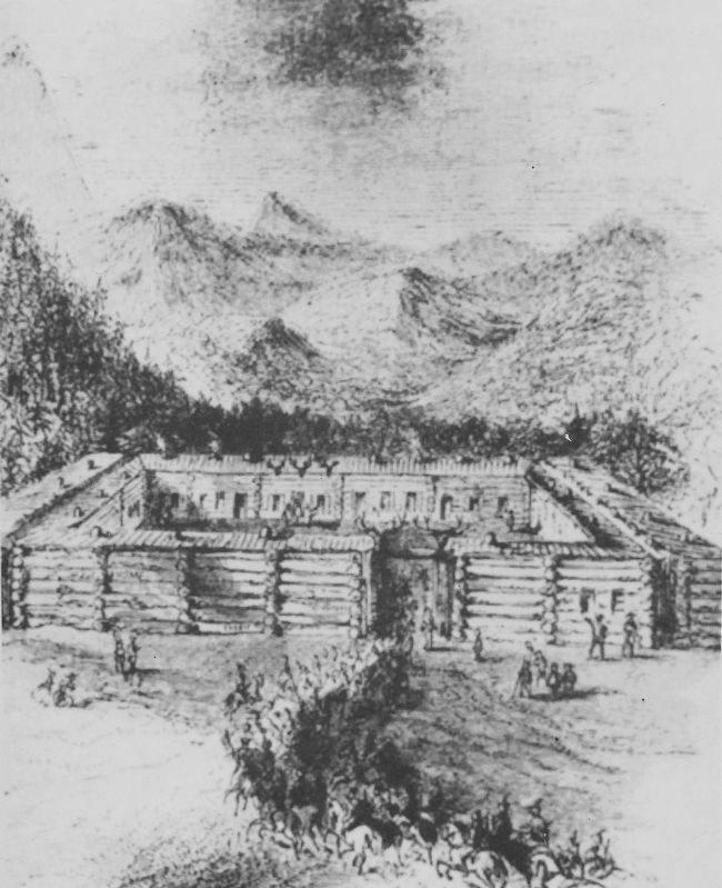
2. Marker detail: 1853 Sketch of Fort Massachusetts
Sketch of Fort Massachusetts from Beckwith Report.
Other nearby markers. At least 8 other markers are within 9 miles of this marker, measured as the crow flies: Peacekeepers of the Frontier (here, next to this marker); Railroad Steams into El Valle de San Luis (here, next to this marker); Welcome to El Valle De San Luis (here, next to this marker); Costilla County Veterans Memorial (approx. 3.2 miles away); a different marker also named Fort Garland (approx. 3.8 miles away); Fort Garland / Buffalo Soldiers (approx. 3.8 miles away); Trails Through Time (approx. 7.8 miles away); The San Luis Southern Railway (approx. 8.1 miles away). Touch for a list and map of all markers in Fort Garland.
Another marker is no longer nearby. Fort Garland (was approx. 3.8 miles away but has been permanently removed).
Related markers. Click here for a list of markers that are related to this marker. Fort Garland
Also see . . .
1. Fort Massachusetts, Colorado (Wikipedia).
Excerpt: Built in 1852, and abandoned in 1858, Fort Massachusetts(Submitted on March 18, 2026, by Cosmos Mariner of Cape Canaveral, Florida.)was the first regularly garrisoned government installation established on the soil that would soon be the territory of Colorado. However, at the time of its construction and occupation, the land was technically part of the New Mexico Territory, and the San Luis Valley remained vastly unsettled. The fort was built to maintain control of the valley and to protect white settlers and Ute Indians from one another. Its other purpose was to serve as a headquarters for Indian Agents and to make clear to Mexico that the area was now a U.S. territory as mandated by the Treaty of Guadalupe Hidalgo, which was signed five years before the construction of Fort Massachusetts. The fortification was commissioned by the United States War Department in June 1852 and commanded by Major George A.H. Blake of the United States First Dragoons. The fort was constructed mostly out of wood in a quadrangular shape from the surrounding forest and was fortified by a wooden palisade wall. It was located near the western bank of Ute Creek on the base of Mount Blanca and sat at an elevation of 8,000 feet.Courtesy Fort Garland Museum3. Marker detail: Soldiers stand at the entrance to Fort Garland in the 1870s
2. Fort Garland, Colorado (Wikipedia).
Photographed by Cosmos Mariner, July 11, 2025
4. Six Miles of Separation Marker
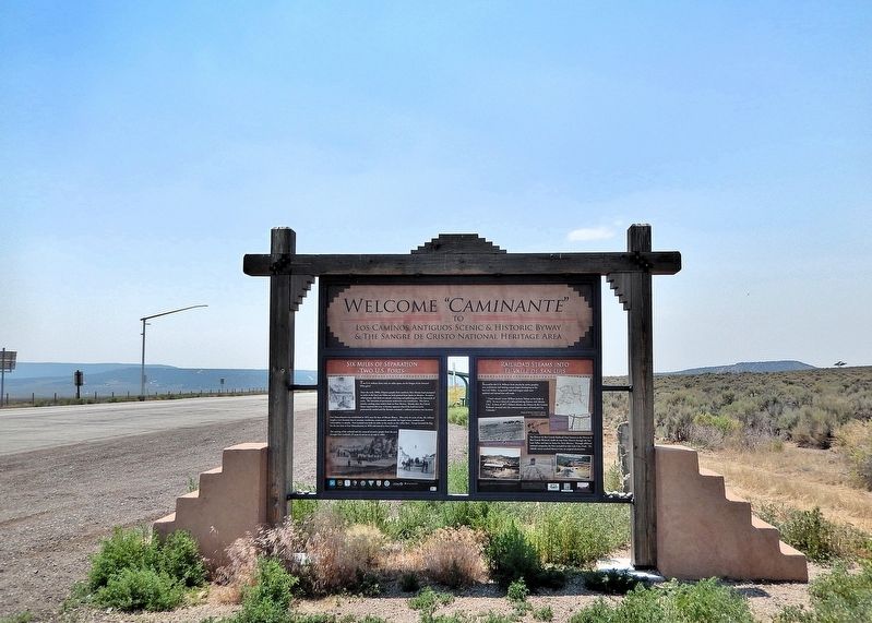
Welcome “Caminante” — to Los Caminos Antiguos Scenic & Historic Byway and The Sangre de Cristo National Heritage Area
This marker is the leftmost of two interpretive panels on the east side of the Los Caminos Antiguos Scenic & Historic Byway kiosk in Fort Garland.
Looking west; U.S. Highway 160 is on the left.
This marker is the leftmost of two interpretive panels on the east side of the Los Caminos Antiguos Scenic & Historic Byway kiosk in Fort Garland.
Looking west; U.S. Highway 160 is on the left.
Excerpt: Fort Garland was established by the United States Army in June 1858 to protect white settlers from the Ute people in the San Luis Valley, which was then part of the New Mexico Territory. Fort Garland was built to replace the earlier Fort Massachusetts. The new Territory of Colorado was organized on February 28, 1861, and the Fort Garland, Colorado Territory, post office opened on February 25, 1862. The fort was abandoned in 1883 following the confinement of the tribes to Indian reservations in the Territory of Utah and the State of Colorado.(Submitted on March 18, 2026, by Cosmos Mariner of Cape Canaveral, Florida.)
Credits. This page was last revised on March 18, 2026. It was originally submitted on March 18, 2026, by Cosmos Mariner of Cape Canaveral, Florida. This page has been viewed 16 times since then. Photos: 1, 2, 3, 4. submitted on March 18, 2026, by Cosmos Mariner of Cape Canaveral, Florida.
