Ridgefield in Western Region, Connecticut — The American Northeast (New England)
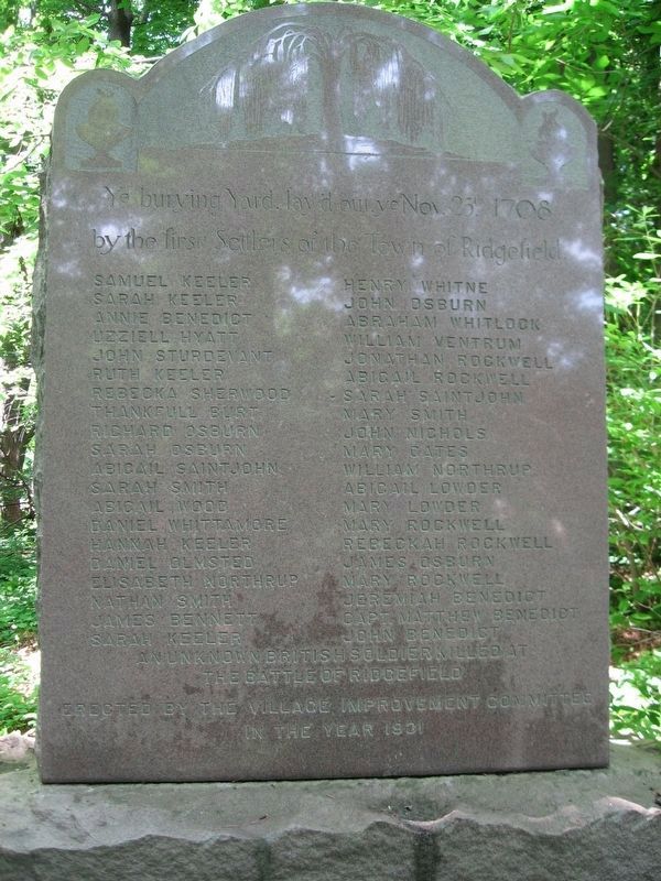
Burying Yard Stone Monument
Photographed by Michael Herrick, June 15, 2010
1. Burying Yard Stone Monument
by the first Settlers of the Town of Ridgefield.
Samuel Keeler • Sarah Keeler • Annie Benedict • Uzziell Hyatt • John Sturdevant • Ruth Keeler • Rebecka Sherwood • Thankfull Burt • Richard Osburn • Sarah Osburn • Abigail Saintjohn • Sarah Smith • Abigail Wood • Daniel Whittamore • Hannah Keeler • Daniel Olmstead • Elisabeth Northrup • Nathan Smith • James Bennett • Henry Whitne • John Osburn • Abraham Whitlock • William Ventrum • Jonathan Rockwell • Abigail Rockwell • Sarah Saintjohn • Mary Smith • John Nichols • Mary Cates • William Northrup • Abigail Lowder • Mary Rockwell • Rebeckah Rockwell • James Osburn • Mary Rockwell • Jeremiah Benedict • Capt. Matthew Benedict • John Benedict
An Unknown British Soldier Killed at the Battle of Ridgefield
Erected by the Village Improvement Committee
In the Year 1931
Erected 1931 by Village Improvement Committee.
Topics. This historical marker and monument is listed in these topic lists: Cemeteries & Burial Sites • Colonial Era • Settlements & Settlers. A significant historical date for this entry is November 25, 1708.
Location. 41° 16.086′ N, 73° 29.606′ W.
this page online

Regionally, this marker and monument is on the Connecticut Shoreline, on the Gold Coast, and in Greater Bridgeport. It is also in the American Northeast and in New England. Globally, it is in North America, the Western Hemisphere, the Western World, and the Anglosphere. Historically, it finds itself in what was once Fairfield County and also one of the original Thirteen Colonies.
Other nearby markers. At least 8 other markers are within walking distance of this marker: Ye Burying Yard (here, next to this marker); Ensign James Benedict House (approx. 0.3 miles away); Keeler Tavern (approx. 0.4 miles away); Keeler Tavern and the “Big Shop” (approx. 0.4 miles away); Ridgefield's Colonial Plans (approx. half a mile away); Ridgefield Veterans Monument (approx. 0.6 miles away); The Town Common and Hauley House (approx. 0.6 miles away);

Photographed by Michael Herrick, June 15, 2010
2. Burying Yard Stone Monument
Credits. This page was last revised on May 19, 2026. It was originally submitted on March 19, 2026, by Michael Herrick of Southbury, Connecticut. This page has been viewed 18 times since then. Photos: 1, 2. submitted on March 19, 2026, by Michael Herrick of Southbury, Connecticut.
