South Padre Island in Cameron County, Texas — The American South (West South Central)
1923 Point Isabel Coast Guard Building

Photographed by Dave W, March 14, 2026
1. 1923 Point Isabel Coast Guard Building Marker
The federal government has operated a coastal installation at Point Isabel since 1852. This structure is the third permanent building erected here, one of a line of nine stations established along the Gulf of Mexico from Florida to the Texas-Mexico border. Originally consisting of a main floor, attic, and lookout tower, all elevated off the ground on wood and concrete pilings, the structure served as barracks and headquarters for the U.S. Coast Guard unit that patrolled the coastline and conducted sea rescues.
Erected 1988 by Texas Historical Commission. (Marker Number 32.)
Topics. This historical marker is listed in these topic lists: Disasters • Law Enforcement • Patriots & Patriotism • Waterways & Vessels. A significant historical year for this entry is 1923.
Location. 26° 4.468′ N, 97° 9.85′ W. Marker is on South Padre Island, Texas, in Cameron County. It can be reached from Wallace L Reed Road west of Padre Blvd. Touch for map. Marker is at or near this postal address: 1 Wallace L Reed Rd, South Padre Island TX 78597, United States of America. Touch for directions.

Regionally, this marker is in
this page online
Other nearby markers. At least 8 other markers are within 3 miles of this marker, measured as the crow flies: Brazos Santiago (approx. half a mile away); Padre J. Nicolas Balli (approx. ¾ mile away); Queen Isabella Causeway Collapse Loss Memorial (approx. ¾ mile away); Queen Isabel Inn (approx. 2.6 miles away); Rio Grande Rail Road Company (approx. 2.6 miles away); Veterans' Park Walls of Honor (approx. 2.6 miles away); Port of Matamoros (approx. 2.7 miles away); Old Point Isabel Lighthouse (approx. 2.7 miles away). Touch for a list and map of all markers in South Padre Island.
Another marker is no longer nearby. Brazos Santiago Pass and Brazos Island Military Depot (was approx. half a mile away but has been confirmed missing).
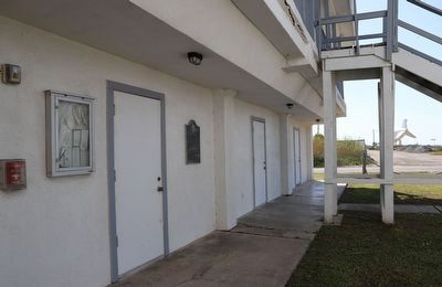
Photographed by Dave W, March 14, 2026
2. 1923 Point Isabel Coast Guard Building Marker

Photographed by Dave W, March 14, 2026
3. 1923 Point Isabel Coast Guard Building Marker
Marker barely visible here just past the breezeway by the staris.

Photographed by Dave W, March 14, 2026
4. 1923 Point Isabel Coast Guard Building Marker
Building from the road.
Credits. This page was last revised on March 21, 2026. It was originally submitted on March 20, 2026, by Dave W of Co, Colorado. This page has been viewed 26 times since then. Photos: 1, 2, 3, 4. submitted on March 20, 2026, by Dave W of Co, Colorado. • James Hulse was the editor who published this page.
