Bethesda in Montgomery County, Maryland — The American Northeast (Mid-Atlantic)
Old Georgetown Road
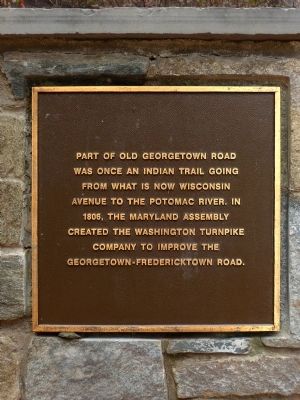
Photographed by Allen C. Browne, April 2, 2014
1. Old Georgetown Road Marker
Topics. This historical marker is listed in these topic lists: Indigenous Peoples and Communities • Roads & Vehicles. A significant historical year for this entry is 1806.
Location. 38° 59.209′ N, 77° 5.899′ W. Marker is in Bethesda, Maryland, in Montgomery County. It can be reached from Old Georgetown Road (Maryland Route 187) just east of Arlington Road, on the right when traveling east. Touch for map. Marker is at or near this postal address: 7740 Old Georgetown Road, Bethesda MD 20814, United States of America. Touch for directions.

Regionally, this marker is in the Washington Metropolitan Area. It is also in the American Mid-Atlantic. Globally, it is in North America, the Western Hemisphere, the Western World, and the Anglosphere. Historically, it finds itself in what was once one of the original Thirteen Colonies and also the Antebellum South.
Other nearby markers. At least 8
this page online
Other markers no longer nearby. Old Georgetown Road (was about 300 feet away, measured in a direct line but has been permanently removed); The Bank of Bethesda Building (was about 400 feet away but has been confirmed missing); Looking North up Wisconsin Avenue at Old Georgetown Road in 1940 (was about 500 feet away but has been permanently removed); The First Building for the Bethesda Fire Department (was about 500 feet away but has been confirmed missing).
Also see . . .
1. Maryland Route 187. , Wikipedia. (Submitted on May 3, 2014, by Allen C. Browne of Silver Spring, Maryland.)
2. "Maryland Route 187".
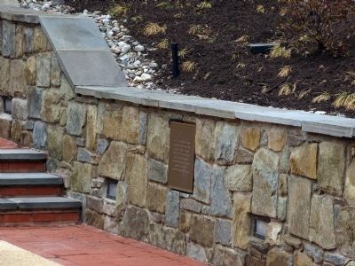
Photographed by Allen C. Browne, April 2, 2014
2. Old Georgetown Road Marker

Photographed by Allen C. Browne, April 2, 2014
3. Allied Realty Corporation
Credits. This page was last revised on March 22, 2026. It was originally submitted on May 3, 2014, by Allen C. Browne of Silver Spring, Maryland. This page has been viewed 1,308 times since then and 62 times this year. Last updated on March 20, 2026, by Carl Gordon Moore Jr. of North East, Maryland. Photos: 1, 2, 3. submitted on May 3, 2014, by Allen C. Browne of Silver Spring, Maryland. • Devry Becker Jones was the editor who published this page.
