Hamden in South Central Region, Connecticut — The American Northeast (New England)
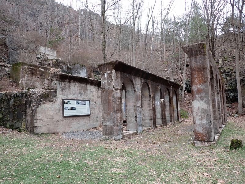
Sleeping Giant Quarry

Photographed by Conrad Ward, April 6, 2025
1. Sleeping Giant Quarry Marker
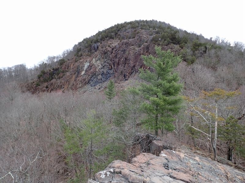
The Sleeping Giant began forming about two hundred million years ago, when molten magma welling up from deep belowground became trapped in an underground chamber on its way to the surface. As the magma in this chamber cooled and solidified, it was transformed into a rock called diabase. Over the course of geologic time, the overlying sedimentary rock gradually eroded away, and the solidified magma chamber was slowly exposed. Continued erosion by wind, water, and the powerful forces of glaciation shaped the now-exposed diabase into the trap rock ridge we recognize today as the Sleeping Giant.
By the latter part of the 19th century, the Sleeping Giant had become a popular attraction with local residents. As cities became more populated and congested, the Giant was seen by many as a means of escaping from the increasing urbanization of New Haven and surrounding cities. During this time, a number of cabins were built on privately owned portions of the Giant's trap rock ridges. These became summer retreats and hiking destinations for area residents, including Judge Willis M. Cook who had purchased the head of the Giant
this page online
Family and friends frequently visited the Cook cabin, often staying overnight. However, uninvited guests also visited the cabin, leaving trash and graffiti behind. Appalled by the vandalism of his property and suffering various financial setbacks, Cook leased the entire Head to the Connecticut Trap Rock Quarries, Inc. in 1911.
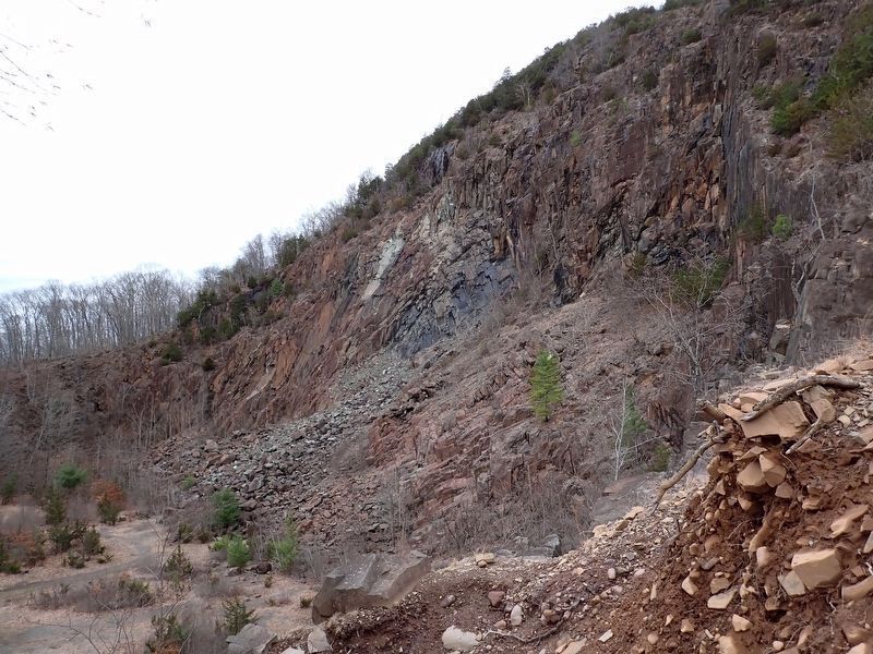
Quarrying operations at the Giant commenced the following year. Rock blasted from the top of the Giant's Head was carried by steam shovels (similar to the one pictured above at the North Branford Quarry on Totoket Mountain circa 1914) to the stone-crushing facility in the Lower Quarry, where material was crushed into smaller pieces and then separated by size. Between 1912 and 1933, more than one million tons of diabase (also called trap rock) had been quarried away, resulting in creation of the now-familiar Upper Quarry.
The crushed stone was carried away from the site by trolley cars. Each car was capable of carrying eight tons of stone. The trolley connected to the New Haven-Waterbury rail line, from where deliveries were subsequently made to New Haven,
Photographed by Conrad Ward, April 6, 2025
2. Sleeping Giant Quarry Marker
Quarrying operations at the Giant continued until 1933. Throughout its period of activity, however, local residents complained about the constant noise of blasting, the danger of flying stones, and the incessant rumbling of heavily laden trolley cars that literally shook the foundations of nearby homes. The North Hamden Improvement Society worked to minimize the impact of quarrying on local residents, but met with limited success. Fortunately, Judge Cook had included a clause in the lease stipulating that the lease could be terminated at any time should quarrying be visible from Mt. Carmel Avenue. Quarry operations were clearly in violation of this provision. This afforded a legal means by which the nascent Sleeping Giant Park Association could break the lease and wrest control of the Giant's Head from the quarrying company.
In 1930, the Sleeping Giant Park Association purchased the Head from Judge Cook's widow.
Photographed by Conrad Ward, April 6, 2025
3. Main Quarry area
The Sleeping Giant Park Association began as a grassroots movement to help preserve one of the most iconic features of the Connecticut landscape, the Sleeping Giant. The Association's effort to prevent the wanton destruction of the Giant's head by continued quarrying
Photographed by Conrad Ward, April 6, 2025
4. The Head of Sleeping Giant
The many dedicated volunteers who worked tirelessly on behalf of the Association pulled out all the stops in their effort to halt the destructive quarrying along the Mt. Carmel trap rock ridge, to raise the funds necessary to purchase the Giant's head, and to continue the slow process of transforming this spectacular ridgeline into one of Connecticut's premier state parks.
On the tenth anniversary of the Sleeping Giant Park Association's founding, SGPA members and various dignitaries gathered in the now-silent Upper Quarry to celebrate saving the Giant's head and to consider a future vision of the Sleeping Giant State Park. Today the park stands as one of the preeminent wilderness areas in the state and is enjoyed by untold numbers of visitors annually.
Erected by Sleeping Giant State Park, Connecticut Department of Energy and Environmental Protection.
Topics. This historical marker is listed in these topic lists: Environment • Industry & Commerce • Parks & Recreational Areas • Railroads & Streetcars. A significant historical year for this entry is 1933.
Location. 41° 25.469′ N, 72° 54.19′ W. Marker is in Hamden in South Central Region, Connecticut. It can be reached from Whitney Avenue east of Todd Street. located along the Violet Trail in Sleeping Giant State Park. Touch for map. Marker is in this post office area: Hamden CT 06518, United States of America. Touch for directions.

Regionally, this marker is in the Connecticut River Valley, on the Connecticut Shoreline, and in Greater New Haven. It is also in the American Northeast and in New England. Globally, it is in North America, the Western Hemisphere, the Western World, and the Anglosphere. Historically, it finds itself in what was once New Haven County and also one of the original Thirteen Colonies.
Other nearby markers. At least 8 other markers are within walking distance of this marker: Judge Cook's Oxen Road (approx. 0.2 miles away); Walter Owen Filley (approx. 0.2 miles away); Edgar Laing Heermance (approx. 0.3 miles away); Sleeping Giant: Stories of an Indigenous Place (approx. 0.3 miles away); Sleeping Giant State Park: The Tower Path (approx. 0.3 miles away); a different marker also named Judge Cook's Oxen Road (approx. 0.3 miles away); Heaton Trail (approx. 0.6 miles away); Sleeping Giant State Park (approx. 0.8 miles away). Touch for a list and map of all markers in Hamden.
Also see . . .
1. Sleeping Giant State Park. (Submitted on March 29, 2026, by Michael Herrick of Southbury, Connecticut.)
2. Sleeping Giant (Connecticut) (Wikipedia). (Submitted on March 29, 2026, by Michael Herrick of Southbury, Connecticut.)
Credits. This page was last revised on May 19, 2026. It was originally submitted on March 22, 2026, by Conrad Ward of Guilford, Connecticut. This page has been viewed 20 times since then. Photos: 1, 2, 3, 4. submitted on March 22, 2026, by Conrad Ward of Guilford, Connecticut. • Michael Herrick was the editor who published this page.
