Prospect Park in Delaware County, Pennsylvania — The American Northeast (Mid-Atlantic)
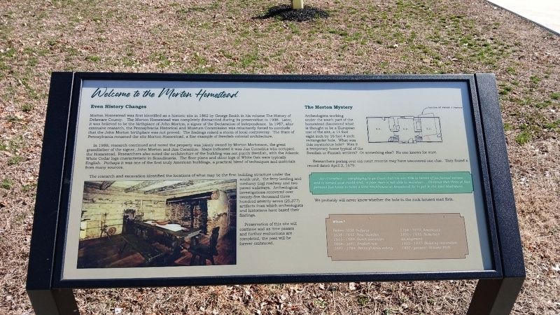
Welcome to the Morton Homestead
Photographed by Kate Clifford
1. Welcome to the Morton Homestead Marker
Even History Changes Morton Homestead was first identified as an historic site in 1862 by George Smith in his volume The History of Delaware County. The Morton Homestead was completely dismantled during its preservation in 1938. Later, it was believed to be the birthplace of John Morton, a signer of the Declaration of Independence. In 1957, after extensive research, the Pennsylvania Historical and Museum Commission was reluctantly forced to conclude that the John Morton birthplace was not proved. The findings raised a storm of local controversy. The State of Pennsylvania renamed the site Morton Homestead, a fine example of Swedish colonial architecture.
In 1988, research continued and noted the property was jointly owned by Morton Mortonson, the great-grandfather of the signer, John Morton and Jan Cornelius. Maps indicated it was Jan Cornelius who occupied the Homestead. Researchers also noted the architecture of the building was not purely Swedish, with the Atlantic White Cedar logs characteristic in Scandinavia. The floor plans and other logs of White Oak were typically English. Perhaps it was one of the first
this page online
The research and excavation identified the locations of what may be the first building structure under the south unit, the ferry landing and corduroy (log) roadway and two paved walkways. Archeological investigations recovered over twenty-five thousand three hundred seventy-seven (25,377) artifacts from which archeologists and historians have based their findings.
Preservation of this site will continue and as time passes and further evaluations are completed, the past will be forever embraced.
The Morton Mystery
Archeologists working under the south part of the homestead discovered what is thought to be a European use of the site, a 14 foot eight inch by 16 foot 4 inch rectangular hole. What was this mysterious hole? Was it a temporary home typical of the Swedish or Finnish settlers? Or something else? No one knows for sure.
Researchers poring over old court records may have uncovered one clue. The found a record dated April 3, 1679.
Jan Cornelius... complaying to ye Court that his son Erik is berect of jos factural senses & is turned quyt madd and ... a poor man is not able to maintain … Ordered that three or four persons live hired to build a little blockhouse at Amosland for to put in the said Madhouse.
We
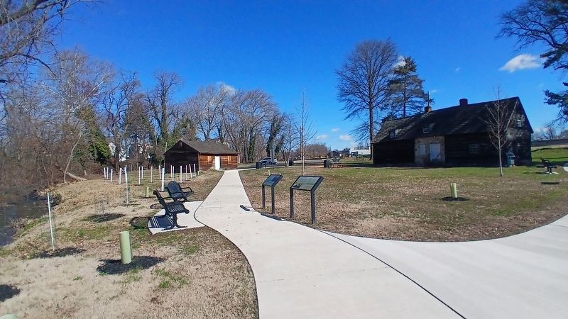
Photographed by Kate Clifford, March 17, 2026
2. Welcome to the Morton Homestead Marker
When?
Before 1638: Indians
1638 - 1655: New Sweden
1655 - 1664: Dutch dominion
1664 - 1681: English rule
1681 - 1784: Pennsylvania colony
1784 - 1870: Americans
1870 - 1935: Suburban development
1935 - 1937: Building restoration
1937 - present: Historic park
Erected 2024 by Borough of Prospect Park and Delaware County Council.
Topics. This historical marker is listed in these topic lists: Colonial Era • Settlements & Settlers • Waterways & Vessels. A significant historical date for this entry is April 3, 1679.
Location. 39° 52.607′ N, 75° 18.341′ W. Marker is in Prospect Park, Pennsylvania, in Delaware County. It can be reached from Lincoln Avenue. This marker is to the right of another marker of the same name. Touch for map. Marker is at or near this postal address: 100 Lincoln Ave, Prospect Park PA 19076, United States of America. Touch for directions.

Regionally, this marker is in Southeast Pennsylvania and in Greater Philadelphia. It is also in the American Northeast and in the Mid-Atlantic. Globally, it is in North America, the Western Hemisphere, the Western World, and the Anglosphere. Historically, it finds itself in what was once the Haudenosaunee (Iroquois) Confederacy, New Netherland, and one of the original Thirteen Colonies.
Other nearby markers. At least 8 other markers are within walking distance of this marker: A different marker also named Welcome to the Morton Homestead (here, next to this marker); A Change For the Worse? (a few steps from this marker); John Morton– Signer of the Declaration of Independence (within shouting distance of this marker); Welcome (within shouting distance of this marker); a different marker also named The Ferry Landing (within shouting distance of this marker); Darby Creek Then and Now (within shouting distance of this marker); a different marker also named Darby Creek Then and Now (within shouting distance of this marker); a different marker also named Morton Homestead (within shouting distance of this marker). Touch for a list and map of all markers in Prospect Park.
Other markers no longer nearby. The Second Building (was here, next to this marker but has been replaced with another marker now near it); The First Building (was here, next to this marker but has been replaced with another marker now near it); A Morton Mystery (was here, next to this marker but has been replaced with another marker now near it); Morton Homestead (was here, next to this marker but has been replaced with another marker now near it); The Ferry Landing (was within shouting distance of this marker but has been replaced with another marker now near it); a different marker also named Darby Creek Then and Now (was within shouting distance of this marker but has been replaced with another marker now near it); Welcome to The Morton Homestead (was within shouting distance of this marker but has been replaced with another marker now near it); Even History Changes (was within shouting distance of this marker but has been replaced with another marker now near it).
More about this marker. This marker replaces an unreadable marker at approximately the same location
Credits. This page was last revised on March 26, 2026. It was originally submitted on March 24, 2026, by Kate Clifford of Lansdowne, Pennsylvania. This page has been viewed 27 times since then. Photos: 1, 2. submitted on March 24, 2026, by Kate Clifford of Lansdowne, Pennsylvania. • Bill Pfingsten was the editor who published this page.
