Prospect Park in Delaware County, Pennsylvania — The American Northeast (Mid-Atlantic)
The Ferry Landing
Photographed by Kate Clifford
1. The Ferry Landing Marker
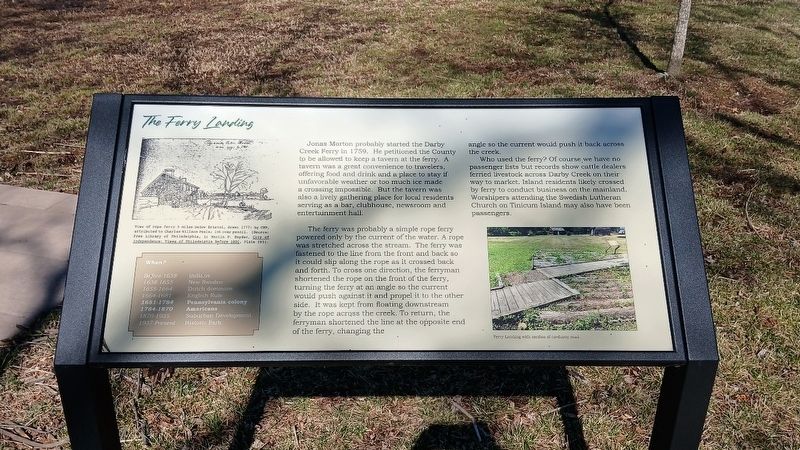
Jonas Morton probably started the Darby Creek Ferry in 1759. He petitioned the County to be allowed to keep a tavern at the ferry. A tavern was a great convenience to travelers, offering food and drink and a place to stay if unfavorable weather or too much ice made a crossing impossible. But a tavern was also a lively gathering place for local residents serving as a bar, clubhouse, newsroom and entertainment hall.
The ferry was probably a simple rope ferry powered only by the current of the water. A rope was stretched across the stream. The ferry was fastened to the line from the front and back so it could slip along the rope as it crossed back and forth. To cross one direction, the ferryman shortened the rope on the front of the ferry, turning the ferry at an angle so the current would push against it and propel it to the other side. It was kept from floating downstream by the rope across the creek. To return, the ferryman shortened the line at the opposite end of the ferry, changing the angle so the current would push it back across the creek.
Who used the ferry? Of course we have no passenger lists but records
this page online
When?
Before 1638: Indians
1655 - 1664: Dutch dominion
1664 - 1681: English rule
1681 - 1784: Pennsylvania colony
1784 - 1870: Americans
1870 - 1935: Suburban development
1935 - 1937: Building restoration
1937 - present: Historic park
Erected 2024 by Borough of Prospect Park and Delaware County Council.
Topics. This historical marker is listed in these topic lists: Colonial Era • Settlements & Settlers • Waterways & Vessels. A significant historical year for this entry is 1759.
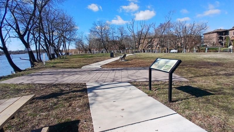
Location. 39° 52.592′ N, 75° 18.322′ W. Marker is in Prospect Park, Pennsylvania, in Delaware County. It can be reached from Lincoln Avenue. This marker is located next to a reproduction of the 'corduroy road'. Touch for map. Marker is at or near this postal address: 100 Lincoln Ave, Prospect Park PA 19076, United States of America. Touch for directions.

Regionally,
Photographed by Kate Clifford, March 17, 2026
2. The Ferry Landing Marker
Other nearby markers. At least 7 other markers are within walking distance of this marker: A Change For the Worse? (within shouting distance of this marker); Darby Creek Then and Now (within shouting distance of this marker); a different marker also named Darby Creek Then and Now (within shouting distance of this marker); Welcome to the Morton Homestead (within shouting distance of this marker); a different marker also named Welcome to the Morton Homestead (within shouting distance of this marker); John Morton– Signer of the Declaration of Independence (within shouting distance of this marker); Welcome (within shouting distance of this marker). Touch for a list and map of all markers in Prospect Park.
Other markers no longer nearby. The Ferry Landing (has been replaced with this marker); Morton Homestead (was within shouting distance of this marker but has been replaced with another marker now near it); The Second Building (was within shouting distance of this marker but has been replaced with another marker now near it); The First Building (was within shouting distance of this marker but has been replaced with another marker now near it); Even History Changes (was within shouting distance of this marker but has been replaced with another marker now near it); A Morton Mystery (was within shouting distance of this marker but has been replaced with another marker now near it); River of Change (was within shouting distance of this marker but has been replaced with another marker now near it); a different marker also named Darby Creek Then and Now (was within shouting distance of this marker but has been replaced with another marker now near it); Welcome to The Morton Homestead (was within shouting distance of this marker but has been replaced with another marker now near it).
More about this marker. This marker replaced an unreadable marker of the same name at approximately the same location.
Credits. This page was last revised on March 26, 2026. It was originally submitted on March 24, 2026, by Kate Clifford of Lansdowne, Pennsylvania. This page has been viewed 22 times since then. Photos: 1, 2. submitted on March 24, 2026, by Kate Clifford of Lansdowne, Pennsylvania. • Bill Pfingsten was the editor who published this page.
