Tinicum Township near Prospect Park in Delaware County, Pennsylvania — The American Northeast (Mid-Atlantic)
Darby Creek Then and Now
Photographed by Kate Clifford
1. Darby Creek Then and Now Marker
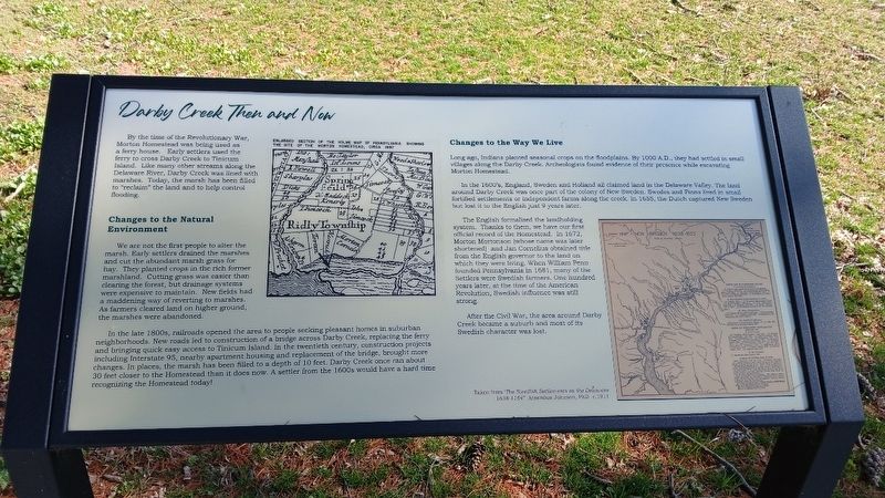
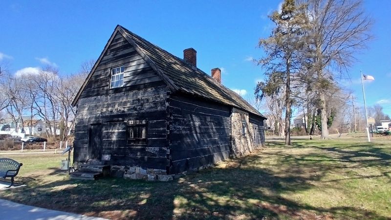
By the time of the Revolutionary War, Morton Homestead was being used as a ferry house. Early settlers used the ferry to cross Darby Creek to Tinicum Island. Like many other streams along the Delaware River, Darby Creek was lined with marshes. Today, the marsh has been filled in to "reclaim" the land and to help control flooding.
Changes To The Natural Environment
We are not the first people to alter the marsh. Early settlers drained the marshes and cut the abundant marsh grass for hay. They planted crops in the rich former marshland. Cutting grass was easier than clearing the forest, but drainage systems were expensive to maintain. New fields had a maddening way of reverting to marshes. As farmers cleared land on higher ground, the marshes were abandoned.
In the late 1800s, railroads opened the area to people seeking pleasant homes in suburban neighborhoods. New roads led to construction of a bridge across Darby Creek, replacing the ferry and bringing quick easy access to Tinicum Island. In the twentieth century, construction projects including Interstate 95, nearby apartment housing and replacement of the bridge,
this page online
Changes To The Way We Live
Long ago, Indians planted seasonal crops on the floodplains. By 1000 A.D., they had settled in small villages along the Darby Creek. Archeologists found evidence of their presence while excavating Morton Homestead.
In the 1600’s, England, Sweden and Holland all claimed land in the Delaware Valley. The land around Darby Creek was once part of the colony of New Sweden. Swedes and Finns lived in small fortified settlements or independent farms along the creek. In 1655, the Dutch captured New Sweden but lost it to the English just 9 years later.
The English formalized the landholding system. Thanks to them, we have our first official record of the Homestead. In 1672, Morton Mortonson (whose name was later shortened) and Jan Cornelius obtained title from the English governor to the land on which they were living. When William Penn founded Pennsylvania in 1681,

Photographed by Kate Clifford, March 17, 2026
2. Darby Creek Then and Now Markers and Morton Homestead
After the Civil War the area around Darby Creek became a suburb and most of its Swedish character was lost.
Erected 2024 by Borough of Prospect Park and Delaware County Council.
Topics. This historical marker is listed in these topic lists: Colonial Era • Settlements & Settlers • Waterways & Vessels. A significant historical year for this entry is 1672.
Location. 39° 52.611′ N, 75° 18.313′ W. Marker is near Prospect Park, Pennsylvania, in Delaware County. It is in Tinicum Township. It can be reached from Wanamaker Avenue (Route 420) south of 2nd Avenue, on the right when traveling south. This marker is to the left of another marker of the same name, both to the southeast of Morton Homestead. Touch for map. Marker is at or near this postal address: 100 Lincoln Ave, Prospect Park PA 19076, United States of America. Touch for directions.

Regionally, this marker is in Southeast Pennsylvania and in Greater Philadelphia. It is also in the American Northeast and in the Mid-Atlantic.
Photographed by Kate Clifford
3. Morton Homestead South & East Elevations
Other nearby markers. At least 8 other markers are within walking distance of this marker: A different marker also named Darby Creek Then and Now (here, next to this marker); A Change For the Worse? (within shouting distance of this marker); John Morton– Signer of the Declaration of Independence (within shouting distance of this marker); a different marker also named The Ferry Landing (within shouting distance of this marker); Welcome to the Morton Homestead (within shouting distance of this marker); a different marker also named Welcome to the Morton Homestead (within shouting distance of this marker); Welcome (within shouting distance of this marker); a different marker also named Morton Homestead (within shouting distance of this marker). Touch for a list and map of all markers in Prospect Park.
Other markers no longer nearby. Even History Changes (was here, next to this marker but has been replaced with another marker now near it); The Ferry Landing (was within shouting distance of this marker but has been replaced with another marker now near it); Morton Homestead (was within shouting distance of this marker but has been replaced with another marker now near it); The First Building (was within shouting distance of this marker but has been replaced with another marker now near it); The Second Building (was within shouting distance of this marker but has been replaced with another marker now near it); A Morton Mystery (was within shouting distance of this marker but has been replaced with another marker now near it); a different marker also named Darby Creek Then and Now (was within shouting distance of this marker but has been replaced with another marker now near it).
More about this marker. These markers replaced an unreadable marker of the same name
Credits. This page was last revised on April 7, 2026. It was originally submitted on March 24, 2026, by Kate Clifford of Lansdowne, Pennsylvania. This page has been viewed 25 times since then. Photos: 1, 2, 3. submitted on March 24, 2026, by Kate Clifford of Lansdowne, Pennsylvania. • Devry Becker Jones was the editor who published this page.
