
Aransas Pass in Aransas County, Texas — The American South (West South Central)
Aransas Pass Light Station
Photographed by Dave W, March 24, 2026
1. Aransas Pass Light Station Marker
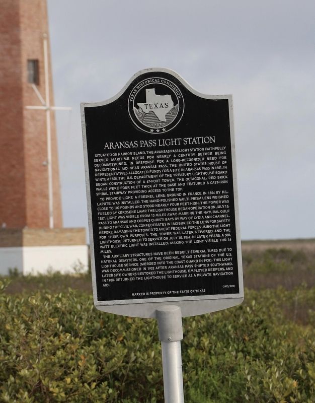
Situated on Harbor Island, the Aransas Pass Light Station faithfully served maritime needs for nearly a century before being decommissioned. In response for a long-recognized need for navigational aid near Aransas Pass, the United States House of Representatives allocated funds for a site in Aransas Pass in 1851. In winter 1855, the U.S. Department of the Treasury Lighthouse Board began construction of a 67-foot tower. The octagonal, red brick walls were four feet thick at the base and featured a cast-iron spiral stairway providing access to the top.
To provide light, a Fresnel Lens, ground in France in 1854 by H.L. Lapute, was installed. The hand-polished multi-prism lens weighed close to 100 pounds and stood nearly four feet high. The power was fueled by kerosene lamp. The lighthouse began operation on July 15, 1857. Light was visible from 13 miles away, marking the natural Gulf Pass to Aransas and Corpus Christi Bays by way of Lydia Ann Channel. During the Civil War, Confederates in 1863 buried the lens for safety before damaging the tower to avert Federal forces using the light for their own purposes. The tower
this page online
The auxiliary structures have been rebuilt several times due to natural disasters. One of the original Texas stations of the U.S. Lighthouse Service (merged into the Coast Guard in 1939), this light was decommissioned in 1952 after Aransas Pass shifted southward. Later site owners restored the lighthouse, employed keepers, and in 1988 returned the lighthouse to service as a private navigation aid.
Erected 2019 by Texas Historical Commission. (Marker Number 184.)
Topics. This historical marker is listed in these topic lists: Disasters • War, US Civil • Waterways & Vessels. A significant historical date for this entry is July 15, 1857.
Location. 27° 51.79′ N, 97° 3.351′ W. Marker is in Aransas Pass, Texas, in Aransas County. It can be reached from State Highway 361 2 miles north of J C Barr Blvd. Access to the markers is only by boat. Touch for map. Marker is in this post office area: Port Aransas TX 78373, United States of America. Touch for directions.

Regionally,
Photographed by Dave W, March 24, 2026
2. Aransas Pass Light Station Marker
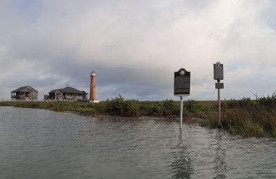
Marker seen here on left with lighthouse in the distance.
Other nearby markers. At least 8 other markers are within 2 miles of this marker, measured as the crow flies: A different marker also named Aransas Pass Light Station (here, next to this marker); Aransas Pass (approx. 1.6 miles away); U.S. Coast Guard on Mustang Island (approx. 1.6 miles away); Port Aransas Memorial (approx. 1.7 miles away); Tarpon Inn (approx. 1.8 miles away); Mustang Island (approx. 1.9 miles away); The Mercer Family on Mustang Island (approx. 1.9 miles away); Gun Locations (approx. 2 miles away).
More about this marker. The lighthouse itself and surrounding structures and land are private property. Access to the markers is only by boat.
Related marker. Click here for another marker that is related to this marker.
Photographed by Dave W, March 24, 2026
3. Aransas Pass Light Station Marker
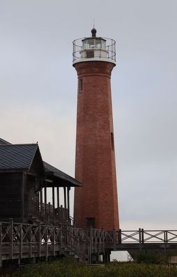
Closer view of the lighthouse from the water near the private dock.
Credits. This page was last revised on March 26, 2026. It was originally submitted on March 24, 2026, by Dave W of Co, Colorado. This page has been viewed 29 times since then. Photos: 1, 2, 3. submitted on March 24, 2026, by Dave W of Co, Colorado. • James Hulse was the editor who published this page.
