Rowville in Knox, Victoria, Australia — Oceania
Well
Stamford Park Homestead
| — | Stamford Park Homestead | — |
Photographed by Dean Barton-Ancliffe, March 25, 2026
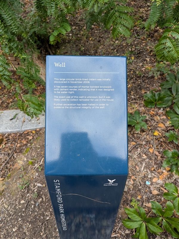
1. Well Marker
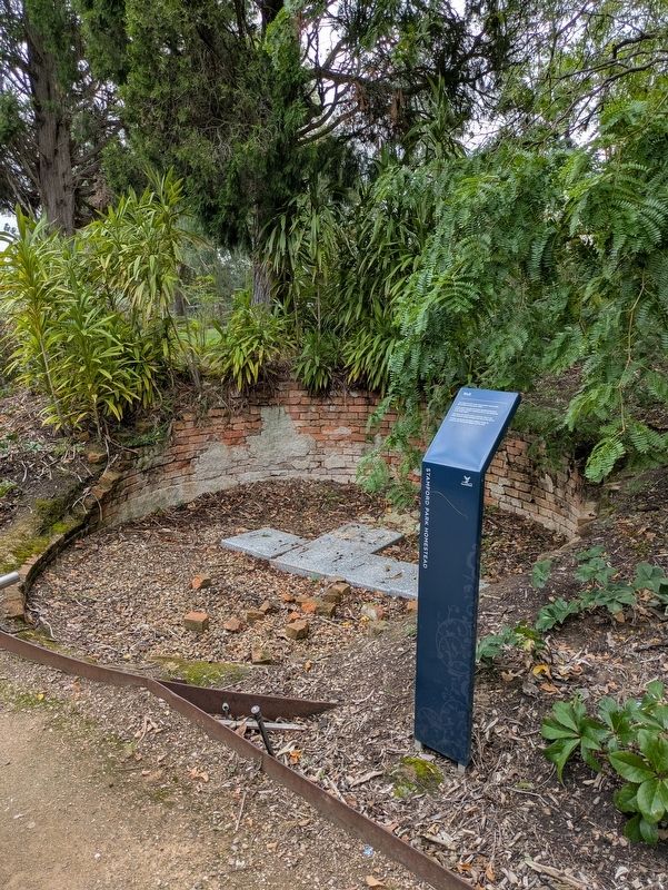
It has seven courses of mortar bonded brickwork with cement render, indicating that it was designed to be water-tight.
The exact use of this well is unknown, but it was likely used to collect rainwater for use in the house.
Further excavation has been halted in order to preserve the structural integrity of the well.
Erected by Knox City Council.
Topics. This historical marker is listed in these topic lists: Colonial Era • Man-Made Features • Settlements & Settlers. A significant historical year for this entry is 2008.
Location. 37° 54.856′ S, 145° 14.017′ E. Marker is in Rowville, Victoria, in Knox. It can be reached from Emmeline Row 0.1 kilometers west of Enterprise Drive. After travelling up the driveway to Stamford Park House, follow around the back of the house to the right to locate this marker. Touch for map. Marker is at or near this postal address: 8 Emmeline Row, Rowville VIC 3178, Australia. Touch for directions.

Regionally, it is in Oceania, in Australasia, in the Pacific Ocean, in South Pacific, on the
this page online
Other nearby markers. At least 8 other markers are within 6 kilometers of this marker, measured as the crow flies: Cool Store - Dairy (a few steps from this marker); An Entwined History (within shouting distance of this marker); Homestead (about 90 meters away, measured in a direct line); Rowville War Memorial (approx. 0.7 kilometers away); Rowville Carwash (approx. 1.5 kilometers away); Original Scoresby School (approx. 1.7 kilometers away); Scoresby Wesleyan Church (approx. 1.8 kilometers away); The Opperman Trails (approx. 5.3 kilometers away). Touch for a list and map of all markers in Rowville.
Also see . . . Stamford Park Homestead at Knox City Council Website. Stamford Park Homestead is a magnificent example of 19th-century architecture featuring Gothic gables, fretted barge boards, intricate wrought iron and five-metre high ceilings.
It is one of the last remaining substantial 19th century houses in the region.
The homestead was in an advanced state of disrepair when it was acquired
Photographed by Dean Barton-Ancliffe, March 25, 2026
2. The Well at the Marker
Several rooms have been completely restored to give visitors an appreciation of the homestead as it was in its heyday.
Further restorations on the house and six acres of parkland were carried out as part of the Stamford Park Redevelopment Project. (Submitted on March 24, 2026, by Dean Barton-Ancliffe of Rowville, Victoria.)
Credits. This page was last revised on March 26, 2026. It was originally submitted on March 24, 2026, by Dean Barton-Ancliffe of Rowville, Victoria. This page has been viewed 16 times since then. Photos: 1, 2. submitted on March 24, 2026, by Dean Barton-Ancliffe of Rowville, Victoria. • Andrew Ruppenstein was the editor who published this page.
